
 United Kingdom
 France
 Germany
 Netherlands
 Sweden
 USA
USA
 Italy
Italy
 Spain
Spain
More From Contributor

Hong Kong Special Administrartive Region - WEST
Western sheet of the Hong Kong Special Administrative Region detailed topographic map at 1:50, 000 from its official Survey and Mapping Office, with bilingual place names and English language map legend.The map has contours at 50m intervals, enhanced by relief shading and altitude colouring, plus graphics to show cultivated areas and woodlands. Nature or marine reserve boundaries are marked. Road network differentiates between expressways/major roads, secondary roads and tracks, with footpaths also marked. Railway lines indicate main lines and light rail transit routes. Other features include pipelines, water tunnels, power lines, signal stations and navigational beacons. The map has a 1-km UTM grid and margin ticks for latitude and longitude 1
Product Description
Reviews/Comments
Add New
Intelligent Comparison
Archived Product
Hong Kong Special Administrative Region - EAST Stanfords
£19.95
Archived Product
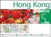
Hong Kong Special Administrative Region Stanfords
£16.50
Archived Product
Hong Kong Special Administrative Region (50K) Stanfords
£14.95
Archived Product
Hong Kong Special Administrative Region (100K) Stanfords
£11.95
Archived Product
Hong Kong Special Administrative Region (100K) Stanfords
£11.99
Archived Product
Hong Kong Special Administrative Region DOUBLE-SIDED Stanfords
£16.99
Vouchers
No voucher codes found.
Do you know a voucher code for this product or supplier? Add it to Insights for others to use.
Do you know a voucher code for this product or supplier? Add it to Insights for others to use.
 Denmark