More From Contributor

£9.99
Indonesia in New Holland’s Globetrotter Travel Guide series, comprising a range of practical & accessible guides to a number of cities, regions & countries worldwide. Globetrotter guides incorporate essential information in an easy-to-carry & easy-to-reference format. They provide visitors with an introduction highlighting the country’s ‘must see’ areas, allowing readers to make the most of their time away. Presented in a paperback PVC format, each guide in the series provides vital tips for visitors &

Includes::
information on the best places to stay, eat & shop, star-rated top attractions, detailed regional profiles & recommendations of the best tours & excursions. Individual titles also have a separate, pull-out overview map in the rear pocket of the guide that serves as a companion to the book itself. An introductory section profiles the destination with details of the l&, a brief history, government & economy & the people. Every chapter is summarised in the ‘ At-a-Glance’ sections at the end of each chapter. There is also a Travel Tips section at the back of each guide providing practical guidance & information on tourist information services, entry requirements, customs, health requirements, getting there, what to pack, money matters, accommodation, transport, business hours, time difference, electricity, health precautions, useful phrases, personal safety, emergencies, etiquette & tipping.

...
Archived Product
£9.99
Indonesia at 1:2, 400, 000 on a double-sided indexed map from ITMB & cartography designed to show the country’s topography through bright altitude colouring & spot heights (elevation shown in feet). The map divides Indonesia west/east, with Sumatra, Borneo, Java, Bali, Lombok & Sumbawa on one side, & Sulawesi with the remaining islands & West Papua on the reverse. Individual small islands & groups are named, as are the surrounding seas, straights & bays. The map shows ferry connections between the islands & on the larger ones shows their road network with distances on main routes. Various places of interest are highlighted: national parks & other protected areas, cultural & religious places, beaches, snorkeling/diving/fishing sites, etc. some annotated with brief notes. Latitude & longitude lines are drawn at 2° intervals. Each side has a separate index. ...
Archived Product
£6.99
Indonesia on a double-sided map at 1:4, 000, 000 from Periplus, with more detailed presentation of Bali & Bali’s southern tourist region, a large street plan of central Jakarta, plus a map of the capital with its outer suburbs. On one side are the islands Western Indonesia: Sumatra, Kalimantan, Java, Bali, Lombok & most of Sumbawa, plus the whole of the Peninsular Malaysia. The network of main roads & railways is shown on a base with bold relief shading with spot heights for main peaks. Local airports are marked & main places of interest highlighted, but ferry connections are not included. The map also shows internal administrative divisions with names of the provinces. Latitude & longitude lines are drawn at intervals of 5°. On the reverse similar mapping at 1:4, 000, 000 covers Eastern Indonesia, from Sulawesi & Sumbawa eastwards, including Flores, Timor, the Maluku Islands & the Indonesian part of Papua. This side also

Includes::
an enlargement of Bali at 1:500, 000 with a more detailed map at 1:100, 000 of the island’s popular central area including Kuta & Denpasar, annotated with numerous beaches, tourist accommodation, etc. None of the maps or plans are indexed. Also included is a large street plan of central Jakarta at 1:30, 000 highlighting various facilities, tourist accommodation, etc, plus a road map of the whole city with its outer suburbs at 1:100, 000.

...
Archived Product
£9.99
Indonesia Travel Atlas from Periplus is a unique, indexed collection of 89 maps.

Includes::
road maps of islands

...
Archived Product
£14.95
Map No. L-11D in the TPC series: military topographic survey mapping covering the world's land masses & significant islands at 1:500, 000. The maps are useful as general topographical coverage where nothing else is available, although they are designed primarily as flying charts for military aircraft. TPC stands for Tactical Pilotage Chart. Relief is portrayed by a combination of contours (basic interval 500ft, intermediate contours shown where appropriate), elevation tinting & relief shading, plus spot heights. Towns, villages, major roads, railways & airports are shown but please note that many of the smaller settlements are not named & the road information is not necessarily up to date, as compilation & revision dates vary. Some air navigation information also appears on the map, such as radio beacons & restricted flying zones. Each TPC chart has both UTM & latitude/longitude grids overprinted on it, with additional margin ticks. IMPORTANT
- PLEASE NOTE: The series is gradually being withdrawn from sale to the general public & some sheets may no longer be available when ordered by us. Due to the nature of the map projection assembling these sheets to make a larger map is not recommended. in addition, colours used for relief are not constant throughout the series. In some areas of central Africa & South America the maps have blank spaces, reflecting localized deficiencies or inconsistencies in the survey data.
...
Archived Product
£9.99
A series of maps of Indonesia from ITMB presenting either the whole country on one sheet or providing separate, more detailed coverage of the most visited islands. Topography is shown by bold altitude colouring, although heights are given on some maps in meters & on others in feet. The maps are indexed & most titles include enlargements and/or street plans of main cities. For more information please see the individual descriptions. ...
Archived Product
£7.95
A series of maps of Indonesia from Nelles presenting either the whole country on one sheet or providing separate, more detailed coverage of Java, Sumatra, Borneo, Bali with Lombok, Sulawesi, & the eastern islands with the Papua provinces. Numerous small islands are named & ferry links are marked. On larger islands the maps show the road network &, where appropriate, indicate airports. Numerous places of interest are highlighted. Topography is indicated by relief shading with spot heights; national parks & other protected areas are marked. The maps have latitude & longitude margin ticks &, unless indicated to the contrary, are not indexed. Map legend

Includes::
English. Most titles include enlargements and/or street plans of most visited locations
- for more details please see the individual description of each title.


...
Archived Product
£6.99
Coverage of the Indonesian islands by the Singapore-based Periplus Editions is designed to present the most visited parts of the main islands in greater detail & to provide street plans of principal towns and/or holiday resorts. The main island itself is shown at a smaller scale than on maps from other publishers. Each title consists of several panels with road maps & street plans. The maps use altitude colouring with relief shading to indicate topography & show the road network, ferry routes & local airports. Numerous places of interest are highlighted. On street plans hotels are also marked. Unless indicated in the individual description, the titles are not indexed. For more information please see the individual descriptions. ...
Archived Product
£10.50
A series of maps of Indonesia from Reise Know-How printed on light, waterproof & tear-resistant synthetic paper & published as part of their highly acclaimed “ World Mapping Project. The maps are double-sided & aim to show the islands at a good scale rather than to provide enlargements particular tourist areas and/or street plans of main towns. Each title is indexed. Topography is shown by altitude colouring with spot heights & names of mountain ranges, etc. National parks & other protected areas are highlighted. Road network is very clearly presented & shows driving distances on main routes. Railway lines are included & ferry connections are shown. Numerous places of interest are marked. For more information & exact coverage by each title please see the individual entries. ...
Archived Product
£12.50
' Routledge's Colloquial series is the best place you could start.' Rough Guide to Europe COLLOQUIAL INDONESIAN is easy to use & completely up to date! Specially written by an experienced teacher for self-study or class use, the course offers you a step-by-step approach to written & spoken Indonesian. No prior knowledge of the language is required. What makes COLLOQUIAL INDONESIAN your best choice in personal language learning? Interactive
- lots of exercises for regular practice Clear
- concise grammar notes Practical
- useful vocabulary & pronunciation guide Complete
- including answer key & reference section By the end of this rewarding course you will be able to communicate confidently & effectively in Indonesian in a broad range of everyday situations. Two 60-minute CDs are available to complement the book. Recorded by native speakers, these will help develop your listening & pronunciation skills.


...
Archived Product

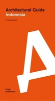
Indonesia: Architectural Guide

The fifth largest population in the world is rapidly expanding. For the past seven decades, both Indonesian and international architects have developed new ideas in order to fulfil the demands of the country`s 250_ million inhabitants, in line with economic progress. Imelda Akmal`s Architectural Guide Indonesia presents over one hundred must-visit buildings which date from the post- independence era (1945) to the present day. The book explores buildings that still embrace traditional Indonesian architectural heritage as well as those whose design is based on practical considerations, thus offering a valuable insight into the works of emerging and established architects. Each project is illustrated with stunning colour photo graphs and detailed information to facilitate an understanding
of its historical and political context.
RIP - This product is no longer available on our network. It was last seen on 25.09.2019

This page now acts as a permanent archive for this product. Add more information using the comments box below to ensure it can still be found by future generations.

Use our search facility to see if it is available from an alternative contributor.
  • Availability: Out Of Stock
  • Supplier: Stanfords
  • SKU: 9783869224251
Availability: In Stock
£32.00

Product Description

The fifth largest population in the world is rapidly expanding. For the past seven decades, both Indonesian & international architects have developed new ideas in order to fulfil the demands of the country`s 250_ million inhabitants, in line with economic progress. Imelda Akmal`s Architectural Guide Indonesia presents over one hundred must-visit buildings which date from the post- independence era (1945) to the present day. The book explores buildings that still embrace traditional Indonesian architectural heritage as well as those whose design is based on practical considerations, thus offering a valuable insight into the works of emerging & established architects. Each project is illustrated with stunning colour photo graphs & detailed information to facilitate an understanding of its historical & political context.

Reviews/Comments

Add New

Intelligent Comparison

Oooops!
We couldn't find anything!
Perhaps this product's unique.... Or perhaps we are still looking for comparisons!
Click to bump this page and we'll hurry up.

Price History

Vouchers

No voucher codes found.
Do you know a voucher code for this product or supplier? Add it to Insights for others to use.

Facebook

Jargon Buster

Date - A day on a calendar
Date - A social activity whith a current or potential partner
World - A physical grouping, commonly used to describe earth and everything associated with ti
Colour - The categorised spectrum of light visable to humans
Day - The time it takes a planet or other space objects to complete one rotation.
Traditional - Something that has become the same through a period of time and thus repeated.
Traditional - Something that has been around for a while and is repeated regularly.
Practical - Weather a task is easy to carry out and realistically succeed.
Design - A drawing or styles that shows the look and functionality of something before its made.

Supplier Information

Stanfords
Stanfords was established in 1853 and opened their iconic Covent Garden flagship store in 1901. They have become the top retailer of maps, travel books and accessories in the UK and arguably offer the largest selection of maps and travel books worldwide. Famous names such as Captain Robert Falcon Scott, Ranulph Fiennes and Michael Palin have purchased from Stanfords. They now have a shop in Bristol and both stores together with other venues operate a calendar of events including talks, book signings and exhibitions. As a specialist map retailer, the map selection is comprehensive and includes road maps, street maps and walking maps from worldwide destinations, as well as a selection of world atlases and wall maps. Books include travel guides and travel literature. Stanfords also stock globes, from miniatures made of blue marble to magnificent floor-standing globes. The website features a selection of interesting articles on travel topics.
Page Updated: 2023-11-12 20:15:36

Community Generated Product Tags

Oh No! The productWIKI community hasn't generated any tags for this product yet!
Menu