
 United Kingdom
 France
 Germany
 Netherlands
 Sweden
 USA
USA
 Italy
Italy
 Spain
Spain
More From Contributor


Jazz Playground
Jazz Playground is a collection of international jazz songs for children from Putumayo World Music. From bebop and swing to Latin and African jazz, this multicultural CD celebrates the vibrant diversity and global influence of jazz and will get the whole family grooving! Over the last century, jazz has traveled around the world and influenced musicians in even the most remote corners of the earth. Jazz Playground demonstrates how artists in North and South America, Europe, Asia, Africa and Oceania have adopted jazz and made it their own. CD Track listing:1 Lewis Franco & The Missing Cats, 'Stomp, Stomp' (USA) 2 Chris McKhool, 'Spider-man' (Canada) 3 Jose Conde, 'Cumbamba' (USA/Cuba) 4 Trioc
Product Description
Reviews/Comments
Add New
Intelligent Comparison
Archived Product
African Playground Stanfords
£10.50
Archived Product

African Playground Stanfords
£10.50
Archived Product

World Playground Stanfords
£10.50
Archived Product

World Playground Stanfords
£10.50
Archived Product
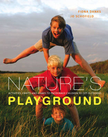
Nature`s Playground Stanfords
£16.99
Vouchers
No voucher codes found.
Do you know a voucher code for this product or supplier? Add it to Insights for others to use.
Do you know a voucher code for this product or supplier? Add it to Insights for others to use.
 Denmark