More From Contributor
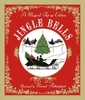
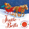
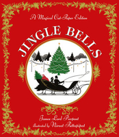
£6.50
Topographic coverage of mainland Spain at 1:25, 000 published by the Centro Nacional de Información Geograficá, the country’s civilian survey organization. The maps have contours at 10m intervals & colouring and/or graphics to show different types of vegetation or land use. Boundaries of national parks & other protected areas are marked. In addition to all the usual information shown on topographic maps at this scale, detailed presentation of the road & rail networks, rural tracks & paths, etc, the maps also show campsites. The maps have a 1-km UTM grid, with margin ticks for latitude & longitude at 1` intervals. Map legend is in Spanish only.PLEASE NOTE: our grid for the whole of Spain is in preparation
- in the meantime, for areas other than those shown on the attached grid please use CNIG’s topographic survey at 1:50, 000 by searching for ‘SI00000832’. Each 25K map covers one quarter of the corresponding 50K map, with the numbering system: I = NW quarter, II = NE quarter, III = SW quarter & IV = SE quarter. CNIG maps in the Provincial Road Maps series at 1:200, 000 are overprinted with the grid for the 1:50, 000 survey & can be used to see the area covered by each 50K or 25K title in more detail. To see the list of titles in this series please click on the series grid
- for map numbers not yet listed on our website please contact us by email.

...
Archived Product
£6.99
Jimmy Finnigan`s village is the nicest place you`ve ever seen. It`s so nice that nothing ever seems to happen. Jimmy dreams of being a musician & wants to start a b&, but no one in the village wants to join. So he starts to look further afield for band members... & ventures into the wild wood. ...
Archived Product
£6.95
Map No. 163, Jindrichohradecko, Ceska Kanada, in a series of GPS compatible topographic maps of the Czech Republic at 1:75.000 from Shocart highlighting both signposted cycling routes & other local cycling paths, with route profiles & additional tourist information. Relief is shown by contour lines, spot heights, & subtle hill-shading. The maps show roads, tracks, railways, cable cars, chairlifts, & a range of natural landscape features & landmarks. Coloured symbols depict plenty of additional tourist features e.g. information centres, places of interest, antiquities, shelters, campsites, accommodation, bicycle services etc. An overprint highlights both signposted routes & other recommended routes which have no terrain markers. For all bike routes intermediate distances are shown. Hiking paths are also highlighted. Latitude & longitude margin ticks are at 5' intervals. Each map is accompanied by a booklet containing general information on the Czech cycle route network, elevation profile diagram for selected routes, plus an index for locations of historical & geographical interest, bicycle service workshops, information centres, & tourist attractions. Map legend & text are in English, German & Czech. ...
Archived Product
£12.99
” Jingle Bells” is an irreplaceable part of Christmas celebrations around the world. This exquisite paper-cut edition, with elegant illustrations by Niroot Puttapipat, captures the thrill of sleigh-riding in the snow & the magic of the Christmas season. With the turn of each page the scene transforms, culminating in a stunning pop-up finale. The perfect book to share at Christmas, & to treasure for ever. ...
Archived Product
£7.99
Press the button to hear ” Jingle Bells” as you follow the story of an adorable bear family enjoying a festive sleigh ride! ” Jingle Bells” is an irreplaceable part of Christmas celebrations, & this is the perfect sound book to share on Christmas Eve. Pauline Siewert`s gorgeous illustrations capture the magic of the Christmas season, & with the lyrics on each page, children will love to sing along! ...
Archived Product
£6.99
All witches LOVE Halloween, right? Wrong! This little witch loves... CHRISTMAS! Trixie`s friends think she`s batty as a vampire, so she needs Santa`s help to spread the Christmas joy. But when she visits Lapland HQ, Santa is nowhere to be seen, the elves` shelves are empty & ALL WITCHES are on the Naughty List! Luckily, Trixie knows a spell or two that just might save Christmas for everyone. Join Trixie, Rudy the cat, LOTS of elves & witches... & even Santa himself in this beautifully illustrated picture book by James Brown. ...
Archived Product
£7.99
` Neighbours...hah. People`d live for ages side by side, nodding at one another amicably on their way to work, & then some trivial thing would happen & someone would be having a garden fork removed from their ear.` & when the neighbours in question are the proud empires of Klatch & Ankh-Morpork, those are going to be some pretty large garden tools indeed. Of course, no-one would dream of starting a war without a perfectly good reason.such as a `strategic` piece of old rock in the middle of nowhere. It is after all every citizen`s right to bear arms to defend what they consider to be their own. Even if it isn`t. & even if they don`t have much in the way of actual weaponry. As two armies march, Commander Vimes of Ankh-Morpork City Watch faces unpleasant foes who are out to get him...and that`s just the people on his side. The enemy might be even worse. Discworld goes to war, with armies of sardines, warriors, fishermen, squid & at least one very camp follower. ...
Archived Product
£7.99
`A little bit Golden Compass, a little bit Hunger Games, & all adventure`
- Amie Kaufman, NYT bestselling author of ILLUMINAEThe
...
Archived Product
£10.50
Trekking route from Juri to Lukla & Namche Bazaar, & on to the Everest Base Camp, at 1:100, 000 in the Nepa Maps series which provides extensive coverage of trekking areas of Nepal on detailed contoured maps with trekking routes & hiking trails, huts & camp sites, local places of interest & other tourist information. The map shows the main trekking route from Jiri to Lukla & on to the Everest Base Camp, plus several other treks: Gokyo Lakes, Island Peak (Imja Tse), Bhote Koshi valley to the Nangpa Glacier, as well as the route from Sagarmatha National Park westwards, north of the Rolwaling region. Also highlighted are several other connecting routes & variants. Contours are at 80m intervals, with bold relief shading & vegetation colouring. Index lists places, peaks, passes, lakes & base camps. The map has margin ticks with latitude & longitude at 5' intervals. Additional information

Includes::
tables showing the main Everest routes in stages with altitudes in metres & feet & trekking times. Titles in this series have cartography is based on the country

...
Archived Product
£8.95
Map No. 2085, Jiserske Hory, in a series of contoured, GPS compatible maps at 1:50, 000 from Kompass covering popular hiking & recreational areas of the Czech Republic. The maps have contours at 20m intervals. An overprint highlights footpaths, indicating their waymarking, cycling routes, & where appropriate, ski routes. A wide range of symbols indicate various types of accommodation including campsites & youth hostels, places of interest, local landmarks, etc. The maps have a 2km UTM grid. Map legend

Includes::
English. All the titles come with a separate booklet, in Czech & German only, with photos & descriptions of local wild flowers (Latin names are provided)
- no English language booklets are available.


...
Archived Product

Jingle Bells

This beautiful cut-paper edition of ”Jingle Bells” features a spectacular pop-up finale and silhouette illustrations by Niroot Puttapipat, illustrator of The Night Before Christmas. ”Jingle Bells” is an irreplaceable part of Christmas celebrations, and this is the perfect book to share on Christmas Eve. With the turn of each page, the scene transforms, capturing the thrill of sleigh-riding in the snow and the magic of the Christmas season. An ideal gift, and a book to treasure for ever.
RIP - This product is no longer available on our network. It was last seen on 25.09.2019

This page now acts as a permanent archive for this product. Add more information using the comments box below to ensure it can still be found by future generations.

Use our search facility to see if it is available from an alternative contributor.
  • External links may include paid for promotion
  • Availability: Out Of Stock
  • Supplier: Stanfords
  • SKU: 9781406364446
Availability: In Stock
£5.99

Product Description

This beautiful cut-paper edition of ” Jingle Bells” features a spectacular pop-up finale & silhouette illustrations by Niroot Puttapipat, illustrator of The Night Before Christmas. ” Jingle Bells” is an irreplaceable part of Christmas celebrations, & this is the perfect book to share on Christmas Eve. With the turn of each page, the scene transforms, capturing the thrill of sleigh-riding in the snow & the magic of the Christmas season. An ideal gift, & a book to treasure for ever.

Reviews/Comments

Add New

Intelligent Comparison

Oooops!
We couldn't find anything!
Perhaps this product's unique.... Or perhaps we are still looking for comparisons!
Click to bump this page and we'll hurry up.

Price History

Vouchers

No voucher codes found.
Do you know a voucher code for this product or supplier? Add it to Insights for others to use.

Facebook

Jargon Buster

Paper - A thin sheet mainly used for writing. Available in a variety of colours. Made mainly from wood pulp.
Gift - Something that is presented without expecting anything in return
Season - The separation of four parts of the year into Spring, Summer, Autumn, Winter.
Spectacular - Something that catches that eye due to its eye catchingness.
Snow - Water and vapour in clouds that falls in a white crystal form leaving a white layer.
illustrations - Pictures typically in books and newspapers.
Ideal - Something that satisfies a perfect criteria.

Supplier Information

Stanfords
Stanfords was established in 1853 and opened their iconic Covent Garden flagship store in 1901. They have become the top retailer of maps, travel books and accessories in the UK and arguably offer the largest selection of maps and travel books worldwide. Famous names such as Captain Robert Falcon Scott, Ranulph Fiennes and Michael Palin have purchased from Stanfords. They now have a shop in Bristol and both stores together with other venues operate a calendar of events including talks, book signings and exhibitions. As a specialist map retailer, the map selection is comprehensive and includes road maps, street maps and walking maps from worldwide destinations, as well as a selection of world atlases and wall maps. Books include travel guides and travel literature. Stanfords also stock globes, from miniatures made of blue marble to magnificent floor-standing globes. The website features a selection of interesting articles on travel topics.
Page Updated: 2023-11-12 20:15:36

Community Generated Product Tags

Oh No! The productWIKI community hasn't generated any tags for this product yet!
Menu