More From Contributor

£12.99
When eleven climbers died on K2 on August 1, 2008, it was a stark reminder that the world`s second-highest mountain has, for more than a century, been regarded as the most difficult & dangerous of all-for every four people who reach the top, one dies in the attempt. K2, The Savage Mountain tells the dramatic story of the 1953 American expedition, led by Charles S. Houston, when a combination of terrible storms & illness stopped the team short of the 28, 251-foot summit. Then on the descent, tragedy struck, & how the climbers made it back to safety is renowned in the annals of climbing. K2, The Savage Mountain captures this sensational tale with an unmatched power that has earned this book its place as one of the classics of mountaineering literature. ...
Archived Product
£16.50
Stunning satellite image of the K2 & the Baltoro Glacier in the Karakoram at 1:80, 000, produced by the Polish Mountaineering Association & annotated with names of peaks, glaciers & passes, numerous spot heights, trekking & approach routes, base camps & seasonal settlements. Centered on the peak of K2, coverage extends from the Sughet Jangal (‘ Yinhongtan – Chinese Base Camp) southwards to just beyond the peak of Masherbrum, & west
- east from the Dumordo River to beyond the Gasherbrum group of peaks. The overprint distinguishes between mule paths, easy or moderate glacier trails, & alpine routes. Peak heights indicate the sources from which they were taken. The map has margin ticks for latitude & longitude at intervals of 10’. All the text is in English & a glossary of main terms used in local names is also provided. The image, derived from data gathered by Spot 4 & Landsat 7 in 2001, was originally published in 2004 to celebrate the 100th anniversary of the Association & the 50th anniversary of the first ascent of K2, & is now available in a new 2nd edition, updated & revised in 2013. This title is also available as a wall map.
...
Archived Product
£19.99
A wall map with a stunning satellite image of the K2 & the Baltoro Glacier in the Karakoram at 1:80, 000, size 99 x 68cm ...
Archived Product
£14.99
After an incident-packed 1938 attempt, an American team made another bid to climb the world's second highest peak the following year. The expedition was led by the mercurial Austrian emigre Fritz Wiessner. With the more experienced climbers recovering after the events of 1938, Wiessner was forced to take a weaker team that included a number of rich but inexperienced climber/adventurers. The problem was compounded by a personality clash between the leader & the second most experienced climber, Jack Durrance. The attempt reached a dramatic climax when Wiessner, returning from a final solo summit bid was forced to leave the stricken Dudley Wolfe in a high camp, descending to get assistance & supplies, only to find the lower camps had been emptied of all food & equipment. When a rescue attempt was finally mounted three leading Sherpas perished & Wolfe was found dead. The subsequent recriminations between Wiessner & Durrance have soured American climbing circles for over 50 years. With the help of the only-recently-available Durrance diaries, Putnam & Kauffman have made a re-examination of the decisions & actions that led to tragedy. ...
Archived Product
£8.95
About the series: Maps designed specifically for the trekker, presenting the topography by line drawings of mountain ridges, with main peaks & passes shown with their height above sea level. The maps also show rivers & settlements & clearly indicate trekking routes. On the reverse are descriptions of suggested routes & other information about the area. ...
Archived Product
£17.99
The 1:50 000 topographic map gives a more general picture of the ground features than a basic map. It shows settlements, houses, roads, cultivated areas, waterways, cutting areas, mires, rock exposures, & relief. One map sheet covers an area of 30 x 40 km & one centimetre corresponds to 500 metres on the ground. The 1:50, 000 topographic map is also an ideal complement to nautical charts as it provides useful information about the land areas adjacent to waterways. For example, all Finnish sea areas are covered by 1:50 000 topographic map sheets. ...
Archived Product
£9.99
Focusing mainly on the small islands of the Netherlands, these two-sided GPS compatible walking maps at 1:25, 000 form a series of long-distance & local walking route maps. Printed on environmentally friendly paper, these maps are waterproof & tear-resistant. Varied colouring show different types of landscape. Symbols indicate various facilities. These maps have the lines of the Dutch National Grid for measuring distances & for determining location using GPS device. In Dutch but legend contains English translation. ...
Archived Product
£8.95
Simple but very informative sketch map of the city, produced with the help of Kabul University students. Details include street & district names, notable & public buildings (eg. administrative buldings, embassies, etc.), accommodation, markets, shops & restaurants, various religious buildings, landmarks & monuments. There is no map legend but the symbols are self-explanatory. The map was published in 2005. ...
Archived Product
£9.99
Kabul & the Historic Khyber Pass map from ITMB combining on one side a street plan of Kabul showing government buildings, embassies, accommodation, etc, plus on the reverse the eastern half of Afghanistan on an indexed road map. On one side is a street plan of Kabul at 1:16, 500 extending well beyond the central part of the city to include the international airport. The map indicates locations of various governmental & other institutions, international organizations & NGOs, embassies, as well as selected hotels facilities such as markets, banks, restaurants, etc. Outside the centre only main traffic arteries are named, but the map does indicate district boundaries & gives names of numerous local neighbourhoods. A short index lists main streets in the city. On the reverse is a map at 1:1, 000, 000 covering eastern Afghanistan with northern Pakistan including Islamabad & Rawalpindi. Altitude colouring (in feet) shows the topography, with additional graphics for salt flats, swamps, glaciers & deserts, plus plenty of names of mountain ranges, peaks (heights in metres), etc. Road network

Includes::
selected local tracks & indicates the routes of the old Silk Road, Railway lines are included & local airports are marked. Within Afghanistan internal administrative boundaries are shown with names of the provinces. The map has latitude & longitude lines at 1° intervals & an extensive index.

...
Archived Product
£9.99
Map No. 763, Kachemak Bay State Park, AK, in an extensive series of GPS compatible, contoured hiking maps of USA’s national & state parks or forests & other popular recreational areas. Cartography based on the national topographic survey, with additional tourist information. The maps, with most titles now printed on light, waterproof & tear-resistant plastic paper, highlight walking trails along with campsites & other accommodation, picnic sites, areas for various recreational pursuits such as horse riding or skiing, drinking water sources, & many other facilities of interest to the outdoor enthusiast. Cartography is based on information from the USGS (United States Geological Survey
- the country’s national survey organization), revised by the National Geographic Maps in cooperation with the National Park Service, USDA Forest Service, etc. Topography is excellently presented by contours (interval varies according to scale), enhanced by relief shading & colouring/graphics for wood cover, glaciers, etc. All heights are given in feet. The maps have a UTM grid plus latitude & longitude margin ticks & GPS waypoints for selected important locations. Each map is double-sided to give either maximum coverage of the chosen area or additional enlargements of its important sections. Accompanying notes provide useful information on relevant regulations, safety precautions, contact addresses, etc.* *IMPORTANT
- PLEASE NOTE: the series is very extensive, ranging in scale from 1:400, 000 for the vast national parks of Alaska to 1:25, 000 for local map in several states. We recommend, therefore, viewing the series by state rather than the whole list.*

...
Archived Product

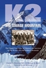
K2: Life And Death On The World`s Most Dangerous Mountain

Ed Viesturs, one of the world’s premier high-altitude mountaineers, explores the remarkable history of K2 and of those who attempted to conquer it. Focusing on seven of the mountain’s most dramatic campaigns, from his own troubled ascent when he and Scott Fischer climbed it in 1992 and got caught in an avalanche that sent them sliding to almost certain death to the 2008 tragedy when 11 mountaineers from an international expedition died on the mountain, Viesturs crafts an edge-of-your-seat narrative that both climbers and armchair travellers alike will find compelling. The book is illustrated with photos from historical sources and from Viesturs’s own collection.
RIP - This product is no longer available on our network. It was last seen on 25.09.2019

This page now acts as a permanent archive for this product. Add more information using the comments box below to ensure it can still be found by future generations.

Use our search facility to see if it is available from an alternative contributor.
  • Availability: Out Of Stock
  • Supplier: Stanfords
  • SKU: 9780767932608
Availability: In Stock
£13.50

Product Description

Ed Viesturs, one of the world’s premier high-altitude mountaineers, explores the remarkable history of K2 & of those who attempted to conquer it. Focusing on seven of the mountain’s most dramatic campaigns, from his own troubled ascent when he & Scott Fischer climbed it in 1992 & got caught in an avalanche that sent them sliding to almost certain death to the 2008 tragedy when 11 mountaineers from an international expedition died on the mountain, Viesturs crafts an edge-of-your-seat narrative that both climbers & armchair travellers alike will find compelling. The book is illustrated with photos from historical sources & from Viesturs’s own collection.

Reviews/Comments

Add New

Intelligent Comparison

Oooops!
We couldn't find anything!
Perhaps this product's unique.... Or perhaps we are still looking for comparisons!
Click to bump this page and we'll hurry up.

Price History

Vouchers

No voucher codes found.
Do you know a voucher code for this product or supplier? Add it to Insights for others to use.

Facebook

Jargon Buster

History - Anything that happens in the past. An acedemic subject.
World - A physical grouping, commonly used to describe earth and everything associated with ti
edge - Enhanced data rates for GSM evolution also known as enhanced GPRS. A mobile phone technology with improved data transmission rates.
edge - The point at which two surfaces meet
Altitude - Something that can be quite high in relation to sea or ground level.

Supplier Information

Stanfords
Stanfords was established in 1853 and opened their iconic Covent Garden flagship store in 1901. They have become the top retailer of maps, travel books and accessories in the UK and arguably offer the largest selection of maps and travel books worldwide. Famous names such as Captain Robert Falcon Scott, Ranulph Fiennes and Michael Palin have purchased from Stanfords. They now have a shop in Bristol and both stores together with other venues operate a calendar of events including talks, book signings and exhibitions. As a specialist map retailer, the map selection is comprehensive and includes road maps, street maps and walking maps from worldwide destinations, as well as a selection of world atlases and wall maps. Books include travel guides and travel literature. Stanfords also stock globes, from miniatures made of blue marble to magnificent floor-standing globes. The website features a selection of interesting articles on travel topics.
Page Updated: 2023-11-12 20:15:36

Community Generated Product Tags

Oh No! The productWIKI community hasn't generated any tags for this product yet!
Menu