
 United Kingdom
 France
 Germany
 Netherlands
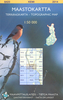
 Sweden
 USA
USA
 Italy
Italy
 Spain
Spain
More From Contributor

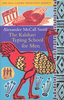


Kaleidoscope City: A Year In Varanasi
Piers Moore Ede first fell in love with Varanasi when he passed through it on his way to Nepal. In the decade that followed, it continued to exert its pull on him and so he returned there to live - to discover what it is that makes the spiritual capital of India so unique. In this intoxicating city, where funeral pyres smoulder beside the river in which thousands of pilgrims bathe, and holiness and corruption walk side by side, Piers discovers a remarkable interplay between death and life, light and dark.
Product Description
Reviews/Comments
Add New
Vouchers
No voucher codes found.
Do you know a voucher code for this product or supplier? Add it to Insights for others to use.
Do you know a voucher code for this product or supplier? Add it to Insights for others to use.
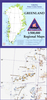
 Denmark