
 United Kingdom
 France
 Germany
 Netherlands
 Sweden
 USA
USA
 Italy
Italy
 Spain
Spain
More From Contributor


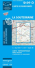


La Senda De Camille Editorial Alpina
La Senda de Camille, the Pyrenean Bear Trail, a 104-km circuit in the central Pyrenees, on a contoured GPS compatible map at 1:25, 000 from Editorial Alpina, plus a booklet providing information on mountain refuges. The route, which crosses over from the Spanish side to the Parc National des Pyrénées in France and incorporates part of the Pyrenees High Route (HRP), is highlighted on a detailed base with contours at 10m intervals and colouring to indicate vegetation. Also highlighted are shorter alternatives on the Spanish side which include part of the GR11. The map also shows local footpaths and other long-distance trails. Symbols indicate various types of accommodation (local hotels, campsites, mountain refuges and cabins, youth hostels), tourist information offices, sites
for skiing, climbing and canyoning, car parks and picnic sites, etc. The map has a 1-km UTM grid.The accompanying booklet includes 11 pages in English with photos and full details of refuges and campsites along the Bear Trail, details of each recommended stage of the route and general information about the area.To see the list of all the maps from Editorial Alpina covering long-distance hiking routes please click on the series link.
for skiing, climbing and canyoning, car parks and picnic sites, etc. The map has a 1-km UTM grid.The accompanying booklet includes 11 pages in English with photos and full details of refuges and campsites along the Bear Trail, details of each recommended stage of the route and general information about the area.To see the list of all the maps from Editorial Alpina covering long-distance hiking routes please click on the series link.

Product Description
Reviews/Comments
Add New
Vouchers
No voucher codes found.
Do you know a voucher code for this product or supplier? Add it to Insights for others to use.
Do you know a voucher code for this product or supplier? Add it to Insights for others to use.
 Denmark