
 United Kingdom
 France
 Germany
 Netherlands
 Sweden
 USA
USA
 Italy
Italy
 Spain
Spain
More From Contributor

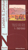


Ladakh And Zanskar: Illustrated Travel Map
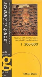
Ladakh and Zanskar region on a double-sided map at 1:300, 000 from Editions Olizane, printed on light, waterproof and tear-resistant plastic paper and illustrated with drawings of local landscape and cultural heritage.The map covers roughly the same area as the publishers’ highly acclaimed series of three maps covering the region at 1:150, 000. The base map, derived from satellite imagery, presents a vivid picture of the terrain, with numerous peaks named on it. The map shows local roads and mountain trails, and highlights 68 various places of interest, cross-referenced to a list which conveniently groups them into villages, palaces and forts, monasteries, sacred sites, low relief and steles, rock art sites, etc. The map has latitude and longitude cross-hairs at 12’.Fine
drawings provide illustrations of local Buddhist structures and figures, steles, rock art and artefacts.Map legend and all the text are in English and French.
drawings provide illustrations of local Buddhist structures and figures, steles, rock art and artefacts.Map legend and all the text are in English and French.

Product Description
Reviews/Comments
Add New
Intelligent Comparison
Archived Product
Ladakh And Zanskar Trekking Map Stanfords
£10.95
Vouchers
No voucher codes found.
Do you know a voucher code for this product or supplier? Add it to Insights for others to use.
Do you know a voucher code for this product or supplier? Add it to Insights for others to use.
 Denmark