
 United Kingdom
 France
 Germany
 Netherlands
 Sweden
 USA
USA
 Italy
Italy
 Spain
Spain
More From Contributor


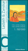
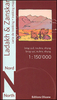

Ladakh - Zanskar Nelles
Ladakh and Zanskar at 1:350, 000 on a contoured and GPS compatible, double-sided map from Nelles, now published on a light, waterproof and tear-resistant synthetic paper. Coverage extends from Kulu in the south to the Baltoro Range and the Nubra Valley in the north, with an inset extending the map westwards to include Srinagar, Jammu and Pathankot. Also provided is a street plan of Leh.The map shows the region’s mountainous topography by contours at 200m intervals with very effective relief shading, plus spot heights and mountain passes. In addition to roads and local cart tracks, trekking trails are also marked. Symbols indicate various facilities and places of interest including campsites, temples, hot springs and waterfalls, etc. Latitude and longitude lines are drawn at
10’ intervals. Map legend includes English. The street plan of Leh shows location of numerous hotels and includes an enlargement for the old town.This title supplements the publishers’ coverage of India on regional maps at 1:1, 500, 000 - to see other titles in this series please click on the series link.
10’ intervals. Map legend includes English. The street plan of Leh shows location of numerous hotels and includes an enlargement for the old town.This title supplements the publishers’ coverage of India on regional maps at 1:1, 500, 000 - to see other titles in this series please click on the series link.

Product Description
Reviews/Comments
Add New
Vouchers
No voucher codes found.
Do you know a voucher code for this product or supplier? Add it to Insights for others to use.
Do you know a voucher code for this product or supplier? Add it to Insights for others to use.
 Denmark