More From Contributor

£9.50
One of the titles in a series of double-sided topographic maps with hiking routes & tourist information. Cartography is identical to the standard topographic survey of Germany, with contours at 10m intervals. Extensive overprint highlights numerous local footpaths & long-distance hiking routes, indicating waymarking. Cycling routes, mountain bike centres & trails, & cross-country ski routes are also marked. Extensive range of symbols highlight sport & leisure facilities, various types of accommodation, places of interest, tourist railways, etc. Boundaries of national parks & nature reserves are marked. The maps have a 2km UTM grid. Map legend

Includes::
English. The maps also have lists of contact details of various organizations & facilities within the region, plus brief descriptions in German only.

...
Archived Product
£12.99
The eastern part of Lake Constance (Bodensee) at 1:35, 000 from Kümmerly+ Frey in a series GPS compatible, double-sided maps printed on durable, waterproof & tear-resistant plastic paper; contoured, with hiking & cycle routes, other recreational activities, etc. Maps in this series are at a scale of either 1:50, 000 or 1:35, 000. Contour interval varies from 10m to 40m according to the area &, where appropriate, the maps have finely drawn additional graphic relief to provide an excellent representation of the terrain, with plenty of names of peaks, valleys, etc, national parks or other protected areas, plus colouring/graphics indicating different types of vegetation. An overprint, graded according to the difficulty of the route, highlights hiking trails indicating their waymarking. Also marked are local & long-distance cycle routes, plus a selection of mountain-bike trails, cross-country & alpine ski routes & horse-riding paths. A wide range of symbols indicate locations for other outdoor activities: climbing, paragliding, toboggan runs, sailing or surfing, etc. Also marked are various sport facilities, different types of accommodations including alpine huts, campsites, youth hostels, sites of botanical or cultural interest, etc. For access the maps show local bus stops, car parks/park+ride facilities, roads with entry restrictions, etc. The maps have a 1km UTM grid. Map legend

Includes::
English. Each title also provides a road map of the region around the area covered by it. To see other titles in this series please click on the series link.

...
Archived Product
£11.99
The environs of the western part of Lake Constance (Bodensee) on a detailed, GPS compatible map at 1:50, 000 from Kompass with local & long-distance footpaths, cycling routes, accommodation, etc, printed on durable, waterproof & tear-resistant synthetic paper. KOMPASS HIKING & RECREATIONAL MAPS: this title is part of an extensive series covering Austria, much of Germany & the Slovenian Alps. Kompass are Europe’s largest publishers of hiking maps; their mapping of other countries, including expanding coverage of Italy, is listed on our website separately.CARTOGRAPHY: the maps are contoured with additional shading, graphic relief & colouring to provide a more detailed picture of the terrain, vegetation and/or land use. Contour interval varies from 10m in the coastal areas of Northern Germany to 40 or 50 metres in the mountainous regions. All the maps highlight local & long-distance waymarked footpaths, including climbing trails. Most titles also show cycling routes, mountain bike trails, &, the in mountainous areas, ski routes. The maps indicate various types of accommodation (selected inns & hotels, youth hostels, campsites, mountain refuges), as well as recreational facilities, places of interest, etc. Latest editions also show access by public transport with bus stops and/or Park+ Ride facilities.GEOGRAPHICAL COORDINATES: unless indicated to the contrary in the individual description, the maps have a UTM grid for GPS users. MAP LEGEND: most maps now include full English legend, particularly titles covering the Alpine areas. Some maps covering mainly eastern Austria or the less popular parts of Germany may still have a legend in German only.OTHER

Features:
selected titles include on the reverse panorama drawings of their area with names of villages, peaks, valleys, etc. and/or have a booklet with pictures of local wild flowers with their Latin names. Many titles are now published as competitively priced sets of two or more maps, offering a wider coverage.BOOKLETS: PLEASE NOTE BEFORE ORDERING!
- many titles come with a booklet describing the area and/or various hiking routes. Unless indicated in the individual description that the booklet

Includes::
English, these booklets are IN GERMAN only. The booklets are not necessary to use the maps since, as stated above, full English language map legend is provided.


...
Archived Product
£9.99
One of the titles in a series of contoured outdoor leisure maps, extending F&B’s extensive coverage of Austria to the neighbouring regions & other popular hiking areas of Germany. The maps have contours at 100-metre intervals in the mountainous areas, & 50 metres elsewhere, shading & graphic relief. An overprint highlights hiking paths, cycling routes &, on most of the titles, ski routes. The maps also show youth hostels, campsites, mountain huts & refuges. Margin ticks show latitude & longitude in steps of 5`. Most titles also give GPS waypoints, as indicated in the individual descriptions. Map legend

Includes::
English. Several of the titles come with a separate booklet, in German only, containing information on places of interest, brief descriptions of selected hiking trails, addresses of various accommodation facilities, etc. This title is a double-sided map of the Lake Constance area. In the accompanying booklet (German text only) are street plans of Constance, Überlingen, Meersburg, Friedrichsshafen, Lindau & Bregenz. This map is available in two different formats:

...
Archived Product
£4.99
Lake Constance & the surrounding area on handy pocket map from Freytag & Berndt, laminated, waterproof & tear-resistant, & highlighting the publishers’ recommendations for five best choices in five categories: adventure, restaurants & cafes, culture, nature & sights. On one side is a detailed road map covering an area from Singen, Stein & Frauenfeld to St. Gallen & Bregenz. The map indicates scenic roads & special tourist routes & gives driving distances on many small local roads. Campsites & youth hostels are marked & picturesque towns & villages are highlighted. No geographical coordinates are given, but the map has an index. The map is annotated with colour-coded markers highlighting the publishers’ recommendations for five best choices in five categories: adventure, culture, restaurants & cafes, nature & sights, all listed on the reverse of the map with brief notes in several languages. Also provided are small street plans of central Bregenz, Constance/ Konstanz, & Friedrichshafen. Map legend & notes about the recommendations include English. To see other titles in this series please click on the series link. ...
Archived Product
£11.95
Lake Constance area on a detailed, GPS compatible map at 1:75, 000 from Kompass with local & long-distance footpaths, cycling routes, accommodation, etc, & a panorama map on the reverse, printed on durable, waterproof & tear-resistant synthetic paper. KOMPASS HIKING & RECREATIONAL MAPS: This title is part of an extensive series covering Austria, much of Germany & the Slovenian Alps. Kompass are Europe’s largest publishers of hiking maps; their mapping of other countries, including expanding coverage of Italy, is listed on our website separately.CARTOGRAPHY: The maps are contoured with additional shading, graphic relief & colouring to provide a more detailed picture of the terrain, vegetation and/or land use. Contour interval varies from 10m in the coastal areas of Northern Germany to 40 or 50 metres in the mountainous regions. All the maps highlight local & long-distance waymarked footpaths, including climbing trails. Most titles also show cycling routes, mountain bike trails, &, the in mountainous areas, ski routes. The maps indicate various types of accommodation (selected inns & hotels, youth hostels, campsites, mountain refuges), as well as recreational facilities, places of interest, etc. Latest editions also show access by public transport with bus stops and/or Park+ Ride facilities.GEOGRAPHICAL COORDINATES: Unless indicated to the contrary in the individual description, the maps have a UTM grid for GPS users. MAP LEGEND: Most maps now include full English legend, particularly titles covering the Alpine areas. Some maps covering mainly eastern Austria or the less popular parts of Germany may still have a legend in German only.OTHER
Features: Selected titles include on the reverse panorama drawings of their area with names of villages, peaks, valleys, etc. and/or have a booklet with pictures of local wild flowers with their Latin names. Many titles are now published as competitively priced sets of two or more maps, offering a wider coverage.BOOKLETS: PLEASE NOTE BEFORE ORDERING! Many titles come with a booklet describing the area and/or various hiking routes. Unless indicated in the individual description that the booklet

Includes::
English, these booklets are IN GERMAN only. The booklets are not necessary to use the maps since, as stated above, full English language map legend is provided.


...
Archived Product
£10.99
Lake Constance area at 1:75, 000 on a touring & cycling map from Freytag & Berndt prominently highlighting scenic roads & special tourist routes, recommended cycling routes, & locations worth visiting. Coverage extends from north of Ravensburg in Germany to St. Gallen in Switzerl&, &

Includes::
Bregenz & Dornbirn in Austria. On the reverse of this version is a beautiful, h&-drawn panorama map of the region, looking southwards from Weingarten in Germany towards the peaks of the Swiss Alps, with Säntis in the middle & Lake Zurich with Rigi in the west. Various local attractions & sights are highlighted by small drawings. The main map is also available without the panorama map but with German language descriptions of places of interest. Road network

Includes::
small local roads, many shown with driving distances. Scenic roads & special tourist routes are prominently highlighted, as are recommended cycling routes & picturesque local towns. Railway lines are shown with stations & ferry connections on the lake are marked. Icons indicate other places of interest & facilities, including campsites & youth hostels, cultural & historical heritage, beaches & spas, etc. The map has latitude & longitude lines at 5’ intervals. Map legend

Includes::
English.


...
Archived Product
£9.95
Lake Constance (Bodensee) & the surrounding areas of Germany, Switzerland & Austria on a double-sided map combining a road map with a panorama drawing highlighting main places of interest & the views southwards towards the Swiss Alps. On one side is a map of the area around the lake, with an overprint highlighting scenic roads & special tourist routes, cycling routes, various facilities including campsites, youth hostels & sport/recreational sites, as well as many places of tourist interest. The map has no geographical coordinates or an index. Map legend

Includes::
English. Please note: publication date shows the map as valid until 12/2008. On the reverse is a panorama drawing of the area, looking southwards across the lake to the Swiss Alps, from the B

...
Archived Product
£13.99
The 601km eastern half of Europe’s E5 long distance footpaths from Lake Constance across the Austrian Alps to Verona on a waterproof & tear-resistant, contoured & GPS compatible concertina map from Kompass presenting the route on 40 panels, each 17.5x 20cm. Plus accommodations recommendations & street plans. The route is highlighted on maps at 1:50, 000 & is annotated with 5km markers. Topography is shown by contours at 40m intervals, enhanced by relief shading & spot heights, with colouring and/or graphics to indicate scree, woodlands, vineyards & hop fields, etc. Symbols show various accommodation options including campsites & youth hostels, sport & recreational facilities, & places of interest. Road network, presented in detail including forest tracks & country paths, indicates locations of car parks. Railway lines & mountain transport facilities (cable car lines, chair lifts) are also marked. Each panel has a 2-km UTM grid. Street plans cover central Konstanz, Bregenz, Bolzano & Verona, highlighting important sights, cycle repair shops, banks, etc, & are accompanied by brief notes about their main sights. A route profile shows the changes in altitude along the trail. Also provided is an extensive list of recommended accommodation facilities for the whole course of the route. Map legend & notes on places of interest include English. Details in the accommodation list are in German only. ...
Archived Product
£10.99
Lake Constance area at 1:75, 000 on a touring & cycling map from Freytag & Berndt prominently highlighting scenic roads & special tourist routes, recommended cycling routes, & locations worth visiting. Coverage extends from north of Ravensburg in Germany to St. Gallen in Switzerl&, &

Includes::
Bregenz & Dornbirn in Austria. On the reverse of this version of the map are German language descriptions of places of interest – the same map is also available with on the reverse a beautiful, h&-drawn panorama map of the region. Road network

Includes::
small local roads, many shown with driving distances. Scenic roads & special tourist routes are prominently highlighted, as are recommended cycling routes & picturesque local towns. Railway lines are shown with stations & ferry connections on the lake are marked. Icons indicate other places of interest & facilities, including campsites & youth hostels, cultural & historical heritage, beaches & spas, etc. The map has latitude & longitude lines at 5’ intervals. Map legend

Includes::
English.


...
Archived Product

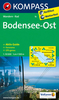
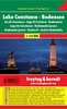
Lake Constance K+F Hiking Map 2

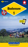
Lake Constance (Bodensee) area at 1:60, 000 in Kümmerly + Frey’s hiking series of Switzerland, with most titles now printed on light, waterproof and tear-resistant plastic paper. The series offers a popular alternative to Swiss survey maps and cartography which many walkers find easier to follow.Coverage of the whole country is designed so that each title presents a popular hiking area. The maps have contours at 50 or 25-metre intervals according to the terrain, enhanced by graphic relief and shading. An overprint distinguishes between sign-posted hiking paths, mountain path where proper walking shoes are necessary, and alpine paths requiring special equipment. Most titles now also indicate national and regional long-distance hiking routes, each annotated with its official
number.Mountain huts are marked, plus various types of accommodation: campsites, youth hostels, “Friends of Nature” houses, and secluded hotels and restaurants. Road network indicates local bus routes with stops. Railways, narrow gauge mountain railways, cable car lines, and chair lifts are shown, with various symbols highlighting places of interest, viewpoints, picnic sites, swimming pools, etc.Each title covers an area of approximately 60 x 42 km (37 x 26 miles). The maps have a 1km Swiss national grid, plus latitude and longitude margin ticks at 5’ intervals. *Map legend includes English.* On the reverse, an index of towns and villages includes names of geographical features such as mountains, alpine passes, glaciers, lakes, rivers, as well as places of
interest. Also provided is an overview road map of surrounding region.
RIP - This product is no longer available on our network. It was last seen on 25.09.2019

This page now acts as a permanent archive for this product. Add more information using the comments box below to ensure it can still be found by future generations.

Use our search facility to see if it is available from an alternative contributor.
  • External links may include paid for promotion
  • Availability: Out Of Stock
  • Supplier: Stanfords
  • SKU: 9783259008669
Availability: In Stock
£19.99

Product Description

Lake Constance (Bodensee) area at 1:60, 000 in Kümmerly + Frey’s hiking series of Switzerl&, with most titles now printed on light, waterproof & tear-resistant plastic paper. The series offers a popular alternative to Swiss survey maps & cartography which many walkers find easier to follow. Coverage of the whole country is designed so that each title presents a popular hiking area. The maps have contours at 50 or 25-metre intervals according to the terrain, enhanced by graphic relief & shading. An overprint distinguishes between sign-posted hiking paths, mountain path where proper walking shoes are necessary, & alpine paths requiring special equipment. Most titles now also indicate national & regional long-distance hiking routes, each annotated with its official number. Mountain huts are marked, plus various types of accommodation: campsites, youth hostels, “ Friends of Nature” houses, & secluded hotels & restaurants. Road network indicates local bus routes with stops. Railways, narrow gauge mountain railways, cable car lines, & chair lifts are shown, with various symbols highlighting places of interest, viewpoints, picnic sites, swimming pools, etc. Each title covers an area of Approx. 60 x 42 km (37 x 26 miles). The maps have a 1km Swiss national grid, plus latitude & longitude margin ticks at 5’ intervals. * Map legend

Includes::
English.* On the reverse, an index of towns & villages

Includes::
names of geographical features such as mountains, alpine passes, glaciers, lakes, rivers, as well as places of interest. Also provided is an overview road map of surrounding region.

Reviews/Comments

Add New

Intelligent Comparison

Oooops!
We couldn't find anything!
Perhaps this product's unique.... Or perhaps we are still looking for comparisons!
Click to bump this page and we'll hurry up.

Price History

Vouchers

No voucher codes found.
Do you know a voucher code for this product or supplier? Add it to Insights for others to use.

Facebook

Jargon Buster

Paper - A thin sheet mainly used for writing. Available in a variety of colours. Made mainly from wood pulp.
Plastic - A generic term for a synthetic product used in the manufacture of products
Hiking - An outdoor activity envolving walking in nature
Shoes - An item of footwear made from Leather or other synthetic materials
swiss - Short for Switzerland, one of the richest countries in the world
switzerland - A landlocked country in western Europe. One of the richest countries in the world
Cable - A series of wires bonded to form a single thread
Waterproof - Resistant to water, usualy specified by depth in metres
Friends - A close associate or a popular US based sitcom about a group of friends
Railways - A set of tracks that have been laid for the purpose of trains to travel up and down them
Car - A machine used for transport which runs on roads
Network - A link and communication between things. Often computers or people.
Km - Kilometre. A unit of measurement equal to 1000 metres.
Road - a manmade lane or a path that is used to speed up travel.
Resistant - Something that can repel against something.
Equipment - A product or good that is tactile.
Alternative - Another available choice or possibility
Metre - 100cm. A unit of length.
Accommodation - A room in which someone can live in, for example in a hotel
Popular - Something that is admired and liked by many people.
Regional - An adjective to describe a set geographic area.

Supplier Information

Stanfords
Stanfords was established in 1853 and opened their iconic Covent Garden flagship store in 1901. They have become the top retailer of maps, travel books and accessories in the UK and arguably offer the largest selection of maps and travel books worldwide. Famous names such as Captain Robert Falcon Scott, Ranulph Fiennes and Michael Palin have purchased from Stanfords. They now have a shop in Bristol and both stores together with other venues operate a calendar of events including talks, book signings and exhibitions. As a specialist map retailer, the map selection is comprehensive and includes road maps, street maps and walking maps from worldwide destinations, as well as a selection of world atlases and wall maps. Books include travel guides and travel literature. Stanfords also stock globes, from miniatures made of blue marble to magnificent floor-standing globes. The website features a selection of interesting articles on travel topics.
Page Updated: 2023-11-12 20:15:36

Community Generated Product Tags

Oh No! The productWIKI community hasn't generated any tags for this product yet!
Menu