
 United Kingdom
 France
 Germany
 Netherlands
 Sweden
 USA
USA
 Italy
Italy
 Spain
Spain
More From Contributor


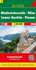
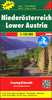

Lower Austria - Vienna - Burgenland
Austrian provinces of Lower Austria and Burgenland on an indexed, double-sided touring map at 1:175, 000 from Hallwag Kümmerly + Frey, printed on durable, waterproof and tear-resistant synthetic paper. Coverage, with good overlap between the sides, extends from Linz to Bratislava, and in the south-east to Szombathely in Hungary.Clear and easy to read road network highlights scenic roads and indicates motorway junction numbers and services, steep gradients and winter closures, roads not recommended to or closed to caravans, etc. Driving distances are marked on main and on most connecting local routes. Railway lines are shown with stations and include heritage tourist routes. Various places of interest are highlighted. The map also indicates campsites and youth hostels. Topography
is presented by light, unobtrusive relief shading with plenty of names of mountain ranges, etc, plus colouring for woodlands and boundaries of national/natural parks. The map is indexed and has latitude and longitude lines at intervals of 10’. Map legend includes English.To see other maps in this series please click on the series link.
is presented by light, unobtrusive relief shading with plenty of names of mountain ranges, etc, plus colouring for woodlands and boundaries of national/natural parks. The map is indexed and has latitude and longitude lines at intervals of 10’. Map legend includes English.To see other maps in this series please click on the series link.

Product Description
Reviews/Comments
Add New
Vouchers
No voucher codes found.
Do you know a voucher code for this product or supplier? Add it to Insights for others to use.
Do you know a voucher code for this product or supplier? Add it to Insights for others to use.
 Denmark