
 United Kingdom
 France
 Germany
 Netherlands
 Sweden
 USA
USA
 Italy
Italy
 Spain
Spain
More From Contributor


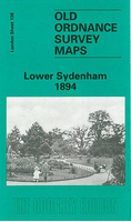
Lower Sydenham 1894
Lower Sydenham in 1894 in a fascinating series of reproductions of old Ordnance Survey plans in the Alan Godfrey Editions, ideal for anyone interested in the history of their neighbourhood or family. The map is centred on Lower Sydenham and covers the area from Sydenham station on the LBSCR line eastward to Lower Sydenham station on the SER `Mid Kent` line, and a little beyond; also from Bampton Road and Houston Road southward to Woodbastwick Road. Apart from the two railways, features on the map include Sydenham Road, Bell Green, and the Crystal Palace Gas Works. On the reverse are street directory entries for Bell Green, Champion Park, Fairlawn Park, Mayow Road, Paxton Park, Perry Rise and Sydenham Road.About the Alan Godfrey Editions of the 25” OS SeriesSelected towns in
Great Britain and Ireland are covered by maps showing the extent of urban development in the last decades of the 19th and early 20th century. The plans have been taken from the Ordnance Survey mapping and reprinted at about 15 inches to one mile (1:4, 340). On the reverse most maps have historical notes and many also include extracts from contemporary directories. Most maps cover about one mile (1.6kms) north/south, one and a half miles (2.4kms) across; adjoining sheets can be combined to provide wider coverage.FOR MORE INFORMATION AND A COMPLETE LIST OF ALL AVAILABLE TITLES PLEASE CLICK ON THE SERIES LINK.
Great Britain and Ireland are covered by maps showing the extent of urban development in the last decades of the 19th and early 20th century. The plans have been taken from the Ordnance Survey mapping and reprinted at about 15 inches to one mile (1:4, 340). On the reverse most maps have historical notes and many also include extracts from contemporary directories. Most maps cover about one mile (1.6kms) north/south, one and a half miles (2.4kms) across; adjoining sheets can be combined to provide wider coverage.FOR MORE INFORMATION AND A COMPLETE LIST OF ALL AVAILABLE TITLES PLEASE CLICK ON THE SERIES LINK.

Product Description
Reviews/Comments
Add New
Intelligent Comparison
Archived Product
Upper Sydenham 1894 Stanfords
£3.50
Archived Product

Lower Streatham 1894 Stanfords
£3.50
Archived Product
Upper Sydenham 1914 Stanfords
£3.50
Vouchers
No voucher codes found.
Do you know a voucher code for this product or supplier? Add it to Insights for others to use.
Do you know a voucher code for this product or supplier? Add it to Insights for others to use.
 Denmark