More From Contributor

£6.95
Topographic coverage of mainland Spain at 1:50, 000 in the MTN50 (Mapa Topográfico Nacional) series from the Centro Nacional de Información Geografica, the country’s civilian survey organization. The maps have contours at 20m intervals, enhanced by relief shading, plus colouring and/or graphics to show different types of terrain, vegetation or land use. Boundaries of national parks & other protected areas are marked. In addition to all the usual information featured on topographic mapping at this scale, detailed presentation of the road & rail networks, rural tracks & paths, etc, the maps also show campsites & mountain refuges. On more recent editions some GRs, the official long-distance hiking routes, are also marked (although not as clearly as on hiking maps from other publishers). Each map covers 29.5x 18.5 km (with adjustments in the border or coastal areas). The maps have a 1-km UTM grid, plus margin ticks for latitude & longitude at 1` intervals. Map legend is in Spanish only.HOW TO CHOOSE THE RIGHT 50K MAP: all the titles in CNIG’s 200K Provincial Road Maps series at 1:200, 000 are overprinted with the grid for the 1:50, 000 maps & can be used to see the area covered by each 50K title. TO SEE THE LIST OF TITLES IN THIS SERIES PLEASE CLICK ON THE SERIES LINK.PLEASE NOTE
- MAP TITLES: the grids shown on our website serve both the civilian & the military 1:50, 000 topographic series. Although the areas covered by maps in both series are identical (apart from some border or coastal sheets), occasionally map titles differ – only one title is shown on the grid, usually the military one. In Galicia, the Basque country & in the Catalan speaking areas the tendency now is to use local place names rather than the often better known Castilian ones. Where possible, both versions are included in our titles. Map titles listed on our website are based on information received by us at the time of publication, but sometimes maps arrive showing a completely different title! As long as the map number is as ordered, the correct map has been supplied.
...
Archived Product
£6.50
Topographic coverage of mainland Spain at 1:25, 000 published by the Centro Nacional de Información Geograficá, the country’s civilian survey organization. The maps have contours at 10m intervals & colouring and/or graphics to show different types of vegetation or land use. Boundaries of national parks & other protected areas are marked. In addition to all the usual information shown on topographic maps at this scale, detailed presentation of the road & rail networks, rural tracks & paths, etc, the maps also show campsites. The maps have a 1-km UTM grid, with margin ticks for latitude & longitude at 1` intervals. Map legend is in Spanish only.PLEASE NOTE: our grid for the whole of Spain is in preparation
- in the meantime, for areas other than those shown on the attached grid please use CNIG’s topographic survey at 1:50, 000 by searching for ‘SI00000832’. Each 25K map covers one quarter of the corresponding 50K map, with the numbering system: I = NW quarter, II = NE quarter, III = SW quarter & IV = SE quarter. CNIG maps in the Provincial Road Maps series at 1:200, 000 are overprinted with the grid for the 1:50, 000 survey & can be used to see the area covered by each 50K or 25K title in more detail. To see the list of titles in this series please click on the series grid
- for map numbers not yet listed on our website please contact us by email.

...
Archived Product
£7.95
Small indexed street plan of Lucerne, indicating the pedestrian zone in the old historic town centre, car parks in the surrounding part of the city & public transport network. For the opera lovers, the plan extends south to Tribschen. Map legend

Includes::
English.

...
Archived Product
£17.99
Street plan of the town & the surrounding area, showing public transport lines & highlighting car parks & taxi ranks. An enlargement shows the town centre at 1:5, 000. A separate booklet contains an index & a brief guide to the city in English. ...
Archived Product
£8.99
Lucerne street plan at 1:10, 000 from Swiss publishers Orell Füssli, with an enlargement showing the historic city centre in greater clarity & detail at 1:5, 000. The plan shows bus routes with stops & line numbers; S-Bahn lines also have numbers. The plan shows car parks & pedestrianized areas, but one way streets are not indicated. Symbols highlight tourist information offices, cultural institutions, etc. The index is on the reverse, together with notes about the city’s best sights. Map legend & the text include English. For the opera lovers, the plan extends south to include Tribschen. ...
Archived Product
£20.99
Map No. 2510, Lucerne
- Pilatus – Rigi, STANDARD EDITION, in the topographic survey of Switzerland at 1:25, 000 from Swisstopo,
...
Archived Product
£8.99
The double-sided city maps include all essential information:- detailed & clear representation of town centre- appealing 3D-display of selected typical buildings- brief description of 16 highlights in 4 languages complemented with attractive pictures- useful additional information for a successful trip (vicinity map, public transport, travel information, climate chart, index of important streets)- up-to-date amendments via QR-Code (airports, local traffic, fairgrounds…). ...
Archived Product
£19.99
One of a series of beautiful, h&-drawn plans, offering bird`s-eye views of popular cities. Every building is drawn to scale with full architectural details, from street arcades to rooftops & inner courtyards. The plans were drawn in 1950s to 1970s & offer a unique opportunity to see these cities as they were before many of the often controversial redevelopments. ...
Archived Product
£12.99
Map No. 1150, Lucerne, in the topographic survey of Switzerland at 1:25, 000 from Bundesamt für Landestopographie (swisstopo), covering the whole country on 247 small format sheets, with special larger maps published for popular regions including some titles now available in hiking versions. Highly regarded for their superb use of graphic relief & hill shading, the maps give an almost 3-D picture of Switzerland`s mountainous terrain. Contours are at 10 m intervals, with 20m intervals in the mountainous areas. All the maps have a 1-km grid for Swiss national coordinates (datum CH 1903). * Small format sheets (Nos. 1011
- 1374)* Map legend in the language of the area covered by the map. Additional margin ticks show latitude & longitude in steps of 2`. The area covered by each map is 17 x 12 km (11 x 7 miles approx). * Special larger sheets (Nos. from 2501 onwards) – STANDARD editions:* No map legend is included but a separate leaflet can be provided instead. The area covered by each map is 25 x 17 km (15 x 11 miles approx).* Special larger sheets (Nos. from 2501 onwards) – HIKING editions:* An overprint highlights hiking, mountain & alpine paths, including regional & national long-distance trails. The maps also show bus routes with bus stops, plus inns in remote locations. The area covered by each map is 25 x 17 km (15 x 11 miles approx).
...
Archived Product
£13.99
The Luchon region of the French Pyrenees, around St. Gaudens, the Louron Valley & Bagnères-de-Luchon, on a contoured & GPS compatible map at 1:50, 000 from Rando Editions with topographic base provided by the IGN, highlighting local & long-distance hiking trails, cycle & mountain bike routes, etc. Topography is vividly presented by contours at 20m intervals enhanced by shading & graphic relief, plus colouring for woodlands & brushwood. An overprint highlights waymarked local & long-distance trails, including the course of the GR10, as well as other hiking paths, indicating difficult sections & traverses across ice. The map also highlights recommended mountain biking routes. A wide range of symbols presents different accommodation options (campsites, mountain refuges or lodges, gîtes d’etape), locations for various recreational pursuits (mountain biking, climbing, hand gliding, canoeing & rafting, etc), historical & cultural sites, tourist information offices, etc. On the Spanish side of the border, main hiking trails are highlighted but other recreational & tourist information is limited. The map has a 2km UTM grid & its map legend

Includes::
English. Current 5th edition of this title was published in 2008. To see the list of titles in this series please click on the series link.

...
Archived Product

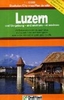
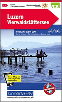
Lucerne - Lake Lucerne K+F Cycling Map 11

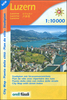
Lucerne - Lake Lucerne region of Switzerland, including Pilatus and Rigi, at 1:60, 000 in Kümmerly + Frey’s series of cycling maps published in co-operation with the Association for Transport and Environment and showing the official “Cycling in Switzerland” routes. The aim of the series is to present a network of routes with as few problems as possible caused by motor traffic. The maps have a detailed base, with contours plus graphic relief and shading providing an excellent representation of the terrain. Routes are classified according to the density of motorized traffic, the difficulty of the terrain, and road restrictions. Unsurfaced roads are indicated, gradient marks show steep inclines, and local danger spots are highlighted. The maps show facilities for transporting
cycles by train, bus, ferries, mountain railways, chair lifts, and cable cars. Border crossings indicate those open only to hikers and cyclist during daylight hours. Bike rental facilities are marked and towns with special bicycle-friendly accommodation are highlighted. Other tourist information includes various types of accommodations (campsites, youth hostels, “Friends of Nature” houses, etc), viewpoints, picnic sites, swimming pools, and places of interest. Each title covers an area of approximately 60 x 42 km (37 x 26 miles). The maps have a 1km grid for GPS users, with latitude and longitude shown as margin ticks. Map legend includes English. On the reverse, an index of towns and villages also lists names of geographical features such as mountains, alpine passes,
glaciers, etc. Also included is general information on the country’s long-distance cycling routes and on transporting bikes by train (text includes English).To see the list of titles in this series please click on the series link.
RIP - This product is no longer available on our network. It was last seen on 25.09.2019

This page now acts as a permanent archive for this product. Add more information using the comments box below to ensure it can still be found by future generations.

Use our search facility to see if it is available from an alternative contributor.
  • Availability: Out Of Stock
  • Supplier: Stanfords
  • SKU: 9783259005200
Availability: In Stock
£19.99

Product Description

Lucerne
- Lake Lucerne region of Switzerl&, including Pilatus & Rigi, at 1:60, 000 in Kümmerly + Frey’s series of cycling maps published in co-operation with the Association for Transport & Environment & showing the official “ Cycling in Switzerland” routes. The aim of the series is to present a network of routes with as few problems as possible caused by motor traffic. The maps have a detailed base, with contours plus graphic relief & shading providing an excellent representation of the terrain. Routes are classified according to the density of motorized traffic, the difficulty of the terrain, & road restrictions. Unsurfaced roads are indicated, gradient marks show steep inclines, & local danger spots are highlighted. The maps show facilities for transporting cycles by train, bus, ferries, mountain railways, chair lifts, & cable cars. Border crossings indicate those open only to hikers & cyclist during daylight hours. Bike rental facilities are marked & towns with special bicycle-friendly accommodation are highlighted. Other tourist information

Includes::
various types of accommodations (campsites, youth hostels, “ Friends of Nature” houses, etc), viewpoints, picnic sites, swimming pools, & places of interest. Each title covers an area of Approx. 60 x 42 km (37 x 26 miles). The maps have a 1km grid for GPS users, with latitude & longitude shown as margin ticks. Map legend

Includes::
English. On the reverse, an index of towns & villages also lists names of geographical features such as mountains, alpine passes, glaciers, etc. Also included is general information on the country’s long-distance cycling routes & on transporting bikes by train (text

Includes::
English). To see the list of titles in this series please click on the series link.

Reviews/Comments

Add New

Intelligent Comparison

Oooops!
We couldn't find anything!
Perhaps this product's unique.... Or perhaps we are still looking for comparisons!
Click to bump this page and we'll hurry up.

Price History

Vouchers

No voucher codes found.
Do you know a voucher code for this product or supplier? Add it to Insights for others to use.

Facebook

Jargon Buster

GPS - Global Positioning System - Global position using satellites
Motor - A evice that converts electricity into motion
switzerland - A landlocked country in western Europe. One of the richest countries in the world
Cable - A series of wires bonded to form a single thread
Friends - A close associate or a popular US based sitcom about a group of friends
Railways - A set of tracks that have been laid for the purpose of trains to travel up and down them
Network - A link and communication between things. Often computers or people.
Km - Kilometre. A unit of measurement equal to 1000 metres.
Road - a manmade lane or a path that is used to speed up travel.
Accommodation - A room in which someone can live in, for example in a hotel
Transport - Something that carries people or goods.
Environment - The conditions and surrounding area.

Supplier Information

Stanfords
Stanfords was established in 1853 and opened their iconic Covent Garden flagship store in 1901. They have become the top retailer of maps, travel books and accessories in the UK and arguably offer the largest selection of maps and travel books worldwide. Famous names such as Captain Robert Falcon Scott, Ranulph Fiennes and Michael Palin have purchased from Stanfords. They now have a shop in Bristol and both stores together with other venues operate a calendar of events including talks, book signings and exhibitions. As a specialist map retailer, the map selection is comprehensive and includes road maps, street maps and walking maps from worldwide destinations, as well as a selection of world atlases and wall maps. Books include travel guides and travel literature. Stanfords also stock globes, from miniatures made of blue marble to magnificent floor-standing globes. The website features a selection of interesting articles on travel topics.
Page Updated: 2023-11-12 20:15:36

Community Generated Product Tags

Oh No! The productWIKI community hasn't generated any tags for this product yet!
Menu