More From Contributor

£5.95
Huertas, Lavapies & Latina districts of Madrid presented as one of four exceptionally detailed street plans of the city from WAU with names & colour-coding of different types of retail outlets, hotels, restaurants, museums & places of entertainment, banks, embassies, governmental & other important public buildings, etc. The map covers the districts south of Plaza Mayor, Plaza del Angel & the Prado, extending just beyond the Reina Sofia Museum. The detailed scale of the plans means that each of the four maps covers an area of Approx. 30 minutes by 15 minutes when walking. Places included in WAU ...
Archived Product
£5.95
Salamanca, the affluent residential part Madrid with up-market shops just north of the Retiro Park presented as one of four exceptionally detailed street plans of the city from WAU with names & colour-coding of different types of retail outlets, hotels, restaurants, museums & places of entertainment, banks, embassies, governmental & other important public buildings, etc. The detailed scale of the plans means that each of the four maps covers an area of Approx. 30 minutes by 15 minutes when walking. Places included in WAU ...
Archived Product
£6.95
Topographic coverage of mainland Spain at 1:50, 000 in the MTN50 (Mapa Topográfico Nacional) series from the Centro Nacional de Información Geografica, the country’s civilian survey organization. The maps have contours at 20m intervals, enhanced by relief shading, plus colouring and/or graphics to show different types of terrain, vegetation or land use. Boundaries of national parks & other protected areas are marked. In addition to all the usual information featured on topographic mapping at this scale, detailed presentation of the road & rail networks, rural tracks & paths, etc, the maps also show campsites & mountain refuges. On more recent editions some GRs, the official long-distance hiking routes, are also marked (although not as clearly as on hiking maps from other publishers). Each map covers 29.5x 18.5 km (with adjustments in the border or coastal areas). The maps have a 1-km UTM grid, plus margin ticks for latitude & longitude at 1` intervals. Map legend is in Spanish only.HOW TO CHOOSE THE RIGHT 50K MAP: all the titles in CNIG’s 200K Provincial Road Maps series at 1:200, 000 are overprinted with the grid for the 1:50, 000 maps & can be used to see the area covered by each 50K title. TO SEE THE LIST OF TITLES IN THIS SERIES PLEASE CLICK ON THE SERIES LINK.PLEASE NOTE
- MAP TITLES: the grids shown on our website serve both the civilian & the military 1:50, 000 topographic series. Although the areas covered by maps in both series are identical (apart from some border or coastal sheets), occasionally map titles differ – only one title is shown on the grid, usually the military one. In Galicia, the Basque country & in the Catalan speaking areas the tendency now is to use local place names rather than the often better known Castilian ones. Where possible, both versions are included in our titles. Map titles listed on our website are based on information received by us at the time of publication, but sometimes maps arrive showing a completely different title! As long as the map number is as ordered, the correct map has been supplied.
...
Archived Product
£9.50
Topographical survey of Belgium at 1:20, 000 from Nationaal Geografisch Instituut / Institut Géographique National, the country’s national survey organization. Each 20K map covers one quarter of the corresponding 1:50, 000 map (with adjustments in the border & coastal areas). The maps provide all the information expected of topographic mapping at this scale & in addition have an unusually large amount of vegetation and/or land use information (different types of woodlands, gardens, orchards, heath, etc). The maps have a 1-km UTM grid, with margin ticks for latitude & longitude at intervals of 1`. Map legend & a glossary of terms used on the maps include English. Stanfords keeps as regular stock 20K maps for the World War I battlefields around the Ypres, Messines & Passchendaele, & for the area of the Battle of Waterloo. The 1:20, 000 survey covers the whole of Belgium & maps for other regions can be supplied as special orders. To see the list of titles in this series please click on the series link.PLEASE NOTE: the Long-Distance Footpaths Map of Belgium at 1:300, 000 which shows the division of Belgium into the 50K survey sheets can also be used to see in more detail coverage by the 20K maps. ...
Archived Product
£3.99
Famous for being ruthless, cruel, & cool, the Mafia has always captured the darker side of the imagination. Here, James Finckenauer debunks the myths surrounding the Mafia to reveal the harsh realities of global organized crime from Japan to Russia to Colombia. Despite popular appeal, these incredibly complex organizations destabilize society on a global scale, perpetuating untold economic, physical, psychological, & societal damage. Mafia & Organized Crime: A Beginner`s Guide provides vital insight into the real stories behind the world`s richest & most successful criminals. ...
Archived Product
£8.99
We see mafias as vast, powerful organisations, harvesting billions of dollars across the globe & wrapping its tentacles around everything from governance to finance. But is this the truth? Travelling from mafia initiation ceremonies in far-flung Russian cities to elite gambling clubs in downtown Macau, Federico Varese sets off in search of answers. Using wiretapped conversations, interviews & previously unpublished police records, he builds up a picture of the real men & women caught up in mafia life, showing their loves & fears, ambitions & disappointments, as well as their crimes. Mafia Life takes us into the real world of organised crime, where mafia henchmen worry about their bad managers & have high blood pressure, assassinations are bungled as often as they come off, & increasing pressure from law enforcement means that a life of crime is no longer lived in the lap of luxury. As our world changes, so must the mafia. Globalisation, migration & technology are disrupting their traditions & threatening their revenue streams, & the mafiosi must evolve or die. Mafia Life is an intense & totally compelling look at an organisation & the daily life of its members, as it gets to grips with the modern world. Out now in paperback. ...
Archived Product
£29.99
Map No. 2524, Mafikeng, in South Africa’s official topographic survey at 1:250, 000 from the country’s national survey organization, the Chief Directorate of Surveys & Mapping. The maps have altitude colouring & contours at 50m or 100m intervals, depending on the map edition, plus spot heights. Deserts, marshes, dry pans, perennial & seasonal water features, etc, as well as protected areas are shown. The maps present the country’s road & rail networks & include the usual information expected on topographic mapping at this scale, although in more rapidly developing areas road information may not necessarily be up to date. Also indicated are magisterial district & provincial boundaries. Latitude & longitude values are shown in the margins at 5` intervals together with South African grid co-ordinates. Typically, each sheet covers an area of one degree of latitude & two degrees of longitude. The projection used is Gauss Conformal. The legend is in English & Afrikaans. ...
Archived Product
£8.95
Street map of the town of Magadan, showing physical relief & communication information. Intermediate driving distances on roads are marked. General relief is shown through contours. An extensive range of symbols represents local facilities, landmarks & other features eg. museums, churches, petrol stations, post offices, cafes, schools. On the reverse: a 1:10, 000 plan of the town centre & a 1:200, 000 road map of Magadan & surroundings. All text is in cyrillic only.IMPOTRANT
- PLEASE NOTE: Deliveries from Russia are highly irregular & we are unable to guarantee delivery dates for maps or atlases that are not currently in stock. Specifications of maps supplied, particularly street plans, may also differ to those described on the website.
...
Archived Product

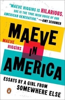
Maeve In America: Essays By A Girl From Somewhere Else

Maeve Higgins was a bestselling memoirist and comedian in her native Ireland when, at the grand old age of 31, she left the only home she`d ever known in search of something more. Like many women in their early thirties, she both was and was not the adult she wanted to be. At once smart, curious and humane, Maeve in America is the story of how Maeve found herself, literally and figuratively, in New York City.
RIP - This product is no longer available on our network. It was last seen on 25.09.2019

This page now acts as a permanent archive for this product. Add more information using the comments box below to ensure it can still be found by future generations.

Use our search facility to see if it is available from an alternative contributor.
  • Availability: Out Of Stock
  • Supplier: Stanfords
  • SKU: 9780143130161
Availability: In Stock
£13.99

Product Description

Maeve Higgins was a bestselling memoirist & comedian in her native Ireland when, at the grand old age of 31, she left the only home she`d ever known in search of something more. Like many women in their early thirties, she both was & was not the adult she wanted to be. At once smart, curious & humane, Maeve in America is the story of how Maeve found herself, literally & figuratively, in New York City.

Reviews/Comments

Add New

Intelligent Comparison

Oooops!
We couldn't find anything!
Perhaps this product's unique.... Or perhaps we are still looking for comparisons!
Click to bump this page and we'll hurry up.

Price History

Vouchers

No voucher codes found.
Do you know a voucher code for this product or supplier? Add it to Insights for others to use.

Facebook

Jargon Buster

New York - A United States State. Commonly known as the Big Apple
Home - A place of permanent residence for families.

Supplier Information

Stanfords
Stanfords was established in 1853 and opened their iconic Covent Garden flagship store in 1901. They have become the top retailer of maps, travel books and accessories in the UK and arguably offer the largest selection of maps and travel books worldwide. Famous names such as Captain Robert Falcon Scott, Ranulph Fiennes and Michael Palin have purchased from Stanfords. They now have a shop in Bristol and both stores together with other venues operate a calendar of events including talks, book signings and exhibitions. As a specialist map retailer, the map selection is comprehensive and includes road maps, street maps and walking maps from worldwide destinations, as well as a selection of world atlases and wall maps. Books include travel guides and travel literature. Stanfords also stock globes, from miniatures made of blue marble to magnificent floor-standing globes. The website features a selection of interesting articles on travel topics.
Page Updated: 2023-11-12 20:15:36

Community Generated Product Tags

Oh No! The productWIKI community hasn't generated any tags for this product yet!
Menu