More From Contributor
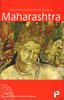
£7.99
The first book in the incredible new series from the author of Percy Jackson, the Kane Chronicles & Heroes of Olympus. My name is Magnus Chase. I`m orphaned & living rough on the streets of Boston. & things are about to get much worse. My day started out normally enough. I was sleeping under a bridge when some guy kicked me awake & said, ` They`re after you.` Next thing I know, I`m reunited with my obnoxious uncle, who casually informs me that my long-lost father is a Norse god. Nothing normal about that. & it turns out the gods of Asgard are preparing for war. Apparently, if I can`t find the sword my father lost two thousand years ago, there will be doom. Doomsday, to be precise. A fire giant attacking the city? Immortal warriors hacking each other to pieces? Unkillable wolves with glowing eyes? It`s all coming up. But first I`m going to die. This is the story of how my life goes downhill from there... ...
Archived Product
£18.95
Magomero is a vivid historical portrait of a Malawian village from 1859 to the present day. It focuses on a region which saw historically important political activity, in the founding of a colony of freed slaves & the rising of an independent church movement against white estate owners. With the dual concerns of a Southern African specialist & a poet, Landeg White offers an `inside` view of social, political & economic change in Malawi, seen through the lives of individuals: the ordinary men & women, whose situation & poverty have hitherto prevented recognition of their vital contribution to African history. ...
Archived Product
£18.99
When editor Susan Ryeland is given the tattered manuscript of Alan Conway`s latest novel, she has little idea it will change her life. She`s worked with the revered crime writer for years & his detective, Atticus Pund, is renowned for solving crimes in the sleepy English villages of the 1950s. As Susan knows only too well, vintage crime sells handsomely. It`s just a shame that it means dealing with an author like Alan Conway... But Conway`s latest tale of murder at Pye Hall is not quite what it seems. Yes, there are dead bodies & a host of intriguing suspects, but hidden in the pages of the manuscript there lies another story: a tale written between the very words on the page, telling of real-life jealousy, greed, ruthless ambition & murder. From Sunday Times bestseller Anthony Horowitz comes Magpie Murders, his deliciously dark take on the cosy crime novel, brought bang- up-to-date with a fiendish modern twist. ...
Archived Product
£8.99
` The finest crime novel of the year` Daily Mail***** Seven for a mystery that needs to be solved... Editor Susan Ryland has worked with bestselling crime writer Alan Conway for years. Readers love his detective, Atticus Pund, a celebrated solver of crimes in the sleepy English villages of the 1950s. But Conway`s latest tale of murder at Pye Hall is not quite what it seems. Yes, there are dead bodies & a host of intriguing suspects, but hidden in the pages of the manuscript lies another story: a tale written between the very words on the page, telling of real-life jealousy, greed, ruthless ambition & murder. From the creator of Midsomer Murders comes a fiendish mystery perfect for fans of Agatha Christie`s Miss Marple & Hercule Poirot.***** Praise for Magpie Murders
- the gripping Sunday Times bestselling crime thriller:` Ingenious` Sunday Times` Thrilling & compelling with a stunning twist` Daily Mail `A stylish thriller` Sunday Mirror `A cunning reinvention of the thriller` Mail on Sunday
...
Archived Product
£4.95
Maharashtra in a series of locally produced administrative maps of Indian states, each with a booklet providing a guide to the area. The maps show the division of each state into districts & have more small towns & villages than on more general maps of India available from other publishers. Presentation is now considerably enhanced with the districts shown in different colours. The maps indicate each district ...
Archived Product
£7.50
Indian state of Maharashtra on road map from the Delhi-based International Publications, showing many small towns & villages, with a 38-page booklet describing the state & its sights. Additional features include an enlargement showing in greater detail road & railway connections around Mumbai; a physical map of the state with altitude colouring; a distance chart; a table listing administrative units with size, population, literacy, etc. Illustrated booklet

Includes::
notes on beaches & hill stations, fairs & festivals, pilgrimage pales, wildlife, etc. Unless indicated to the contrary in the individual description, maps in this series present the state with its constituent districts in different colours & also show the division of districts into talukas. Town symbols indicate both district & taluka headquarters. Road network

Includes::
many local roads, some with driving distances, although sometimes locations are marked without road access to them shown on the map. Railway lines are included & local airports are marked. Symbols indicate various locations of interest, including historical sites, wildlife sanctuaries, beaches, etc. In many titles additional panels around the main map and/or in the accompanying booklet provide more information: enlargements with more detailed presentation of the road network, street plans of main cities, etc. The booklets, which also include a general introduction to the state & district-by-district descriptions, are published on high quality paper & are illustrated with numerous colour photos. To see the list of titles in this series please click on the series link.


...
Archived Product
£4.95
Road atlas of the state with maps arranged by administrative districts. Road information gives distances but does not indicate the type of road surface. The maps show railway lines, places of interest such as hill stations, beaches, historical & religious centres, etc. The atlas also contains rather basic street plans of main towns, indicating important public buildings, monuments, etc. Brief descriptions of each district include details of population, literacy, etc. ...
Archived Product
£8.95
Indexed streetmap of the whole city. Detail

Includes::
unsurfaced roads, tracks, railways, post offices,

...
Archived Product
£6.95
Topographic coverage of the Balearic Islands at 1:50, 000 in the MTN50 (Mapa Topográfico Nacional) series from the Instituto Geográfico Nacional – Centro Nacional de Información Geografica, the country’s civilian survey organization. The maps have contours at 20m intervals, enhanced by relief shading, plus colouring and/or graphics to show different types of terrain, vegetation or land use. Boundaries of national parks & other protected areas are marked. In addition to all the usual information featured on topographic mapping at this scale: detailed presentation of the road & rail networks, rural tracks & paths, etc, the maps also show campsites & mountain refuges. On more recent editions some GRs, the official long-distance hiking routes, are also marked (although not as clearly as on hiking maps from other publishers). The MTN50 series was begun in late 1990s. Each map covers 28.5x 18.5 km (with adjustments in the coastal areas). The maps have a 1-km UTM grid, plus margin ticks for latitude & longitude at 1` intervals. Map legend is in Spanish only. To see other titles in this series please click on the series link. ...
Archived Product
£12.99
Topographic survey of France at 1:25, 000 in IGN`s excellent TOP25 / Série Bleue series. All the maps are GPS compatible, with a 1km UTM grid plus latitude & longitude lines at 5’ intervals. Contours are at 5m intervals except for mountainous areas where the maps have contours at 10m intervals, vividly enhanced by hill shading & graphics for rocky terrain. Colouring with graphics indicates different types of vegetation or land use (deciduous or coniferous forests, moors, orchards, vineyards, etc). PLEASE NOTE: coverage of France at this scale is currently being revised – the format & the presentation of each title are indicated by the letters at the end of its Sheet Reference number (e.g. 0416ET, 3531ETR, 1923SB, etc.)MAPS WITH FULL TOURIST OVERPRINT & AN ENGLISH MAP LEGEND: all TOP25 maps & the SB editions of Série Bleue have an overprint highlighting waymarked walking trails including long-distance GR routes &, where appropriate, ski routes. Symbols indicate campsites, gîtes d’etape, refuges, equestrian centres & other recreational facilities or sites, tourist information centres, cultural heritage, etc. Towns & locations of particular interest are highlighted.- ET or OT = single-sided TOP25 map covering approx. 29x 21 km / 18x 13 miles.- ETR or OTR = waterproof & tear resistant TOP25 map covering the same area as the corresponding ET or OT number, but double-sided, printed on a smaller size sheet with a good overlap between the sides.- SB = Série Bleue map with full tourist overprint; these maps, first introduced in summer 2014, each cover approx. 29x 24km / 18x 15 miles.SÉRIE BLEUE maps with numbers ending in E (Est) or O (Ouest): most editions now indicate the GR routes, but do not show any other tourist information. Map legend is in French only. Each map covers approx. 14x 20km / 9x 12 miles. ...
Archived Product

Maharashtra

Maharashtra in a series of waterproof and tear-resistant maps from Bharat Graphics, showing local districts in different colours and indicating both administrative headquarters of each district and of its subdivisions, the tehsils (or tahsils, tahasils, talukas, taluks, taluqs). Roads are classified as national or state highways and other roads, some with driving distances. Railway lines are also marked and some titles have symbols indicating places of interest or rest houses. Maps of states in mountainous areas show names of main valleys, on other titles there is no topographic information. The maps have no geographical coordinates. Some titles include insets with enlargements of popular areas or street plans, and distance tables. All the maps are indexed and have a small booklet
providing a basic guide to the state district by district. The maps are printed on a waterproof and tear-resistant paper.Please note: the various series of state maps of India often show different small villages, supplementing each other to provide a more detail picture of each state.
RIP - This product is no longer available on our network. It was last seen on 25.09.2019

This page now acts as a permanent archive for this product. Add more information using the comments box below to ensure it can still be found by future generations.

Use our search facility to see if it is available from an alternative contributor.
  • Availability: Out Of Stock
  • Supplier: Stanfords
  • SKU: XL00000102765
Availability: In Stock
£4.50

Product Description

Maharashtra in a series of waterproof & tear-resistant maps from Bharat Graphics, showing local districts in different colours & indicating both administrative headquarters of each district & of its subdivisions, the tehsils (or tahsils, tahasils, talukas, taluks, taluqs). Roads are classified as national or state highways & other roads, some with driving distances. Railway lines are also marked & some titles have symbols indicating places of interest or rest houses. Maps of states in mountainous areas show names of main valleys, on other titles there is no topographic information. The maps have no geographical coordinates. Some titles include insets with enlargements of popular areas or street plans, & distance tables. All the maps are indexed & have a small booklet providing a basic guide to the state district by district. The maps are printed on a waterproof & tear-resistant paper. Please note: the various series of state maps of India often show different small villages, supplementing each other to provide a more detail picture of each state.

Reviews/Comments

Add New

Intelligent Comparison

Oooops!
We couldn't find anything!
Perhaps this product's unique.... Or perhaps we are still looking for comparisons!
Click to bump this page and we'll hurry up.

Price History

Vouchers

No voucher codes found.
Do you know a voucher code for this product or supplier? Add it to Insights for others to use.

Facebook

Jargon Buster

Paper - A thin sheet mainly used for writing. Available in a variety of colours. Made mainly from wood pulp.
India - A subcontinent in Asia
Graphics - A general term for visual aspects of an item/display
Waterproof - Resistant to water, usualy specified by depth in metres
Small - something that takes up less space than normal.
Resistant - Something that can repel against something.
Popular - Something that is admired and liked by many people.

Supplier Information

Stanfords
Stanfords was established in 1853 and opened their iconic Covent Garden flagship store in 1901. They have become the top retailer of maps, travel books and accessories in the UK and arguably offer the largest selection of maps and travel books worldwide. Famous names such as Captain Robert Falcon Scott, Ranulph Fiennes and Michael Palin have purchased from Stanfords. They now have a shop in Bristol and both stores together with other venues operate a calendar of events including talks, book signings and exhibitions. As a specialist map retailer, the map selection is comprehensive and includes road maps, street maps and walking maps from worldwide destinations, as well as a selection of world atlases and wall maps. Books include travel guides and travel literature. Stanfords also stock globes, from miniatures made of blue marble to magnificent floor-standing globes. The website features a selection of interesting articles on travel topics.
Page Updated: 2023-11-12 20:15:36

Community Generated Product Tags

Oh No! The productWIKI community hasn't generated any tags for this product yet!
Menu