More From Contributor

£12.95
We all rely on the apparent accuracy & objectivity of maps, but often do not see the very process of mapping as political. Are the power & purpose of maps inherently political? Maps & Politics addresses this important question & seeks to emphasize that the apparent objectivity' of the map-making & map-using process cannot be divorced from aspects of the politics of representation. Maps have played, & continue to play, a major role in both international & domestic politics. They show how visual geographical representations can be made to reflect & advance political agendas in powerful ways. The major developments in this field over the last century are responses both to cartographic progression & to a greater emphasis on graphic imagery in societies affected by politicization, democratization, & consumer & cultural shifts. Jeremy Black asks whether bias-free cartography is possible & demonstrates that maps are not straight-forward visual texts, but contain political & politicizing subtexts that need to be read with care. ...
Archived Product
£49.00
Maps are universal forms of communication, easily understood & appreciated regardless of culture or language. This truly magisterial book introduces readers to the widest range of maps ever considered in one

Volume:
maps from different time periods & a variety of cultures; maps made for divergent purposes & depicting a range of environments; & maps that embody the famous, the important, the beautiful, the groundbreaking, & the amusing. Built around the functions of maps
- the kinds of things maps do & have done
- maps confirms the vital role of maps throughout history in commerce, art, literature, & national identity. The book begins by examining the use of maps for wayfinding, revealing that even maps as common & widely used as these products of historical circumstances & cultural differences. The second chapter considers maps whose makers employed the smallest of scales to envision the broadest of human stages
- the world, the heavens, even the act of creation itself. The next chapter looks at maps that are, literally, at the opposite end of the scale from cosmological & world maps
- maps that represent specific parts of the world & provide a close-up view of areas in which their makers lived, worked, & moved. Having shown how maps help us get around & make sense of our greater & lesser worlds, ” Maps” then turns to the ways in which certain maps can be linked to particular events in history, exploring how they have helped Americans, for instance, to understand their past, cope with current events, & plan their national future. The fifth chapter considers maps that represent data from scientific instruments, population censuses, & historical records. These maps illustrate, for example, how diseases spread, what the ocean floor looks like, & how the weather is tracked & predicted. Next comes a turn to the imaginary, featuring maps that depict entire fictional worlds, from Hell to Utopia & from Middle Earth to the fantasy game World of Warcraft. The final chapter traces the origins of map consumption throughout history & ponders the impact of cartography on modern society.A companion volume to the most ambitious exhibition on the history of maps ever mounted in North America, ” Maps” will challenge readers to stretch conventional thought about what constitutes a map & how many different ways we can understand graphically the environment in which we live. Collectors, historians, mapmakers & users, & anyone who has ever ”gotten lost” in the lines & symbols of a map will find much to love & learn from in this book.


...
Archived Product
£18.99
Pepin Letter Writing Sets come in carefully designed luxury boxes. Each box contains 10 sheets of 4 different designs (printed ...
Archived Product
£8.99
Following the best-selling Maps, the Mizielinskis return with a companion activity book. Bursting with fascinating facts & puzzles from around the world, this book offers hours of entertainment to young adventurers. Informative & inspiring, the myriad activities in this book challenge the reader to discover something new & explore their imagination to draw, decorate & design every pull-out page. ...
Archived Product
£7.99
Navigate your way through the Galapagos Islands, track down buried treasure, search for a long-lost temple & much more in this entertaining map-themed activity pad. Each brightly illustrated map is crammed full of things to spot & puzzles to solve. The tear-off sheets are great for sharing, & all the answers are given at the back of the pad. ...
Archived Product
£10.99
The Canadian sub-arctic is a world of Indian hunters & trappers
- but also of white energy speculators, ranchers & sports hunters.
...
Archived Product
£12.50
Historical atlases offer an understanding of the past which is invaluable to historians, not only because they convey a previous age's sense of space & distance but also because they reveal what historians & educators of those periods thought important to include or omit. This is perhaps the first comprehensive exploration of the role, development & nature of this important reference tool. The author covers everything from mapping of the Classical World to modern, post-Cold War re-mapping of the globe & the way it is perceived. ...
Archived Product
£15.99
David Smith's painstaking survey details all kinds of historic British maps from estate, enclosure & tithe plans to those of the Ordinance Survey & reveals their value to the historian & collector. Over 100 illustrations include the work of the great map-makers
- Saxton, Speed, Rocque, Jefferys, Greenwood. The author also studies the methods of surveyors & the various elements of map design, & concludes with bibliographies & notes to each chapter & an extensive county-by-county bibliography. This book may be useful for historians & the collectors of every type of British map.
...
Archived Product
£14.99
Old maps provide a rich source of information & insight for all those interested in the history of their locality, including local historians, geographers & cartographers. They are also a popular field for collectors & they fascinate many others. They abound in record offices & archives & are frequently to be found on sale in antique shops. This book represents a comprehensive guide to their provenance, content, accuracy, location & uses. Now in its 2nd edition, it has over 100 illustrations to support the text, including examples of every type of map discussed. The author also uses illustrations to demonstrate the rich variety of ways in which maps represent a source of historical evidence. ...
Archived Product
£8.99
In an unnamed town Jugnu & his lover Chanda have disappeared. Rumours abound in the close-knit Pakistani community, & then on a snow-covered January morning Chanda`s brothers are arrested for murder. Telling the story of the next twelve months, Maps for Lost Lovers opens the heart of a family at the crossroads of culture, community, nationality & religion, & expresses their pain in a language that is arrestingly poetic. ” This is a deeply pastoral novel, tied to the seasons & resonating with birdsong... Like Aslam, I was heartbroken when the dense, dark tapestry was finished”. (Independent on Sunday). ” Despite the violence that lies at the heart of the novel, it is a celebration of love & life. Sights & sounds, smells & colours are not so much vivid backdrops for the narrative as structural, mood- & texture-enhancing parts of it... This is that rare sort of book that gives a voice to those voices that are seldom heard”. (Observer). ...
Archived Product

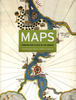
Maps And Civilization

In this concise introduction to the history of cartography, Norman J. W. Thrower charts the intimate links between maps and history from antiquity to the present day. A wealth of illustrations, including the oldest known map and contemporary examples made using Geographical Information Systems, illuminate the many ways in which various human cultures have interpreted spatial relationships. The third edition of ”Maps and Civilization” incorporates numerous revisions, features new material throughout the book, and includes a new, alphabetized bibliography.
RIP - This product is no longer available on our network. It was last seen on 25.09.2019

This page now acts as a permanent archive for this product. Add more information using the comments box below to ensure it can still be found by future generations.

Use our search facility to see if it is available from an alternative contributor.
  • Availability: Out Of Stock
  • Supplier: Stanfords
  • SKU: 9780226799742
Availability: In Stock
£13.00

Product Description

In this concise introduction to the history of cartography, Norman J. W. Thrower charts the intimate links between maps & history from antiquity to the present day. A wealth of illustrations, including the oldest known map & contemporary examples made using Geographical Information Systems, illuminate the many ways in which various human cultures have interpreted spatial relationships. The third edition of ” Maps & Civilization” incorporates numerous revisions, features new material throughout the book, &

Includes::
a new, alphabetized bibliography.

Reviews/Comments

Add New

Intelligent Comparison

Oooops!
We couldn't find anything!
Perhaps this product's unique.... Or perhaps we are still looking for comparisons!
Click to bump this page and we'll hurry up.

Price History

Vouchers

No voucher codes found.
Do you know a voucher code for this product or supplier? Add it to Insights for others to use.

Facebook

Jargon Buster

Contemporary - Modern era design
Contemporary - A design reference to indicate post war modern design
Human - A highly developed and adapted mamal and deminant species on earth
History - Anything that happens in the past. An acedemic subject.
Day - The time it takes a planet or other space objects to complete one rotation.
Contemporary - An object that is living in the same time.
illustrations - Pictures typically in books and newspapers.

Supplier Information

Stanfords
Stanfords was established in 1853 and opened their iconic Covent Garden flagship store in 1901. They have become the top retailer of maps, travel books and accessories in the UK and arguably offer the largest selection of maps and travel books worldwide. Famous names such as Captain Robert Falcon Scott, Ranulph Fiennes and Michael Palin have purchased from Stanfords. They now have a shop in Bristol and both stores together with other venues operate a calendar of events including talks, book signings and exhibitions. As a specialist map retailer, the map selection is comprehensive and includes road maps, street maps and walking maps from worldwide destinations, as well as a selection of world atlases and wall maps. Books include travel guides and travel literature. Stanfords also stock globes, from miniatures made of blue marble to magnificent floor-standing globes. The website features a selection of interesting articles on travel topics.
Page Updated: 2023-11-12 20:15:36

Community Generated Product Tags

Oh No! The productWIKI community hasn't generated any tags for this product yet!
Menu