
 United Kingdom
 France
 Germany
 Netherlands
 Sweden
 USA
USA
 Italy
Italy
 Spain
Spain
More From Contributor


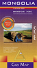
Mongolia
Excellent tourist map with plenty of information on the physical geography of the country: altitude tinting, peaks and mountain passes, rivers and lakes, swamps, salt flats, sand dunes and glaciers. The map shows towns and numerous villages, with connecting road and rail networks, local airfields, as well as the country's administrative divisions. Text is in Roman script only. Sites of interest are marked and the map is annotated with geographic facts. Indexed.Includes a street plan of central Ulaanbaatar (Ulan Bator) and an inset showing the county's natural zones (taiga, steppe, desert, etc.).
Product Description
Reviews/Comments
Add New
Intelligent Comparison
Archived Product
Mongolia Stanfords
£9.50
Archived Product
Mongolia Stanfords
£13.59
Archived Product
Mongolian Stanfords
£18.99
Archived Product
Mongolia ITMB Stanfords
£9.99
Archived Product
Mongolian Pack Stanfords
£34.99
Archived Product
Angola Stanfords
£9.50
Archived Product
Angola Stanfords
£8.99
Vouchers
No voucher codes found.
Do you know a voucher code for this product or supplier? Add it to Insights for others to use.
Do you know a voucher code for this product or supplier? Add it to Insights for others to use.
 Denmark