
 United Kingdom
 France
 Germany
 Netherlands
 Sweden
 USA
USA
 Italy
Italy
 Spain
Spain
More From Contributor


Mont Blanc Pocket Map Edition Didier Richard
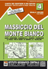
Mont Blanc Mini Map at 1:50, 000 from Editions Didier Richard covering the whole of the Tour of Mont Blanc (TMB) on a double-sided, contoured, GPS compatible hiking map from with both local hiking paths and other long-distance GR routes. The base map, derived from IGN’s topographic survey, has contours at 50m intervals enhanced by shading and graphic relief, with colours indicating wooded areas. An overprint highlights local hiking trail and long-distance GR routes indicating trails without waymarking, difficult sections and via ferrata ladders. Bold symbols mark various features of interest to hikers and other visitors, including gîtes and refuges, tourist information centres, mountain biking centres, interesting natural sites and viewpoints, cultural heritage, etc. The map
has a UTM grid. Map legend includes English.The map covers the whole of the TMB with its Italian and Swiss sections. Coverage includes Chamonix, les Houches, Argentière, Sixt, Samoëns, les Carroz, Flaine, Morillon, Cluses, Salanches, St-Gervais-les-Bains, Megève, les Contamines-Montjoie, les Saises, etc, as well as in Italy Courmayeur and in Switzerland Champex. PLEASE NOTE: the same cartography but at 1:60, 000 is also available as a larger map providing coverage further to the south and particularly to the west.To see the list of all the titles in this series please click on the series link.
has a UTM grid. Map legend includes English.The map covers the whole of the TMB with its Italian and Swiss sections. Coverage includes Chamonix, les Houches, Argentière, Sixt, Samoëns, les Carroz, Flaine, Morillon, Cluses, Salanches, St-Gervais-les-Bains, Megève, les Contamines-Montjoie, les Saises, etc, as well as in Italy Courmayeur and in Switzerland Champex. PLEASE NOTE: the same cartography but at 1:60, 000 is also available as a larger map providing coverage further to the south and particularly to the west.To see the list of all the titles in this series please click on the series link.
Product Description
Reviews/Comments
Add New
Vouchers
No voucher codes found.
Do you know a voucher code for this product or supplier? Add it to Insights for others to use.
Do you know a voucher code for this product or supplier? Add it to Insights for others to use.
 Denmark