More From Contributor
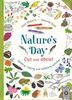
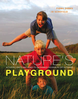
£10.00
Record all of your personal musings in these blank journals featuring adorable illustrations of animals from 20 Ways to Draw a Tree artist, Eloise Renouf. The journals are ideal for recording memories, favorite"es, sketches, lists, or phone numbers. ...
Archived Product
£8.99
A handy pocket guide which will allow nature-lovers to identify a wide range of trees from their size, shape, leaves & seeds
-
...
Archived Product
£20.00
Nature Watch is the ultimate guide to watching British wildlife, from renownednaturalist & TV presenter Simon King. More & more people are discovering the joys of being out & about inthe British countryside. Yet surprisingly few of us know where & what tolook for when spotting wild animals in their natural habitats. In Nature Watch Simon King teaches you how to use your eyes & ears tofind & follow creatures, how to identify tracks & signs that will lead youcloser to them, & how to move without disturbing animals. Much more than just a nature handbook, Simon offers insider knowledgeto help you get closer to the wild: Nature Watch also

Includes::
a chapter on theessential kit you will need to get started & offers photography tips, alongwith Simon`s amazing images, to help you get the best possible view of thenation`s favourite mammals, birds, mini-beasts, amphibians & more.

...
Archived Product
£12.99
Hundreds of years after their extinction in these isles, beavers are back in Britain. These highly skilled engineers of the natural world have been reintroduced at several sites across the UK &, even as they become established, are already having a dramatic effect on our wild landscapes. Here, leading nature writer Jim Crumley reveals the pioneering lifestyle of these intriguing & secretive creatures & considers the ecological & economic impact of the beaver reintroductions. Employing his trademark beautiful prose & empathy for life in the wild, Crumley considers the future for Britain`s beavers & makes the case for giving them their freedom. ...
Archived Product
£8.99
Discover the world of wonder that awaits on your doorstep, with this beautiful activity book from the author & illustrator of Nature`s Day. Learn how to spot different leaves, birds, flowers, & insects, make a bee hotel, ice art & a daisy chain, colour in different seasonal scenes & collect treasures for your nature box. This is the perfect title to get children out & about in spring & summer holidays. ...
Archived Product
£11.50
Map No. 051, Naturno/ Naturns
- Laces/ Latsch, from Kompass, printed on waterproof & tear-resistant synthetic paper in a series
...
Archived Product
£11.50
Frankenhöhe Regional Park, map no. 50-17 covering an area around Rothenburg ob der Tauber & Ansbach, in a series of special contoured & GP-compatible recreational maps from the Bavarian state survey organization, with cartography of the German topographic survey at 1:50, 000 & extensive additional tourist overprint highlighting waymarked hiking trails & cycling routes, campsites & youth hostels, etc. Maps in this series have cartography identical to the standard topographic survey of Germany. Topography is vividly presented by contours at 20m intervals, enhanced by bold shading & graphic relief, plus colouring and/or graphics to show forests & other types of vegetation. Extensive tourist overprint highlights local & long-distance footpaths & cycle routes
- including King Ludwig Way, different variants of the Way of St James, etc
- indicating, where appropriate, their waymarking designation. Symbols show various types of accommodation (campsites, youth hostels, refuges, etc), sport & recreational facilities, places of interest, ski & cable car lift, etc. The maps have UTM grid lines at 1-km UTM intervals. Map legend &, where included, additional text, are in German only. To see the other titles in this series please click on the series link.

...
Archived Product
£12.99
Naturpark Mass
- Schwalm – Nette in Germany at 1:50, 000 from Kümmerly+ Frey in a series GPS compatible, double-sided maps printed
...
Archived Product
£12.99
Topographic survey of France at 1:25, 000 in IGN`s excellent TOP25 / Série Bleue series. All the maps are GPS compatible, with a 1km UTM grid plus latitude & longitude lines at 5’ intervals. Contours are at 5m intervals except for mountainous areas where the maps have contours at 10m intervals, vividly enhanced by hill shading & graphics for rocky terrain. Colouring with graphics indicates different types of vegetation or land use (deciduous or coniferous forests, moors, orchards, vineyards, etc). PLEASE NOTE: coverage of France at this scale is currently being revised – the format & the presentation of each title are indicated by the letters at the end of its Sheet Reference number (e.g. 0416ET, 3531ETR, 1923SB, etc.)MAPS WITH FULL TOURIST OVERPRINT & AN ENGLISH MAP LEGEND: all TOP25 maps & the SB editions of Série Bleue have an overprint highlighting waymarked walking trails including long-distance GR routes &, where appropriate, ski routes. Symbols indicate campsites, gîtes d’etape, refuges, equestrian centres & other recreational facilities or sites, tourist information centres, cultural heritage, etc. Towns & locations of particular interest are highlighted.- ET or OT = single-sided TOP25 map covering approx. 29x 21 km / 18x 13 miles.- ETR or OTR = waterproof & tear resistant TOP25 map covering the same area as the corresponding ET or OT number, but double-sided, printed on a smaller size sheet with a good overlap between the sides.- SB = Série Bleue map with full tourist overprint; these maps, first introduced in summer 2014, each cover approx. 29x 24km / 18x 15 miles.SÉRIE BLEUE maps with numbers ending in E (Est) or O (Ouest): most editions now indicate the GR routes, but do not show any other tourist information. Map legend is in French only. Each map covers approx. 14x 20km / 9x 12 miles. ...
Archived Product
£12.99
Nauders, map No. 249bis, in the standard topographic survey of Switzerland at 1:50, 000 from Swisstopo, i.e. without the special overprint highlighting walking trails, local bus stops, etc, presented in Swisstopo’s hiking editions of the 50K survey. The map covers mainly the Austrian & the Italian side of the border. Highly regarded for their superb use of graphic relief & hill shading, the maps give an almost 3-D picture of Switzerland`s mountainous terrain. Contours are at 20m intervals. All the maps have a 1-km grid with the Swiss national coordinates. This standard version of the 50K survey covers the whole country on 78 small format sheets, with special larger format maps published for several popular tourist destinations. Small format sheets cover an area of 35 x 24 km (21 x 15 miles approx) & have map legend in the language of the area covered by the map. The special larger sheets cover 50 x 35 km (31 x 22 miles approx) & have no map legend, but a separate leaflet can be provided instead.PLEASE NOTE: the hiking editions of the 1:50, 000 Swisstopo survey are listed on our website in a separate series. ...
Archived Product

Nature`s Playground

This delightful illustrated book is a guide to introducing children to the great outdoors through fun activities in nature. Designed for use by families, carers, play workers and teachers, the book sets out guidelines for safe and engaging play outdoors, with useful tips on how to hold children`s attention on longer excursions. The book is divided into seasons, with activities appropriate to each. For example, in spring, children can explore aquatic life in ponds and streams, collect material to make birds` nests or look out for growing bulbs; in autumn they can collect berries or make collages with fallen leaves. Throughout the book, the emphasis is on helping children gain an appreciation of nature`s patterns, giving them confidence in the outdoor environment in a way that is
educational, safe and, above all, fun. The authors, Fiona Danks and Jo Schofield, have produced some outdoor activity sheets in conjuction with the Cub and Scout Naturalist Activity Badge, sponsered by Natural England. To view these acitivity sheets, click here. For more information on Natural England, click the logo on the left.
RIP - This product is no longer available on our network. It was last seen on 25.09.2019

This page now acts as a permanent archive for this product. Add more information using the comments box below to ensure it can still be found by future generations.

Use our search facility to see if it is available from an alternative contributor.
  • External links may include paid for promotion
  • Availability: Out Of Stock
  • Supplier: Stanfords
  • SKU: 9780711224919
Availability: In Stock
£16.99

Product Description

This delightful illustrated book is a guide to introducing children to the great outdoors through fun activities in nature. Designed for use by families, carers, play workers & teachers, the book sets out guidelines for safe & engaging play outdoors, with useful tips on how to hold children`s attention on longer excursions. The book is divided into seasons, with activities appropriate to each. For example, in spring, children can explore aquatic life in ponds & streams, collect material to make birds` nests or look out for growing bulbs; in autumn they can collect berries or make collages with fallen leaves. Throughout the book, the emphasis is on helping children gain an appreciation of nature`s patterns, giving them confidence in the outdoor environment in a way that is educational, safe &, above all, fun. The authors, Fiona Danks & Jo Schofield, have produced some outdoor activity sheets in conjuction with the Cub & Scout Naturalist Activity Badge, sponsered by Natural Engl&. To view these acitivity sheets, click here. For more information on Natural Engl&, click the logo on the left.

Reviews/Comments

Add New

Intelligent Comparison

Oooops!
We couldn't find anything!
Perhaps this product's unique.... Or perhaps we are still looking for comparisons!
Click to bump this page and we'll hurry up.

Price History

Vouchers

No voucher codes found.
Do you know a voucher code for this product or supplier? Add it to Insights for others to use.

Facebook

Jargon Buster

England - A country within the United Kingdom.
Fun - Something that provides amusement or enterainment
Natural - not manmade
Logo - A symbol that is usually associated with a brand or product.
Autumn - A season which falls between summer and winter.
Children - A young life form within the early stages of physical development,
Teachers - A person who educates others, typically in a school.
Confidence - The feeling of being certain and belief in what you do.
Environment - The conditions and surrounding area.

Supplier Information

Stanfords
Stanfords was established in 1853 and opened their iconic Covent Garden flagship store in 1901. They have become the top retailer of maps, travel books and accessories in the UK and arguably offer the largest selection of maps and travel books worldwide. Famous names such as Captain Robert Falcon Scott, Ranulph Fiennes and Michael Palin have purchased from Stanfords. They now have a shop in Bristol and both stores together with other venues operate a calendar of events including talks, book signings and exhibitions. As a specialist map retailer, the map selection is comprehensive and includes road maps, street maps and walking maps from worldwide destinations, as well as a selection of world atlases and wall maps. Books include travel guides and travel literature. Stanfords also stock globes, from miniatures made of blue marble to magnificent floor-standing globes. The website features a selection of interesting articles on travel topics.
Page Updated: 2023-11-12 20:15:36

Community Generated Product Tags

Oh No! The productWIKI community hasn't generated any tags for this product yet!
Menu