
 United Kingdom
 France
 Germany
 Netherlands
 Sweden
 USA
USA
 Italy
Italy
 Spain
Spain
More From Contributor


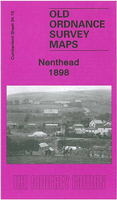
Nenthead 1898
Nenthead in 1898 in a fascinating series of reproductions of old Ordnance Survey plans in the Alan Godfrey Editions, ideal for anyone interested in the history of their neighbourhood or family. Selected towns in Great Britain and Ireland are covered by maps showing the extent of urban development in the last decades of the 19th and early 20th century.In this title: the map is double-sided and covers the village of Nenthead which in the 19th century grew into a mining town of over 2, 000 people, developed by the Quaker London Lead Company, and with pensions, education and health resources that foreshadowed the Welfare State. By the time of this map it was in rapid decline, and during the 20th century the population sank to around 350. The main map covers the northern part of the
village, including Whitehall, Holmsfoot, Wellgill Dykehead, Brownleyhill Dressingfloor, Greenends, Foulard, and stretching east to Haggs Mine and Nentsberry. On the reverse is a large section of adjacent sheet 42.03 which covers the village centre and the Rampgill Mine, part of which forms today's Nenthead Mines Heritage Centre. About the Alan Godfrey Editions of the 25
village, including Whitehall, Holmsfoot, Wellgill Dykehead, Brownleyhill Dressingfloor, Greenends, Foulard, and stretching east to Haggs Mine and Nentsberry. On the reverse is a large section of adjacent sheet 42.03 which covers the village centre and the Rampgill Mine, part of which forms today's Nenthead Mines Heritage Centre. About the Alan Godfrey Editions of the 25
Product Description
Reviews/Comments
Add New
Intelligent Comparison
Archived Product
Nenthead 1898 Stanfords
£3.50
Archived Product

Maidenhead 1897 Stanfords
£3.50
Vouchers
No voucher codes found.
Do you know a voucher code for this product or supplier? Add it to Insights for others to use.
Do you know a voucher code for this product or supplier? Add it to Insights for others to use.
 Denmark