
 United Kingdom
 France
 Germany
 Netherlands
 Sweden
 USA
USA
 Italy
Italy
 Spain
Spain
More From Contributor

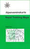


Nepal: Himalayan MapHouse Trekking Map 100 Series With The Great
Himalaya Trail
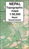
Northern Nepal, from Kanchenjunga in the east to Saipal and Api in the far west of the country, in a series of waterproof and tear-resistant maps at scales between 1:100, 000 and 1:150, 000 published by the Nepa Maps (Himalayan MapHouse).Cartography in these waterproof editions, first published in 2011, is identical to what Himalayan MapHouse use in most maps in their other series, published under the Nepa Maps imprint. Contours are at intervals of 80m or 40m (please check individual descriptions), with relief shading plus colouring to show different types of terrain or vegetation. The maps show names of numerous chains, peaks glaciers, valleys, rivers, lakes, etc.Main trekking routes are prominently highlighted, including the whole of the GHT (Great Himalaya Trail) High Route
between the Kanchenjunga Base Camp and Yulsa (Hilsa) and the GHT Cultural Trail between Tumbeding/Dahalgoan and Darchula in the far west of the country. Also highlighted are selected settlements along all the routes, indicating where tourist accommodation and other services are provided, campsites or base camps, and various places of interest. The maps also show other local trekking paths, often providing variants or shortcuts to the main routes. The maps are not indexed. Latitude and longitude coordinates are given as margin ticks at 5’ intervals.Unless indicated to the contrary in its individual description, each map also includes a profile of the main trekking route(s) across its area and provides on the inside cover other relevant information, including stage-by-stage distances
and timings.The maps are published on thick, sturdy, waterproof and tear-resistant plastic.* For maps not currently in stock please check availability of corresponding titles in the publishers’ other series under the Nepa Maps imprint. Although printed on paper, most titles are indexed and some are at larger scales and/or include enlargements.
Product Description
Reviews/Comments
Add New
Vouchers
No voucher codes found.
Do you know a voucher code for this product or supplier? Add it to Insights for others to use.
Do you know a voucher code for this product or supplier? Add it to Insights for others to use.
 Denmark