
 United Kingdom
 France
 Germany
 Netherlands
 Sweden
 USA
USA
 Italy
Italy
 Spain
Spain
More From Contributor

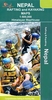


Nepal: Schneider Trekking Maps
Nepal’s most popular trekking regions at 1:50, 000 or 1:100, 000 in a series of detailed topographic maps originally prepared by the Austrian climber and cartographer Erwin Schneider which for nearly five decades provided the best and often the only coverage of these areas. Now sponsored by the German Scientific Association of Comparative High-Mountain Research (Arbeitsgemeinschaft für vergleichende Hochgebirgsforschung), the maps are still traditionally referred to as “the Schneider series”. Most maps have contours at 40-m intervals and, with bold relief shading and colouring for the glaciers, provide a vivid representation of the terrain. As the series is currently being revised to include more trekking information, please see the individual descriptions for more details.

Product Description
Reviews/Comments
Add New
Vouchers
No voucher codes found.
Do you know a voucher code for this product or supplier? Add it to Insights for others to use.
Do you know a voucher code for this product or supplier? Add it to Insights for others to use.
 Denmark