More From Contributor

£17.99
View the world in living colour in this all-encompassing reference book for the 21st century. Dynamic & fun to browse, the 448-page Answer Book tackles every sort of question in the world. From galaxies light-years away to the soil beneath our feet, from ancient China to jam-packed modern cities, from international trade to the medical advances of the 21st century, here is a book of knowledge about our universe, our world, our history, & our future, brilliantly illustrated & carefully researched, as only National Geographic can deliver. Every spread is designed to pop with as many ideas & images as possible. This title

Includes::
such elements as: top ten lists, key dates, & major ideas; Click-It features that recommend websites for further investigation; a glossary of pertinent words; cross-references to related topics elsewhere in the book; &, Fast Facts, with quick hits of fascinating stats & information. Chapters are arranged by major topic, each detailed with lively text & visuals. The book begins with Picturing the World, packed with marvelous maps. The Universe covers celestial bodies, space exploration, & the latest on extraterrestrials. Planet Earth talks about the active geology underlying the continents, as well as landforms, water, & atmosphere. Life on Earth surveys the plant & animal kingdoms & the threats they face, while Climates & Habitats explains weather, environments, & the impact of man. The Human World is all about us: our language, religions, cultures, foods, industries, cities, & more. World History traces global events over millennia, while Science & Technology ponders the history of thought & the best of human innovation. The final chapter, Countries of the World, puts a mini-atlas at your fingertips, with handy information on every nation. Throughout this global adventure, you`ll encounter ancient cultures & people of the modern melting pot. Get the facts on threatened rain forests, melting ice caps, & other fragile habitats. Find out about endangered species. Check current figures & superlatives, from population to mountain height. Every spread has something new to offer. Open to one page, follow where it leads you, repeat, & repeat. You won`t want to put this book down.

...
Archived Product
£19.99
We are able to source a wide range flags in many sizes, sewn or printed on 100% Ministry Of Defence Standard Woven & Knitted Polyester. Flags are supplied with rope & toggle. If you would like more information, have a custom size request or cannot find a desired product, please email us at maritime@stanfords.co.uk. We will be glad to help! ...
Archived Product
£21.00
We are able to source a wide range flags in many sizes, sewn or printed on 100% Ministry Of Defence Standard Woven & Knitted Polyester. Flags are supplied with rope & toggle. If you would like more information, have a custom size request or cannot find a desired product, please email us at maritime@stanfords.co.uk. We will be glad to help! ...
Archived Product
£23.00
We are able to source a wide range flags in many sizes, sewn or printed on 100% Ministry Of Defence Standard Woven & Knitted Polyester. Flags are supplied with rope & toggle. If you would like more information, have a custom size request or cannot find a desired product, please email us at maritime@stanfords.co.uk. We will be glad to help! ...
Archived Product
£4.99
This is a classic Ant & Bee reissue to treasure. First published in 1950, Ant & Bee were in print for over 40 years. These updated editions feature revised text & illustrations by original Ant & Bee creator Angela Banner. Ant & Bee is a classic br&, & the delightful & much-loved characters are instantly recognisable to thousands of diehard fans today. Ant & Bee teach children to read via word recognition & encourage story sharing with siblings & parents. This is the story of how Ant & Bee first met. Join them on their adventure through the alphabet as they search for their lost hats. ...
Archived Product
£7.99
Antalya Main Roads Plan at 1:25, 000 from Mepmedya is an indexed, double-sided road map of the area surrounding the city. Shows main transport routes & many places of interest, &

Includes::
an enlarged inset of Antalya city centre. * Map legend also in English.* Major & secondary roads & main streets are named or numbered; & many more streets are shown but not named. The tramway system is displayed & local bus stations & airports are marked. Local districts are named & demarcated, many places of interest are annotated on the map. These include: hotels, museums, parks & beaches; public buildings, shops, emergency services & university buildings; & sports & entertainment venues. The map coverage appears on two side of the sheet, with a north-south split at a point considerably north of the city centre (no overlap). It covers the central areas of Merkez District in Antalya Province.
Includes: an enlarged inset of the city centre (scale unknown), with greater detail of transport routes, local districts & numerous places of interest. An index appears on the map, listing streetnames, & a small inset shows the location of Antalya within its province.


...
Archived Product
£8.99
Antalya Tourist Plan from Mepmedya is a detailed street plan of the city. Shows main streets, urban transport & many places of interest, &

Includes::
a road map of Antalya Province. * Map legend in English & Turkish.* * * Street plan* Major & secondary roads & main streets are named or numbered. The tramway service is displayed & local bus stations are marked. Local districts are named, & many places of interest are annotated on the map. These include: hotels, museums, parks & beaches; public buildings, emergency services & university buildings; & sports & entertainment venues. The most important sites are numbered, with descriptions & photography appearing on the reverse of the map. The scale of the street plan is not shown.* * Road map* Also

Includes::
a large road map giving an overview of a large part of Antalya Province at 1:330, 000. Motorways, secondary roads & many minor roads are shown, as are railway lines & stations, airports & major harbours. Mountain passes are displayed alongside an indication of their altitude. Major towns & cities & many smaller towns & villages are marked, with an indication of their administrative importance. Relief shading defines the terrain, mountain ranges are named & spot heights are shown for major peaks. The main lakes, rivers & dams of the province are marked & named, & waterfalls, caves & springs are also displayed. The mapping is annotated with numerous places of interest. These range from ancient ruins, castles & historic sites, places of worship, caravanserai & Turkish baths, to national parks, ski centres & marinas.


...
Archived Product
£85.00
ANTarctic is an exquisite photographic tribute to the Polar Regions by much acclaimed & award winning photographer Michael Poliza. The camera leads us through frozen paradise & summer splendours in the Arctic & Antarctic in order to force us notice what we risk losing due to the effects of global warming. In his inimitable style Poliza blends wildlife close-ups & panoramic landscape shots, moments of stillness & moments of motion, capturing the detail & vulnerability, the scale & epic essence at the ends of the earth. ...
Archived Product
£12.99
Antarctica at 1:6, 800, 000 on an attractive & informative map from the Buenos Aires bases publishers Zagier & Urruty printed on waterproof & tear-resistant synthetic paper & showing topography, exploration routes, research stations, etc. The map uses relief shading & graphics to provide a picture of the continent’s topography, with plenty of names of mountain ranges, peaks, glaciers, ice shelves, coastal bays & other geographical features. Several explorations routes are marked, as well as historical sites such as Scott’s & Shackleton’s huts & present-day research stations. On the surrounding oceans are numerous lovely drawings of ships involved in exploring Antarctica, including Endurance, Fram, Discovery, Belgica, Terra Nova, etc. The map also has 11 small panels reproducing exploration maps from James Cook to Amundsen, Scott, Shackleton & Byrd. All place names & the text are in English. ...
Archived Product
£14.99
Presenting a study of the Antarctic explorers Robert Falcon Scott & Ernest Shackleton as well as their most heroic expeditions, the author looks in detail at just how & why their individual reputations have evolved over the course of the last century. This book covers the two most famous expeditions of the heroic age of Antarctic exploration, Robert Falcon Scott`s Terra Nova expedition of 1910-12 & Ernest Shackleton`s Endurance expedition of 1914-16. For decades after his tragic death on the return journey from the South Pole, to which he had been beaten by five weeks by the Norwegian explorer Roald Amundsen, Scott was regarded as a saint-like figure with an unassailable reputation born from his heroic martyrdom in the frozen wastes of the Antarctic. In recent years, however, Scott has attracted some of the most intense criticism any explorer has ever received. Shackleton`s reputation, meanwhile, has followed a reverse trajectory. Although his achievements were always appreciated, they were never celebrated with nearly the same degree of adulation that traditionally surrounded Scott. Today, Scott & Shackleton occupy very different places in the polar pantheon of British heroes. Stephanie Barczewski explores the evolution of their reputations & finds it has little to do with new discoveries regarding their lives & characters, but far more to do with broader cultural changes & changes in conceptions of heroism in Britain & the United States. ...
Archived Product

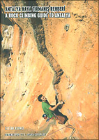
Antalya - Rock Climbing Guide

Cordee’s guide to rock climbing in Antalya covers over 400 routes for every type of climber, being beginner or seasoned professional you will find something here.There is detailed information and guides for each entry, with additional details about the areas around each crag. There are full-colour topographical map sections for each route.*Please note this guide book includes and both English and Turkish text throughout.*
RIP - This product is no longer available on our network. It was last seen on 25.09.2019

This page now acts as a permanent archive for this product. Add more information using the comments box below to ensure it can still be found by future generations.

Use our search facility to see if it is available from an alternative contributor.
  • Availability: Out Of Stock
  • Supplier: Stanfords
  • SKU: 9789944570909
Availability: In Stock
£27.50

Product Description

Cordee’s guide to rock climbing in Antalya covers over 400 routes for every type of climber, being beginner or seasoned professional you will find something here. There is detailed information & guides for each entry, with additional details about the areas around each crag. There are full-colour topographical map sections for each route.* Please note this guide book

Includes::
& both English & Turkish text throughout.*

Reviews/Comments

Add New

Intelligent Comparison

Oooops!
We couldn't find anything!
Perhaps this product's unique.... Or perhaps we are still looking for comparisons!
Click to bump this page and we'll hurry up.

Price History

Vouchers

No voucher codes found.
Do you know a voucher code for this product or supplier? Add it to Insights for others to use.

Facebook

Jargon Buster

Colour - The categorised spectrum of light visable to humans
professional - A term used to describe products or people which may be focused on specialist educational training
Professional - A person that is trained within a profession.

Supplier Information

Stanfords
Stanfords was established in 1853 and opened their iconic Covent Garden flagship store in 1901. They have become the top retailer of maps, travel books and accessories in the UK and arguably offer the largest selection of maps and travel books worldwide. Famous names such as Captain Robert Falcon Scott, Ranulph Fiennes and Michael Palin have purchased from Stanfords. They now have a shop in Bristol and both stores together with other venues operate a calendar of events including talks, book signings and exhibitions. As a specialist map retailer, the map selection is comprehensive and includes road maps, street maps and walking maps from worldwide destinations, as well as a selection of world atlases and wall maps. Books include travel guides and travel literature. Stanfords also stock globes, from miniatures made of blue marble to magnificent floor-standing globes. The website features a selection of interesting articles on travel topics.
Page Updated: 2023-11-12 20:15:36

Community Generated Product Tags

Oh No! The productWIKI community hasn't generated any tags for this product yet!
Menu