
 United Kingdom
 France
 Germany
 Netherlands
 Sweden
 USA
USA
 Italy
Italy
 Spain
Spain
More From Contributor

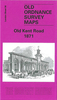


Old Kent Road 1914
Old Kent Road in 1914 in a fascinating series of reproductions of old Ordnance Survey plans in the Alan Godfrey Editions, ideal for anyone interested in the history of their neighbourhood or family. Three versions have been published for this area, stretching from Portland Street eastward to Galley Wall Road and Bramcote Road, and from Southwark Park Road southward to Bird-in-Bush Road. A long stretch of the Old Kent Road runs diagonally through this busy map, which covers the area between Southwark, Bermondsey and Peckham. The map is dominated by streets of housing, although a few empty areas still survive on the 1871 map. Other features include the Surrey Canal, Bricklayers Arms railway branch and Goods Depot, Glengall Works, Newington Institution, South Metropolitan Gas Works,
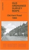
Lock`s Field, tramways, small factories along the canal. The 1914 map mentions the following wards: St Peter`s, Coburg, Addington, St George`s, Marlborough, North Peckham and No.4 Bermondsey Wards. Streets include Old Kent Road, Albany Road, Southwark Park Road, Lynton Road and countless others. Each map includes extracts from directories; the 1914 map also includes information about the OS by Richard Oliver.About the Alan Godfrey Editions of the 25” OS Series:Selected towns in Great Britain and Ireland are covered by maps showing the extent of urban development in the last decades of the 19th and early 20th century. The plans have been taken from the Ordnance Survey mapping and reprinted at about 15 inches to one mile (1:4, 340). On the reverse most maps have historical notes
and many also include extracts from contemporary directories. Most maps cover about one mile (1.6kms) north/south, one and a half miles (2.4kms) across; adjoining sheets can be combined to provide wider coverage.FOR MORE INFORMATION AND A COMPLETE LIST OF ALL AVAILABLE TITLES PLEASE CLICK ON THE SERIES LINK.

Product Description
Reviews/Comments
Add New
Vouchers
No voucher codes found.
Do you know a voucher code for this product or supplier? Add it to Insights for others to use.
Do you know a voucher code for this product or supplier? Add it to Insights for others to use.
 Denmark