More From Contributor
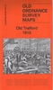
£6.99
Book 10 in the phenomenally bestselling Diary of a Wimpy Kid series is here! Life was better in the old days. Or was it? That`s the question Greg Heffley is asking as his town voluntarily unplugs & goes electronics-free. But modern life has its conveniences, & Greg isn`t cut out for an old-fashioned world. With tension building inside & outside the Heffley home, will Greg find a way to survive? Or is going `old school` just too hard for a kid like Greg? Praise for Jeff Kinney:` The world has gone crazy for Jeff Kinney`s Diary of a Wimpy Kid`
- Sun` Kinney is right up there with J K Rowling as one of the bestselling children`s authors on the planet` -Independent` The most hotly anticipated children`s book of the year is here
- Diary of a Wimpy Kid`
- Big Issue


...
Archived Product
£12.00
Old Series to Explorer is Chris Higley`s comprehensive guide to the history of the Ordnance Survey map & is a must for anyone with an interest in the evolution & development of the famous Ordnance Survey series of maps. The book gives a brief overview of the map series published by the Ordnance Survey in the last 200 years, as well as exploring other subjects closely related to Ordnance Survey. Individual chapters cover how the maps were made, one-inch maps of Engl&, Wales & Scotl&, 1:50, 000 maps of Great Britain, half-inch & smaller scale maps, 1:25, 000 maps, six-inch & larger scale maps, Ireland & the Crown Dependencies, How accurate a picture?, mapmakers at war & a collected bibliography. Details of where to look for more information & other relevant resources are highlighted at the end of each chapter in the book. ...
Archived Product
£3.50
Old St Pancras area of London in 1871-1894 in a series of exceptionally detailed reproductions of old Ordnance Survey street plans for areas of larger cities which have undergone substantial redevelopment in the late 19th or the early 20th century, published in the Alan Godfrey Editions. The plans, printed in back & white, have been taken from the original Ordnance Survey mapping at 1:1, 056 & reproduced at 1:1, 760 – the equivalent of 36 inches (or one yard) to a mile. The maps provide an unrivalled, house-by-house picture of streets & individual buildings with inner courtyards, outbuildings, pavements, covered passages, etc. Many important institutions are named; within the National Galley on Trafalgar Square even the individual rooms (the map is from 1871, so no French Impressionists as yet!). On the reverse are historical notes about the area covered by the map, plus extracts from contemporary street directories. These maps provide a fascinating addition to Alan Godfrey’s huge series of some 2, 000 titles presenting reproductions of street plans at taken from the Ordnance Survey mapping at 1:2, 500 (25” to 1 mile) & reprinted at about 15 inches to one mile (1:4, 340). ...
Archived Product
£22.99
The Old Strynefjellsvegen National Tourist Route Map belongs to a series of 18 map & postcards sets describing popular tourist routes all over Norway. The map set

Includes::
a map in 1: 50, 000 presenting an accurate topography (based on the Norwegian topographic survey) which describes local footpaths, cycle or ski routes, sport & recreational facilities, places of interest, places to stay & eat, viewpoints. The Old Strynefjell Mountain Road (Gamle Strynefjellsveien) is a 27-kilometre long stretch of road between Videseter in the municipality of Stryn & Grotli in the municipality of Skjåk. The Old Strynefjell Mountain Road, now a national tourist route, is a piece of cultural heritage more than 100 years old. Between the mountain village of Skjåk & the fjord village of Stryn there were several ancient routes used for the transport of people & essential goods. In 1881, the decision to build a road between Grotli & Hjelle was made. In 1894 the road was ready for use, a masterpiece of road-building & engineering. The stretch represents a piece of Norwegian natural history as the only way of passage between Skjåk & Stryn during most of the last century. This is the reason why the Old Strynefjell Mountain Road has been awarded the status as a national tourist route. Today, the old road is replaced with a new 12-kilometre long all-year road. However, it is still the old road that provides a view & perspective. Nature displays its contrasts along this stretch of road, with the rounded, glacier-scoured forms to the east & a steeper, more precipitous topography to the west. At Tystigen it is still possible to ski far into the summer. Otherwise, high summer & autumn is the time for walking in the mountains. The road is also excellent for cycling. The road is closed during winter & opens in June, depending on the amount of snow in the mountains. The set
Features: One map: scale 1:50, 000 Text in three languages (Norwegian, English & German)5 Postcards (13.5x 25cm) To see the list of other titles in this series, please click on the series link.


...
Archived Product
£3.99
“ Early morning in the convent garden which has become Covent Garden ” in a series of prints of sepia photos of some of old London’s best loved landmarks, presented by Soho Publishing in an A3 (39.6 x 29.6cm) format. The photo shows the plaza between the church & the market hall, popular these days with many street entertainers. Under the photo are brief notes about the area. Ideal for framing, these reproductions show many long gone or much changed sites & offer a unique way of decorating your home or office with photos of near by or close-to-your-heart parts of the capital. Please note: the prints are supplied flat rather than rolled, with an A3 protective piece of cardboard, so the package will be larger than the standard size letterbox. To see other titles in this series please click on the series link.“ An old tavern on the riverside at Limehouse” in a series of prints of sepia photos of some of old London’s best loved landmarks, presented by Soho Publishing in an A3 (29.6 x 39.6 cm) format. Under the photo are brief notes. Ideal for framing, these reproductions show many long gone or much changed sites & offer a unique way of decorating your home or office with photos of near by or close-to-your-heart parts of the capital. Please note: the prints are supplied flat rather than rolled, with an A3 protective piece of cardboard, so the package will be larger than the standard size letterbox. To see other titles in this series please click on the series link. ...
Archived Product
£3.50
Old Trafford in 1915 in a fascinating series of reproductions of old Ordnance Survey plans in the Alan Godfrey Editions, ideal for anyone interested in the history of their neighbourhood or family. Three versions have been published for this area around & to the west of Old Trafford, showing how it changed across the years. Coverage stretches from Second Avenue (at Trafford Park) eastward to Seymour Grove, & from Gorse Hill Farm northward to Old Trafford Bridge. Features include Old Trafford cricket ground, Gorse Hill, Waters Meeting, Royal Botanical Gardens, Old Trafford station, Cricket Ground station, Cheshire Lines Railway with Trafford Park Junction & Sidings, engine shed, Lard Refinery, Bridgewater Canal, Ordsall Hall Paper Works, small section of Manchester Ship Canal with No. 4 Dock, Sun Mills, etc. Extracts from contemporary directories are on the reverse. About the Alan Godfrey Editions of the 25” OS Series: Selected towns in Great Britain & Ireland are covered by maps showing the extent of urban development in the last decades of the 19th & early 20th century. The plans have been taken from the Ordnance Survey mapping & reprinted at about 15 inches to one mile (1:4, 340). On the reverse most maps have historical notes & many also include extracts from contemporary directories. Most maps cover about one mile (1.6kms) north/south, one & a half miles (2.4kms) across; adjoining sheets can be combined to provide wider coverage.FOR MORE INFORMATION & A COMPLETE LIST OF ALL AVAILABLE TITLES PLEASE CLICK ON THE SERIES LINK. ...
Archived Product
£4.99
Interest in old trolleybuses increased as they began to disappear from the urban landscape in the early 1960s, & this interest has been boosted in recent years by the prospect of a new generation of trolleybuses designed in
- & for
- the twenty-first century. This interest, at once nostalgic & forward-looking, has led to loving restorations of surviving examples, meaning that it is possible in cities including London, Glasgow & Dublin to see & ride in functioning buses. This book traces the fascinating history of the trolleybus since the first experiments in this mode of electric transport were conducted over a century ago.

...
Archived Product
£245.00
A 17th century globe from cartographer Jodicus Hondius, have the Old World at your fingertips. Emblematic of 17th C. science. Uniting precious bronze accents with hardwood & hand applied paper gores on a papier-mâché core. If we do not have this item in stock we will order it for you from our supplier. Delivery generally takes 3 weeks within the UK. For overseas delivery queries please email sales@stanfords.co.uk ...
Archived Product
£25.00
In OLD WORLD, NEW WORLD Kathleen Burk sets out to tell the story of Britain & America across four hundred years, from colonisation to Iraq. There are two strands to this story. The first is the grand narrative that takes in the British colonisation of America & the American Revolutionary War, the American Civil War & the global conflicts of the twentieth century. This is the story of America's inevitable eclipse of its former colonial master as a Great Power, & of the enmities & sympathies, the confusions & understandings born along the way. The second strand is quieter but no less fascinating. Displaying a breathtaking command of her subject, Burk examines the relations between the two countries in many other spheres: economic, religious, cultural, social, even romantic. These two strands taken together make Old World, New World an unprecedented achievement. No one could hope to write the definitive story of these two countries & their relationship, but few will come closer than Kathleen Burk has in this brilliant book. ...
Archived Product
£3.50
Oldbury & Spon Lane in 1904 in a fascinating series of reproductions of old Ordnance Survey plans in the Alan Godfrey Editions, ideal for anyone interested in the history of their neighbourhood or family. The map covers the eastern part of Oldbury, southern part of West Bromwich, & West Smethwick. Coverage stretches from Church Street Oldbury eastward to Kenrick Park, & from Lyttleton Street southward to St Paul`s Road. Features include Hamblet`s Brick Works (top left corner), Bromford Iron Works, Oldbury Railway Carriage Works, Christ Church, Tharsis Works, Springfield Chemical Works, Birmingham Canal (Old Line), Birmingham Canal (Wolverhampton Level), Birmingham Canal (Birmingham Level), Victoria Colliery, LNWR Stour Valley line with Oldbury & Spon Lane stations, Glass Works, trams & depot, short stretch of GWR Stourbridge line with Smethwick Jct station, Spon Lane Colliery (disused), Hollow Ware Manufactory, Kenrick Park, Holy Trinity church, Stour Valley Works, St Paul`s church, British Queen Brewery, Good Shepherd`s church, Lyttleton Hall, short stretch of GWR Birmingham & Dudley line, BCN Titford Feeder, etc. On the reverse are extracts from an 1896 directory. This title doubles as Worcestershire sheet 2.14. About the Alan Godfrey Editions of the 25” OS Series: Selected towns in Great Britain & Ireland are covered by maps showing the extent of urban development in the last decades of the 19th & early 20th century. The plans have been taken from the Ordnance Survey mapping & reprinted at about 15 inches to one mile (1:4, 340). On the reverse most maps have historical notes & many also include extracts from contemporary directories. Most maps cover about one mile (1.6kms) north/south, one & a half miles (2.4kms) across; adjoining sheets can be combined to provide wider coverage.FOR MORE INFORMATION & A COMPLETE LIST OF ALL AVAILABLE TITLES PLEASE CLICK ON THE SERIES LINK. ...
Archived Product

Old Trafford 1905

Old Trafford in 1905 in a fascinating series of reproductions of old Ordnance Survey plans in the Alan Godfrey Editions, ideal for anyone interested in the history of their neighbourhood or family. Three versions have been published for this area around and to the west of Old Trafford, showing how it changed across the years. Coverage stretches from Second Avenue (at Trafford Park) eastward to Seymour Grove, and from Gorse Hill Farm northward to Old Trafford Bridge. Features include Old Trafford cricket ground, Gorse Hill, Waters Meeting, Royal Botanical Gardens, Old Trafford station, Cricket Ground station, Cheshire Lines Railway with Trafford Park Junction and Sidings, engine shed, Lard Refinery, Bridgewater Canal, Ordsall Hall Paper Works, small section of Manchester Ship
Canal with No. 4 Dock, Sun Mills, etc. Extracts from contemporary directories are on the reverse.About the Alan Godfrey Editions of the 25” OS Series:Selected towns in Great Britain and Ireland are covered by maps showing the extent of urban development in the last decades of the 19th and early 20th century. The plans have been taken from the Ordnance Survey mapping and reprinted at about 15 inches to one mile (1:4, 340). On the reverse most maps have historical notes and many also include extracts from contemporary directories. Most maps cover about one mile (1.6kms) north/south, one and a half miles (2.4kms) across; adjoining sheets can be combined to provide wider coverage.FOR MORE INFORMATION AND A COMPLETE LIST OF ALL AVAILABLE TITLES PLEASE CLICK ON THE SERIES LINK.
RIP - This product is no longer available on our network. It was last seen on 25.09.2019

This page now acts as a permanent archive for this product. Add more information using the comments box below to ensure it can still be found by future generations.

Use our search facility to see if it is available from an alternative contributor.
  • Availability: Out Of Stock
  • Supplier: Stanfords
  • SKU: 9780850540550
Availability: In Stock
£3.50

Product Description

Old Trafford in 1905 in a fascinating series of reproductions of old Ordnance Survey plans in the Alan Godfrey Editions, ideal for anyone interested in the history of their neighbourhood or family. Three versions have been published for this area around & to the west of Old Trafford, showing how it changed across the years. Coverage stretches from Second Avenue (at Trafford Park) eastward to Seymour Grove, & from Gorse Hill Farm northward to Old Trafford Bridge. Features include Old Trafford cricket ground, Gorse Hill, Waters Meeting, Royal Botanical Gardens, Old Trafford station, Cricket Ground station, Cheshire Lines Railway with Trafford Park Junction & Sidings, engine shed, Lard Refinery, Bridgewater Canal, Ordsall Hall Paper Works, small section of Manchester Ship Canal with No. 4 Dock, Sun Mills, etc. Extracts from contemporary directories are on the reverse. About the Alan Godfrey Editions of the 25” OS Series: Selected towns in Great Britain & Ireland are covered by maps showing the extent of urban development in the last decades of the 19th & early 20th century. The plans have been taken from the Ordnance Survey mapping & reprinted at about 15 inches to one mile (1:4, 340). On the reverse most maps have historical notes & many also include extracts from contemporary directories. Most maps cover about one mile (1.6kms) north/south, one & a half miles (2.4kms) across; adjoining sheets can be combined to provide wider coverage.FOR MORE INFORMATION & A COMPLETE LIST OF ALL AVAILABLE TITLES PLEASE CLICK ON THE SERIES LINK.

Reviews/Comments

Add New

Price History

Vouchers

No voucher codes found.
Do you know a voucher code for this product or supplier? Add it to Insights for others to use.

Facebook

Jargon Buster

Contemporary - Modern era design
Paper - A thin sheet mainly used for writing. Available in a variety of colours. Made mainly from wood pulp.
Engine - A machine designed to convert fuel into motion
Contemporary - A design reference to indicate post war modern design
sun - A star at the centre of the solar system.
History - Anything that happens in the past. An acedemic subject.
Small - something that takes up less space than normal.
Contemporary - An object that is living in the same time.
Junction - A point where two or more things come together, typically used to describe roads
Hall - A room at the inside of an entrance of a house.
Ideal - Something that satisfies a perfect criteria.
Family - A group of people that live together made up from parents and children.

Supplier Information

Stanfords
Stanfords was established in 1853 and opened their iconic Covent Garden flagship store in 1901. They have become the top retailer of maps, travel books and accessories in the UK and arguably offer the largest selection of maps and travel books worldwide. Famous names such as Captain Robert Falcon Scott, Ranulph Fiennes and Michael Palin have purchased from Stanfords. They now have a shop in Bristol and both stores together with other venues operate a calendar of events including talks, book signings and exhibitions. As a specialist map retailer, the map selection is comprehensive and includes road maps, street maps and walking maps from worldwide destinations, as well as a selection of world atlases and wall maps. Books include travel guides and travel literature. Stanfords also stock globes, from miniatures made of blue marble to magnificent floor-standing globes. The website features a selection of interesting articles on travel topics.
Page Updated: 2023-11-12 20:15:36

Community Generated Product Tags

Oh No! The productWIKI community hasn't generated any tags for this product yet!
Menu