More From Contributor

£11.50
Passau in a series of GPS compatible recreational editions of the Bavarian topographic survey at 1:25, 000, with waymarked hiking trails & cycling routes, campsites & youth hostels, etc. Coverage

Includes::
Büchlberg, Hutthurm, Neuburg a. Inn, Salzweg, Thyrnau, Tiefenbach. Contours used in this map vary between 5 to 20m according to the terrain, with 20m interval predominantly used for hilly areas. Varied colouring show different types of landscape: woods, vineyards, fields etc. Maps in this series feature extensive overprint highlighting local & long-distance footpaths & cycle routes, including King Ludwig Way or different variants of the Way of St James, indicating their waymarking. Symbols highlight different types of accommodation (campsites, youth hostels, refuges, etc), sport & recreational facilities, various places of interest, etc. The maps have a 1-km UTM grid. Map legend & all the text are in German only. To see other titles in this series please click on the series link.

...
Archived Product
£9.95
The British offensive, which became known as Passchendaele, got underway on 31 July, 1917 with the objective of capturing fifteen miles of territory. The attack quickly lost momentum &, it was not until finally in November that the line managed to advance seven miles. With winter setting in, the British troops were subjected to some of the worst conditions they had ever faced. During the attack 265, 000 were either killed or injured. This battlefield guide gives details of the attacks whilst guiding the reader through the battlefield as it stands today. With illustrated maps & then & now photographs it will appeal to those visiting the area as well as armchair historians. ...
Archived Product
£25.00
Between July & November 1917, in a small corner of Belgium, more than 500, 000 men were killed or maimed, gassed or drowned
-
...
Archived Product
£9.99
THE SUNDAY TIMES TOP 10 BESTSELLER`A timely re-appraisal... a masterpiece` General Lord Richard Dannatt The Third Battle of Ypres was a `lost victory` for the British Army in 1917. Between July & November 1917, in a small corner of Belgium, more than 500, 000 men were killed or maimed, gassed or drowned
- & many of the bodies were never found. The Ypres offensive represents the modern impression of the First World War: splintered trees, water-filled craters, muddy shell-holes. The climax was one of the worst battles of both world wars: Passchendaele. The village fell eventually, only for the whole offensive to be called off. But, as Nick Lloyd shows, notably through previously overlooked German archive material, it is striking how close the British came to forcing the German Army to make a major retreat in Belgium in October 1917. Far from being a pointless & futile waste of men, the battle was a startling illustration of how effective British tactics & operations had become by 1917 & put the Allies nearer to a major turning point in the war than we have ever imagined. Published for the 100th anniversary of this major conflict, Passchendaele is the most compelling & comprehensive account ever written of the climax of trench warfare on the Western Front.
...
Archived Product
£25.00
One hundred years on... The Battle of Passchendaele, fought from July to November 1917, epitomises everything that was most terrible about the Western Front in the First World War. This was the war of attrition at its most spectacular & ferocious. The intervening century, the most violent in human history, has not diluted the power of the images we have from this battle. We commemorate the event, we pin poppies to our chests. But it is almost impossible to underst&. Passchendaele: Requiem for Doomed Youth shows how ordinary men on both sides endured this constant state of siege, with a very real awareness that they were being gradually, deliberately, felled. Yet the men never broke. They went over the top when ordered, again & again & again. The commanders saw a soldier as ” Normal wastage”. His family knew him as a son, a husband or a brother before he had enlisted. Only the soldiers truly saw each other in those moments. By the end of 1917 each surviving soldier was a different man to the one who had left home; his experiences on the Western Front, incomprehensible to anyone but him. Here, Paul Ham tells the story of ordinary men in the grip of an extraordinary global power struggle. He lays down a powerful challenge to the idea of war as an inevitable expression of human will, & examines the culpability of governments & military commanders in a catastrophe that destroyed the best part of a generation. ...
Archived Product
£9.99
The Classic Account of Passchendaele
- Reissued for the First World War Centenary. The third battle of Ypres, culminating in a
...
Archived Product
£11.99
In 1926 Vita Sackville-West travelled to Iran to visit her husb&, Harold Nicolson, who was serving as a diplomat in Teheran. Her route was deliberately slow-paced
- she stopped in Egypt, where she sailed up the Nile to Luxor; & India, where she visited New Delhi & Agra before sailing across the Persian Gulf to Iraq & on through bandit-infested mountains to Teheran. She returned to England in an equally circuitous manner & despite travelling under dangerous circumstances, through communist Russia & Poland in the midst of revolution, her humour & sense of adventure never failed. ” Passenger to Teheran” is a classic work, revealing the lesser-known side of one of the twentieth century`s most luminous authors.
...
Archived Product
£16.95
From the Cederberg in the northwest to the Tsitsikamma Mountains in the east, the rugged mountains of the Western Cape from a formidable barrier between the coastal plateau & the hinterl&. Many of the modern passes through them still follow ancient animal migration routes; others are engineering masterpieces that challenge gravity. Passes & Poorts provides a detailed guide to the most scenic & is packed with information to enrich readers` driving experience, from fauna & flora to the personalities behind the passes. Activities highlighted in each area include favourite hiking trails, mountain biking tracks & 4x 4 routes. Each chapter ends with tips to make driving the passes more pleasurable: the best picnic spots, view points, farm stalls, roadside restaurants, guesthouses & self-catering cottages, & quirky country attractions. Many can be done as day drives or weekend trips from Cape Town or Garden Route towns such as George & Knysna, or combined for longer holidays. Full-colour maps assist in travel planning & the routes are illustrated with photographs from the author & the Getaway library. ...
Archived Product
£12.99
Passo del Bernina, map No. 269, in the standard topographic survey of Switzerland at 1:50, 000 from Swisstopo, i.e. without the special overprint highlighting walking trails, local bus stops, etc, presented in Swisstopo’s hiking editions of the 50K survey. The map covers mostly Italy, extending from the Berninia Pass to Bormio. Highly regarded for their superb use of graphic relief & hill shading, the maps give an almost 3-D picture of Switzerland`s mountainous terrain. Contours are at 20m intervals. All the maps have a 1-km grid with the Swiss national coordinates. This standard version of the 50K survey covers the whole country on 78 small format sheets, with special larger format maps published for several popular tourist destinations. Small format sheets cover an area of 35 x 24 km (21 x 15 miles approx) & have map legend in the language of the area covered by the map. The special larger sheets cover 50 x 35 km (31 x 22 miles approx) & have no map legend, but a separate leaflet can be provided instead.PLEASE NOTE: the hiking editions of the 1:50, 000 Swisstopo survey are listed on our website in a separate series. ...
Archived Product
£12.99
Swiss topographic survey at 1:100, 000 from Swisstopo, highly regarded for it superb use of graphic relief & hill shading, ...
Archived Product

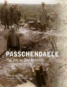
Passchendaele: The Day-by-Day Account

It will be forever known as Passchendaele: the very word is used to describe wretched and perilous conditions such as were encountered at the battles which became officially designated as Third Ypres. There with better tactics, equipment and experience than he had previously employed, Haig was surely set for considerable advance and ultimate success. Initial successes were, however, reversed by stout German defence and weak British strategy before unprecedented rainfall reduced the Belgian landscape to a quagmire. Through August the British suffered net losses and only towards the end of September did the more enlightened command of Plumer bring gains against the German divisions, only for more rain and the subsequent reduction of offensive effectiveness to reduce territorial gains to
a meaningless trickle. Following his popular volume on The Somme, Chris McCarthy re-assesses and enhances the official history of Third Ypres, presenting his research with comprehenive illustrations and valuable coloured maps.
RIP - This product is no longer available on our network. It was last seen on 25.09.2019

This page now acts as a permanent archive for this product. Add more information using the comments box below to ensure it can still be found by future generations.

Use our search facility to see if it is available from an alternative contributor.
  • Availability: Out Of Stock
  • Supplier: Stanfords
  • SKU: 9781910500866
Availability: In Stock
£28.00

Product Description

It will be forever known as Passchendaele: the very word is used to describe wretched & perilous conditions such as were encountered at the battles which became officially designated as Third Ypres. There with better tactics, equipment & experience than he had previously employed, Haig was surely set for considerable advance & ultimate success. Initial successes were, however, reversed by stout German defence & weak British strategy before unprecedented rainfall reduced the Belgian landscape to a quagmire. Through August the British suffered net losses & only towards the end of September did the more enlightened command of Plumer bring gains against the German divisions, only for more rain & the subsequent reduction of offensive effectiveness to reduce territorial gains to a meaningless trickle. Following his popular volume on The Somme, Chris Mc Carthy re-assesses & enhances the official history of Third Ypres, presenting his research with comprehenive illustrations & valuable coloured maps.

Reviews/Comments

Add New

Intelligent Comparison

Oooops!
We couldn't find anything!
Perhaps this product's unique.... Or perhaps we are still looking for comparisons!
Click to bump this page and we'll hurry up.

Price History

Vouchers

No voucher codes found.
Do you know a voucher code for this product or supplier? Add it to Insights for others to use.

Facebook

Jargon Buster

August - The third season of the year after summer, before winter.
History - Anything that happens in the past. An acedemic subject.
Day - The time it takes a planet or other space objects to complete one rotation.
Set - a group of items usually related to one another. Some objects cannot function without the complete set of items.
Equipment - A product or good that is tactile.
Experience - To gain further knowledge by practising.
illustrations - Pictures typically in books and newspapers.
Popular - Something that is admired and liked by many people.

Supplier Information

Stanfords
Stanfords was established in 1853 and opened their iconic Covent Garden flagship store in 1901. They have become the top retailer of maps, travel books and accessories in the UK and arguably offer the largest selection of maps and travel books worldwide. Famous names such as Captain Robert Falcon Scott, Ranulph Fiennes and Michael Palin have purchased from Stanfords. They now have a shop in Bristol and both stores together with other venues operate a calendar of events including talks, book signings and exhibitions. As a specialist map retailer, the map selection is comprehensive and includes road maps, street maps and walking maps from worldwide destinations, as well as a selection of world atlases and wall maps. Books include travel guides and travel literature. Stanfords also stock globes, from miniatures made of blue marble to magnificent floor-standing globes. The website features a selection of interesting articles on travel topics.
Page Updated: 2023-11-12 20:15:36

Community Generated Product Tags

Oh No! The productWIKI community hasn't generated any tags for this product yet!
Menu