More From Contributor

£12.99
Provence & the Cote D' Azur in the Key Guide series from AA Publishing; exploring a range of international destinations & recently been re-launched with full colour pages. Thorough & detailed in style, the guides are targeted at an older audience, exploring the principal sights, walks, activities, restaurants & accommodation of the destination. A detailed introductory section provides comprehensive information about the destination, including the economy, politics, heritage & language. There are also specific sections unique to each destination, covering society, the urban & rural, sports & leisure, art media & culture, history & science & technology. Each title is organised in the same way with destinations grouped by region or district & colour-coded to help readers navigate around the guide. An On the Move section provides details on transport, with important information on arriving, getting around (including distinctive local transport features such as metro & underground networks) & for visitors with a disability. Individual regional sections cover Sights, driving & walking opportunities, what to do, eating & accommodation. Local listings are accompanied by addresses, opening times, prices, directions & local transport options, though options for younger travellers & those with children are more limited. Extensive colour photography accompanies the text, with a range of pictures illustrations the main sites of the city, region or country. An extensive Practicalities chapter at the back of each guide carries essential information on weather, documents & customs, money, health, communication, tourist information, useful websites, finding help, opening times & entrance fees, media & books, films & maps. There is also basic information on entertainment & nightlife, sports & activities, film & music & festivals & events. ...
Archived Product
£15.99
This guide expertly divides Provence into touring areas
- one per chapter. The best of Provence is included, from the landscapes
...
Archived Product
£9.99
Provence & the French Riviera in the Frommer's Day By Day series is a pocket-sized guide ideal for short trips, covering a variety of budgets. The best sights of each destination are listed in convenient full-day tours for one, two or three days such as: thematic tours for interests including art, architecture & history are described, allowing you to get the most out of your time; walking tours take you around each destination ...
Archived Product
£12.00
Provence in the Landscapes of the Imagination guide series; providing an in-depth cultural & account of some of the world’s most memorable & evocative landscapes. Presented as a cultural & literary guide, each title in the series explores the cultural history of a landscape, providing an overview of the area’s development from its earliest roots to the modern day. Particular emphasis is placed on the literary, poetic, architectural, cultural & historical elements that make up the landscape & each title is written & researched by an academic expert. An Epilogue offers suggestion for further reading & indices of literary, artistic & historical names & places & landmarks. ...
Archived Product
£5.99
MICHELIN Zoom Map Provence is the ideal travel companion to fully explore this popular French tourist destination thanks to its easy to use format & its scale of 1/160, 000. This map covers the area & the cities of Montpellier, Montelimar, Avignon & Marseille. In addition to Michelin`s clear & accurate mapping. The Zoom collection are characterized by the high precision of their detailed scale, specially adapted for very touristy areas or with a high density road network, including new developments & industrial areas. In addition to clarity, reliability & up-to-date information, all Michelin cartography features include a wealth of practical information: places & monuments of tourist interest, picturesque tours, areas for sports & leisure activities... Useful plans of cities & a practical index of localities. Also the maps contain places of interest & signposting of tracks for bicycles & greenways. ...
Archived Product
£14.95
Guidebook to a range of 30 varied, graded day walks in the Alpes Maritimes, Alpes de Haute-Provence & Mercantour regions of Provence. Provence`s sunshine & relaxed Mediterranean charm offers the walker a diversity of landscapes
- from Mont Mounier in the remote mountains of the north west Mercantour to the spectacular Verdon Gorge, one of many in the region. Lower-level walks in the Alpes Maritimes are also described, nestling inland from the craggy Esterel. None of the routes require special equipment although some of the more challenging routes may be exposed & precipitous. All should be suitable for walkers of average fitness. Routes are described step by step, with clear sketch maps & profiles to help you assess them, along with the standard route summary table at the back of the guide.
...
Archived Product
£27.99
Takes us on a journey through the jewel of southeastern France, whose vistas have inspired artists for generations. Captures the spirit of the landscape & the people who live there as never before.

Includes::
a beautiful, frameable print by photographer Joel Meyerowitz. Provence, the jewel of southeastern France, has a rich & varied history & vistas that have inspired artists for generations. Yet there is more to the Land of Impressionism than lavender fields, green rolling hills, Riviera beaches & quaint villages. Renowned photographer Joel Meyerowitz & novelist/playwright Maggie Barrett take us on their journey through four seasons in Provence, capturing the spirit of this quintessential French landscape & the people who live there as never before.

Includes::
a beautiful print by Meyerowitz that is suitable for framing.


...
Archived Product
£10.99
Ste-Victoire
- Ste-Baume
- Calanques area of Provence in a series of GPS compatible, contoured TOP 75 maps at 1:75, 000 from

...
Archived Product
£14.95
Guidebook to a range of 30 varied, graded day walks in the sunny south-east of France in the Drome Provencale, the Vaucluse & the Var regions of Provence. Provence`s lower western regions offer wonderful walking
- the vineyards, lavender fields & rolling hills of the Drome Provencale, the historic old towns & castles set in the river valleys & gorges of Vaucluse & low sheltered valleys & craggy ridges on the Sainte-Baume massif in the Var. There are charming bases from which to explore the regions, including Nyons, Apt & Aix-en-Provence. None of the routes require special equipment although some may be a little exposed. All should be suitable for walkers of average fitness. Routes are described step by step, with clear sketch maps & profiles to help you assess them, along with the standard route summary table at the back of the guide.
...
Archived Product
£11.19
Provence & the Cote d' Azur in the Countries & Regions series from Lonely Planet, market-leading comprehensive guides aimed at independent travellers & serving a large range of international destinations. Frank & informal in style, the guides explore an extensive range of sights, activities, accommodation, restaurants & nightlife & are designed for practical use while travelling on the road. Written & researched by a team of experts, each book is independent in its recommendations & suggestions, often offering individual takes on individual destinations. Widely recognised for their reliability, each Lonely Planet country & region guide has the same layout. Introductory sections profile the destination with individual chapters on particular highlights, getting started, (including when to go) itineraries, history, culture, arts, food & drink & the environment. Each guide is organised geographically by region, with individual sections detailing an extensive range of sights, places of interest, attractions, restaurants, nightlife, accommodation & any local activities. The guides have detailed explanations of historical context where relevant. There is also practical guidance on ...
Archived Product

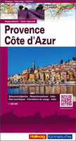
Provence - Cote D`Azur

Provence and Côte d`Azur road map from the Hallwag Kümmerly + Frey group providing on one large sheet convenient coverage at 1:200, 000 of south-eastern France from Nîmes and the Gorges of the Ardéche in the west to San Remo on the Italian Riviera, and northwards across the Provencal Alps to beyond Gap and Embrun.Subtle but very effective relief shading combined with plenty of names of topographic features (mountain chains, peaks, passes, etc) provides an excellent presentation of the terrain, particularly for those who want to venture inland from the coastal resorts towards the more precipitous roads across the mountain passes such as the Col d’Allos or the hairpin bends leading to the Madone d’Utelle. Numerous scenic routes and viewpoints are prominently but unobtrusively
highlighted.Road network clearly differentiates between different types of roads. Motorway junctions are shown with numbers and names; toll stations, services and rest areas (aire de repos) are marked. The map also shows restricted entry roads, routes closed to or not recommended for caravans, seasonal closures on alpine roads, and steep gradients. Railway lines are shown with stations. Various places of interest are marked, including campsites and youth hostels. Latitude and longitude lines are drawn at 10’ intervals. The index is in a separate booklet attached to the cover. Also provided is information on driving regulations in France. Map legend includes English.
RIP - This product is no longer available on our network. It was last seen on 25.09.2019

This page now acts as a permanent archive for this product. Add more information using the comments box below to ensure it can still be found by future generations.

Use our search facility to see if it is available from an alternative contributor.
  • External links may include paid for promotion
  • Availability: Out Of Stock
  • Supplier: Stanfords
  • SKU: 9783828308299
Availability: In Stock
£12.99

Product Description

Provence & Côte d` Azur road map from the Hallwag Kümmerly + Frey group providing on one large sheet convenient coverage at 1:200, 000 of south-eastern France from Nîmes & the Gorges of the Ardéche in the west to San Remo on the Italian Riviera, & northwards across the Provencal Alps to beyond Gap & Embrun. Subtle but very effective relief shading combined with plenty of names of topographic features (mountain chains, peaks, passes, etc) provides an excellent presentation of the terrain, particularly for those who want to venture inland from the coastal resorts towards the more precipitous roads across the mountain passes such as the Col d’ Allos or the hairpin bends leading to the Madone d’ Utelle. Numerous scenic routes & viewpoints are prominently but unobtrusively highlighted. Road network clearly differentiates between different types of roads. Motorway junctions are shown with numbers & names; toll stations, services & rest areas (aire de repos) are marked. The map also shows restricted entry roads, routes closed to or not recommended for caravans, seasonal closures on alpine roads, & steep gradients. Railway lines are shown with stations. Various places of interest are marked, including campsites & youth hostels. Latitude & longitude lines are drawn at 10’ intervals. The index is in a separate booklet attached to the cover. Also provided is information on driving regulations in France. Map legend

Includes::
English.

Reviews/Comments

Add New

Intelligent Comparison

Oooops!
We couldn't find anything!
Perhaps this product's unique.... Or perhaps we are still looking for comparisons!
Click to bump this page and we'll hurry up.

Price History

Vouchers

No voucher codes found.
Do you know a voucher code for this product or supplier? Add it to Insights for others to use.

Facebook

Jargon Buster

Italian - A word used ot descibe something from Italy
France - A state situated in Western Europe with several overseas territories.
Remo - The worlds drumhead specialists for over 50 years
Network - A link and communication between things. Often computers or people.
Large - something that takes up more space than normal.
Road - a manmade lane or a path that is used to speed up travel.
Subtle - Something that is delicate and not to harsh, can be difficult to describe.
Convenient - Something that suits and fits well to other activities.

Supplier Information

Stanfords
Stanfords was established in 1853 and opened their iconic Covent Garden flagship store in 1901. They have become the top retailer of maps, travel books and accessories in the UK and arguably offer the largest selection of maps and travel books worldwide. Famous names such as Captain Robert Falcon Scott, Ranulph Fiennes and Michael Palin have purchased from Stanfords. They now have a shop in Bristol and both stores together with other venues operate a calendar of events including talks, book signings and exhibitions. As a specialist map retailer, the map selection is comprehensive and includes road maps, street maps and walking maps from worldwide destinations, as well as a selection of world atlases and wall maps. Books include travel guides and travel literature. Stanfords also stock globes, from miniatures made of blue marble to magnificent floor-standing globes. The website features a selection of interesting articles on travel topics.
Page Updated: 2023-11-12 20:15:36

Community Generated Product Tags

Oh No! The productWIKI community hasn't generated any tags for this product yet!
Menu