More From Contributor

£4.99
The Lonely Planet Russian Phrasebook is not only an extensive list of useful phrases, but also an ideal tool to start getting to grips with a language & beginning two-way communication. Containing excellent sections on language basics such as numbers, question phrases, dates, phrase construction, grammar & pronunciation, as well as containing concise but well-rounded two-way dictionaries, Lonely Planet phrasebooks enable you to quickly & confidently construct your own phrases in addition to those given. The given phrases cover all the essential travel & tourism categories such as transport, communications, business meetings & accommodation, as well as in-depth categories such as health, food & social interaction. The phrasebooks are designed to enable more than just simple question-answer communication, allowing the start of two-way conversations
- putting you comfortably on your way to learning the language & understanding its speakers. True to Lonely Planet’s reputation for ease of use, the Phrasebooks are well designed, well structured & clearly categorized, making it easy to find the information you need quickly. Useful background information is given throughout the phrasebooks, giving you quick tips on culture, customs & etiquette.
...
Archived Product
£17.99
In this guide, Rick Steves focuses on some of the grandest sights in Europe. As always, he has a plan to help you have a meaningful cultural experience while you`re there--even with just a few hours in port. You can count on Rick Steves to tell you what you ”really” need to know when cruising the Mediterranean. Inside you`ll find one-day itineraries for sightseeing at or near the major Mediterranean ports of call, including: Barcelona, Marseille, Toulon, Nice, Villefranche-sur-Mer, & Monaco, Florence, Rome, Naples, & Venice, Dubrovnik, Split, Athens, Mykonos, & Santorini, Istanbul & Ephesus.” Rick Steves` Mediterranean Cruise Ports” explains how to get into town from the cruise terminal, shares sightseeing tips, &

Includes::
self-guided walks & tours. You`ll learn which destinations are best for an excursion--and which you can confidently visit on your own. You`ll also get tips on booking a cruise, plus hints for saving time & money on the ship & in port.

...
Archived Product
£10.95
For over three decades R. Crumb has shocked, entertained, titillated & challenged the imaginations (and the inhibitions) of comics fans the world over. The acknowledged father of ”underground comix, ” Crumb is the single greatest influence on the alternative comics of today. The three companion sets of trading cards
- Heroes of the Blues, Early Jazz Greats, & Pioneers of Country Music
- have all been sought by collectors. Although, they are currently back in print as individual card sets, this is the first time they are being published together in book form. A biography of each musician is provided, along with a full colour original illustration by underground cartoonist & music historian R. Crumb.

...
Archived Product
£17.99
The 1:50, 000 topographic map gives a more general picture of the ground features than a basic map. It shows settlements, houses, roads, cultivated areas, waterways, cutting areas, mires, rock exposures, & relief. One map sheet covers an area of 30 x 40 km & one centimetre corresponds to 500 metres on the ground. The 1:50, 000 topographic map is also an ideal complement to nautical charts as it provides useful information about the land areas adjacent to waterways. For example, all Finnish sea areas are covered by 1:50, 000 topographic map sheets. ...
Archived Product
£17.99
The 1:50 000 topographic map gives a more general picture of the ground features than a basic map. It shows settlements, houses, roads, cultivated areas, waterways, cutting areas, mires, rock exposures, & relief. One map sheet covers an area of 30 x 40 km & one centimetre corresponds to 500 metres on the ground. The 1:50, 000 topographic map is also an ideal complement to nautical charts as it provides useful information about the land areas adjacent to waterways. For example, all Finnish sea areas are covered by 1:50 000 topographic map sheets. ...
Archived Product
£9.09
Map No. 24, Raasay & Applecross, in the waterproof & tear-resistant OS Active version of the Ordnance Survey Landranger series at 1:50, 000, including Plockton, Duirinish, Stromeferry, Lochcarron, Sanachan, Toscaig, Camusterrach, Lonbain, Cuaig, Fearnmore, Shieldaid, Lower Diabaig, Redpoint Baosbheinn, Beinn Alligin, Beinn Bh ...
Archived Product
£10.39
Map No. 24, Raasay & Applecross, in a waterproof & tear-resistant version of the Ordnance Survey Landranger series at 1:50, 000, including Plockton, Duirinish, Stromeferry, Lochcarron, Sanachan, Toscaig, Camusterrach, Lonbain, Cuaig, Fearnmore, Shieldaid, Lower Diabaig, Redpoint Baosbheinn, Beinn Alligin, Beinn Bh ...
Archived Product
£14.99
Waterproof & tear-resistant OS Active version of map No. 24 from the Ordnance Survey’s Landranger series at 1:50, 000, with contoured & GPS compatible topographic mapping plus tourist information.MOBILE DOWNLOADS: As well as the physical edition of the map, each Landranger title now

Includes::
a code for downloading after purchase its digital version onto your smartphone or tablet for viewing on the OS smartphone app.OS LANDRANGER SERIES: to see the list of all the titles in the OS Landranger series, both paper & waterproof versions, please click on the series link. Maps in the Landranger series provide plenty of recreational & tourist information, indicating the traditional public right of way paths (except in Scotland where different laws apply), including bridleways & byways restricted or open to motorized traffic. National Trails & selected other long-distance paths are marked, as well as on-road & traffic-free cycle routes with their National/ Regional Cycle Network numbers. National Trust/ National Trust for Scotland & Forestry Commission land is clearly marked, indicating open or restricted access. A range of symbols highlights camping & caravanning sites, youth hostels, tourist information offices & visitors’ centres, parking & picnicking places, World Heritage sites, sport & recreational facilities, etc. The maps provide detailed presentation of topography with contours at 10m intervals, numerous spot heights & additional colouring and/or graphics for different types of woodlands, orchards or parkl&, rock features including scree & cliffs, water features inland & along the sea shore with marshl&, dunes, s&, mud, shingle & the high water mark. All the standard information expected of survey mapping at this scale is included: finely graded road network, railway lines with stations, cuttings, embankments, etc; individual isolated buildings; archaeological & historical sites, etc. For GPS users the British National Grid is shown at 1km intervals, with latitude & longitude given by margin ticks at 1` & cross hairs on the map at 5`. Each map covers an area of 40 x 40km, (approx. 25 x 25 miles).

...
Archived Product
£8.99
Paper version of map No. 24 from the Ordnance Survey’s Landranger series at 1:50, 000, with contoured & GPS compatible topographic mapping plus tourist information.MOBILE DOWNLOADS: As well as the physical edition of the map, each Landranger title now

Includes::
a code for downloading after purchase its digital version onto your smartphone or tablet for viewing on the OS smartphone app.OS LANDRANGER SERIES: to see the list of all the titles in the OS Landranger series, both paper & waterproof versions, please click on the series link. Maps in the Landranger series provide plenty of recreational & tourist information, indicating the traditional public right of way paths (except in Scotland where different laws apply), including bridleways & byways restricted or open to motorized traffic. National Trails & selected other long-distance paths are marked, as well as on-road & traffic-free cycle routes with their National/ Regional Cycle Network numbers. National Trust/ National Trust for Scotland & Forestry Commission land is clearly marked, indicating open or restricted access. A range of symbols highlights camping & caravanning sites, youth hostels, tourist information offices & visitors’ centres, parking & picnicking places, World Heritage sites, sport & recreational facilities, etc. The maps provide detailed presentation of topography with contours at 10m intervals, numerous spot heights & additional colouring and/or graphics for different types of woodlands, orchards or parkl&, rock features including scree & cliffs, water features inland & along the sea shore with marshl&, dunes, s&, mud, shingle & the high water mark. All the standard information expected of survey mapping at this scale is included: finely graded road network, railway lines with stations, cuttings, embankments, etc; individual isolated buildings; archaeological & historical sites, etc. For GPS users the British National Grid is shown at 1km intervals, with latitude & longitude given by margin ticks at 1` & cross hairs on the map at 5`. Each map covers an area of 40 x 40km, (approx. 25 x 25 miles).

...
Archived Product
£6.39
A detailed topographic map of Raasay, Rona & Scalpay from the Ordnance Survey Explorer series. Edition A1; Publication date September 2007 About this series: These highly detailed maps show all the administrative boundaries, settlements as small as isolated farms, the road network down to unfenced roads & country tracks, & field boundaries (hedges & drystone walls) which make navigation across the countryside much easier. Steep gradients on roads are indicated. Various landmarks, e.g. powerlines, archaeological sites, windmills, churches & lighthouses are shown & additional graphics indicate natural terrain features such as cliffs, scree, mud & vegetation variations. The contour interval is 5 metres in the lower parts of the country & 10 metres in the uplands, & spot heights are marked. Each map covers an area of 30 x 20km (i.e. approx. 19 x 12 miles), with some double-sided maps covering more, as indicated in the individual descriptions. The maps are fully GPS compatible, with the National Grid shown at 1km intervals & latitude & longitude indicated by margin ticks at 1'. The Explorer series has replaced the earlier, green-cover Pathfinder maps. The Explorer series is now complete & covers all of Engl&, Wales & Scotl&. Some sheets for popular areas like the National Parks are still branded as Outdoor Leisure (OL) maps, but are now included in this series as the cartography is the same as that in the Explorer Maps. The Explorer maps offer a substantial improvement on the Pathfinder series, with greater use of colour, larger area per map, & stronger emphasis on information for ramblers & tourists. This series is ideal for walking & other outdoor pursuits & each map shows a large amount of information for ramblers & tourists. Public rights of way are shown (except in Scotland), together with other routes with public access: National Trails & Recreational Paths, permitted paths & bridleways, & selected cycle routes. Open access land created under the Countryside & Rights of Way Act 2000 is marked. Tourist information

Includes::
caravan & camp sites, Park & Ride locations, recreation/leisure/sport centres, museums, historic buildings, English Heritage & National Trust sites, rural pubs, etc. The map legend is in English only, except for the tourist information content which is also in French & German.

...
Archived Product

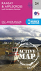
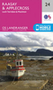
Raasay And Applecross

Map No. 24, Raasay and Applecross, in the Ordnance Survey Landranger series at 1:50, 000, including Plockton, Duirinish, Stromeferry, Lochcarron, Sanachan, Toscaig, Camusterrach, Lonbain, Cuaig, Fearnmore, Shieldaid, Lower Diabaig, Redpoint Baosbheinn, Beinn Alligin, Beinn Bh
RIP - This product is no longer available on our network. It was last seen on 25.09.2019

This page now acts as a permanent archive for this product. Add more information using the comments box below to ensure it can still be found by future generations.

Use our search facility to see if it is available from an alternative contributor.
  • Availability: Out Of Stock
  • Supplier: Stanfords
  • SKU: 9780319231104
Availability: In Stock
£5.59

Product Description

Map No. 24, Raasay & Applecross, in the Ordnance Survey Landranger series at 1:50, 000, including Plockton, Duirinish, Stromeferry, Lochcarron, Sanachan, Toscaig, Camusterrach, Lonbain, Cuaig, Fearnmore, Shieldaid, Lower Diabaig, Redpoint Baosbheinn, Beinn Alligin, Beinn Bh

Reviews/Comments

Add New

Price History

Vouchers

No voucher codes found.
Do you know a voucher code for this product or supplier? Add it to Insights for others to use.

Facebook

Jargon Buster

Supplier Information

Stanfords
Stanfords was established in 1853 and opened their iconic Covent Garden flagship store in 1901. They have become the top retailer of maps, travel books and accessories in the UK and arguably offer the largest selection of maps and travel books worldwide. Famous names such as Captain Robert Falcon Scott, Ranulph Fiennes and Michael Palin have purchased from Stanfords. They now have a shop in Bristol and both stores together with other venues operate a calendar of events including talks, book signings and exhibitions. As a specialist map retailer, the map selection is comprehensive and includes road maps, street maps and walking maps from worldwide destinations, as well as a selection of world atlases and wall maps. Books include travel guides and travel literature. Stanfords also stock globes, from miniatures made of blue marble to magnificent floor-standing globes. The website features a selection of interesting articles on travel topics.
Page Updated: 2023-11-12 20:15:36

Community Generated Product Tags

Oh No! The productWIKI community hasn't generated any tags for this product yet!
Menu