
 United Kingdom
 France
 Germany
 Netherlands
 Sweden
 USA
USA
 Italy
Italy
 Spain
Spain
More From Contributor


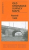


Rainsough, Kersal And Hilton Park 1907
Rainsough, Kersal and Hilton Park in 1907 in a fascinating series of reproductions of old Ordnance Survey plans in the Alan Godfrey Editions, ideal for anyone interested in the history of their neighbourhood or family. The map covers the Rainsough and Hilton Park areas of Prestwich; further south is part of the Kersal area of Salford. Features include Kersal Hall, Kersal Vale Works, Kersal Moor, Myrtle Grove Bleach Works, Hilton House, Hope Square, part of Prestwich Hills Reservoirs, Rainsough Hill, Prestwich Lodge, Irwell House smallpox hospital. etc. The River Irwell runs through the map and west of it is a largely rural area, including part of Northern Cemetery, Hall Hill, Agecroft Grange, Agecroft Hall and a stretch of the Manchester Bolton & Bury Canal. A selection of
trade directory entries is on the reverse, plus street entries for Bury New Road, George Street and Hilton Lane.About the Alan Godfrey Editions of the 25” OS Series:Selected towns in Great Britain and Ireland are covered by maps showing the extent of urban development in the last decades of the 19th and early 20th century. The plans have been taken from the Ordnance Survey mapping and reprinted at about 15 inches to one mile (1:4, 340). On the reverse most maps have historical notes and many also include extracts from contemporary directories. Most maps cover about one mile (1.6kms) north/south, one and a half miles (2.4kms) across; adjoining sheets can be combined to provide wider coverage.FOR MORE INFORMATION AND A COMPLETE LIST OF ALL AVAILABLE TITLES PLEASE CLICK ON THE SERIES
LINK.

Product Description
Reviews/Comments
Add New
Vouchers
No voucher codes found.
Do you know a voucher code for this product or supplier? Add it to Insights for others to use.
Do you know a voucher code for this product or supplier? Add it to Insights for others to use.
 Denmark