
 United Kingdom
 France
 Germany
 Netherlands
 Sweden
 USA
USA
 Italy
Italy
 Spain
Spain
More From Contributor


Rajac Mountain
Rajac Mountain in the Suvobor range at 1:25, 000 on a detailed, GPS compatible map from the Belgrade based Geokarta highlighting waymarked hiking trails, with on the reverse extensive notes about the area.The map is centred on Rajac and shows the topography by contours at 10m intervals, with colouring for the forested areas. An overprint highlights waymarked hiking trails and symbols indicate locations of hotels and mountain huts, various places of interest, etc. Local roads show locations of petrol stations. All place names are in the Latin alphabet only. The map has latitude and longitude lines at intervals of 1’, plus GPS waypoints for the mountain huts.On the reverse are notes about the area illustrated with colour photos.Map legend and all the text include English.

Product Description
Reviews/Comments
Add New
Intelligent Comparison
Archived Product
Tatra Mountains Stanfords
£6.95
Archived Product

Goat Mountain Stanfords
£8.99
Archived Product
Namira Mountains Stanfords
£9.99
Archived Product
Parang Mountains Stanfords
£9.99
Archived Product
Tatras Mountains Stanfords
£12.99
Archived Product
Table Mountain Stanfords
£12.95
Archived Product

Table Mountain Stanfords
£13.95
Archived Product
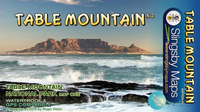
Table Mountain Stanfords
£19.99
Vouchers
No voucher codes found.
Do you know a voucher code for this product or supplier? Add it to Insights for others to use.
Do you know a voucher code for this product or supplier? Add it to Insights for others to use.
 Denmark