More From Contributor

£4.95
A page for each of the 30 districts of Rajasthan with railways, highways, main roads & other important routes marked. Symbols are used to show the locations of religious sites, forts, wildlife sanctuaries & other places of tourist interest. Street maps are included for ten major cities & there is also a short introduction to each district. ...
Archived Product
£8.99
Rajasthan offers huge variety to travellers, from impressive palaces & temples to glimpsing tigers in the misty hills. Footprint Focus provides invaluable information on transport, accommodation, eating & entertainment to ensure that your trip

Includes::
the best of this magnificent destination. Essentials section with useful advice on getting to & around Rajasthan. Comprehensive, up-to-date listings of where to eat, sleep & play.

Includes::
information on tour operators & activities, from the navigating the craziness of Delhi to the absorbing the calm of sacred temples. Detailed maps for Rajasthan & its key destinations. Slim enough to fit in your pocket. With detailed information on all the main sights, plus many lesser-known attractions, Footprint Focus Rajasthan, Delhi & Agra provides concise coverage of one of India's most traditional regions. Footprint Focus Rajasthan, Delhi & Agra has been extracted from Footprint's India Handbook.


...
Archived Product
£12.79
Rajasthan, Delhi & Agra in the Countries & Regions series from Lonely Planet, market-leading comprehensive guides aimed at independent travellers & serving a large range of international destinations. Frank & informal in style, the guides explore an extensive range of sights, activities, accommodation, restaurants & nightlife & are designed for practical use while travelling on the road. Written & researched by a team of experts, each book is independent in its recommendations & suggestions, often offering individual takes on individual destinations. Widely recognised for their reliability, each Lonely Planet country & region guide has the same layout. Introductory sections profile the destination with individual chapters on particular highlights, getting started, (including when to go) itineraries, history, culture, arts, food & drink & the environment. Each guide is organised geographically by region, with individual sections detailing an extensive range of sights, places of interest, attractions, restaurants, nightlife, accommodation & any local activities. The guides have detailed explanations of historical context where relevant. There is also practical guidance on ...
Archived Product
£12.99
Rajasthan offers huge variety to travellers, from impressive palaces & temples to glimpsing tigers in the misty hills. Footprint Focus provides invaluable information on transport, accommodation, eating & entertainment to ensure that your trip

Includes::
the best of this magnificent destination. Essentials section with useful advice on getting to & around Rajasthan. Comprehensive, up-to-date listings of where to eat, sleep & play.

Includes::
information on tour operators & activities, from the navigating the craziness of Delhi to the absorbing the calm of sacred temples. Detailed maps for Rajasthan & its key destinations. Slim enough to fit in your pocket. With detailed information on all the main sights, plus many lesser-known attractions, Footprint Focus Rajasthan, Delhi & Agra provides concise coverage of one of India`s most traditional regions. Footprint Focus Rajasthan, Delhi & Agra has been extracted from Footprint`s India Handbook.


...
Archived Product
£14.99
Discover Rajasthan, Delhi & Agra
See the Taj Mahal in a new light with a romantic midnight viewing
Appreciate the balance

...
Archived Product
£23.99
Rakkestad area in Norway in a series of GPS compatible recreational maps at 1:50, 000 with cartography from Norway’s topographic survey & additional tourist information. Contours lines are drawn at 20m intervals. The overprint varies from title to title, but

Includes::
local footpaths, in some cases distinguishing between easy & more difficult trails, as well as mountain huts & campsites. Many titles also indicate cycle or ski routes, other accommodation possibilities, sport & recreational facilities, including alpine skiing slopes, places of interest, etc. The maps have a UTM grid & margin ticks giving latitude & longitude. Map legend

Includes::
English. Several titles have on the reverse additional tourist information, although in most cases in Norwegian only. To see the list of Turkart maps at 1:50, 000 & links to Turkart series at 25K, 100K & Hiking Sets please click on the series link above.


...
Archived Product
£6.99
During a bloody war, a child is born at the cost of his mother`s life. From this baby comes forth a huge & powerful dragon born of shadow that lays waste to the landscape. A quick-thinking knight locks the baby in a cage of darkness, where he grows to be a young man, knowing only the kindness of his young female tutor. Until the day the Shadows attack... ...
Archived Product
£7.99
Raleigh & Durham in North Carolina on an indexed street plan from Rand Mc Nally in their extensive range of maps covering cities in the United States. Enlargements shows downtown Raleigh, Durham & Chapel Hill in greater detail & a small panel provides a road map of the surrounding area. Communities covered by this map include Apex, Carrboro, Cary, Hillsborough & Morrisville.NEW STREET PLAN CARTOGRAPHY FROM RAND Mc NALLY: Rand Mc Nally are currently changing the cartography of their street plans to a more “ European” style. In many titles streets are now shown by parallel lines, providing a much clearer, easier to read presentation. Better use of colouring indicates different types of land use and/or institutions (parks, shopping centres, academic institutions, etc) &, in most titles, different administrative units. More streets are annotated with block numbers. Some new editions still retain the traditional American presentation of streets by a single line, but with more prominent marking for various institutions, facilities & places of interest. Our cartography sample indicates which style is used in this title.COVERAGE: Rand Mc Nally street plans cover cities with their outer suburbs, prominently highlighting principal traffic arteries & connecting main streets. Railway & subway stations are marked. ...
Archived Product
£23.99
Rallarvegen: Haugastøl
- Finse
- Myrdal
- Flåm area of the Hardangervidda region in a series of GPS compatible recreational


...
Archived Product
£14.99
Trekking through the Pallars following in the footsteps of Camilo Jose Cela & Josep M. Espinas. This Editorial Alpina map & guide at 1:50, 000 scale is in English, French, Spanish & Catalan. Covers: La Pobla de Segur, Peramea, Gerri de la Sal, Baro, Tornafort, Sort, Llessui, Rialp, Llavorsi, Tirvia, Areu. ...
Archived Product

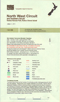
Rakiura (Stewart Island:) North West Circuit And Southern Circuits

The 125-km North West Circuit plus the adjoining Southern Circuit on the Rakiura / Stewart Island at 1:65, 000 in a series of contoured and GPS compatible maps from NewTopo NZ Ltd, with exceptionally vivid presentation of the terrain, routes clearly highlighted, and symbols to show locations of various facilities. The map also shows other local walking and tramping routes and in addition to the NZ national grid lines also has latitude and longitude grid at 10’ intervals. Contour interval is 20m.Maps in the series from NewTopo NZ Ltd cover the country’s popular hiking and tramping areas. The maps have contours (20m in most titles - please confirm in the individual description) enhanced by relief shading, plus colouring and/or graphics to indicate various types of the terrain and
vegetation: glaciers, scree, lava flows, shingle, sand, swamps, exotic forest, scrub, native bush, etc. The overprint for the routes distinguishes, as appropriate, between tramping tracks and routes, walking tracks, and waymarked or unmarked trails. Symbols show facilities such huts, campsites, public toilets, viewpoints, car parks, etc. Where useful, the maps also have brief notes about hut reservations. All the titles are GPS compatible, most with a 1-km NZ national grid (GPS users can uses WGS84).To see all the titles in this series please click on the series link.
RIP - This product is no longer available on our network. It was last seen on 25.09.2019

This page now acts as a permanent archive for this product. Add more information using the comments box below to ensure it can still be found by future generations.

Use our search facility to see if it is available from an alternative contributor.
  • External links may include paid for promotion
  • Availability: Out Of Stock
  • Supplier: Stanfords
  • SKU: XL122816
Availability: In Stock
£15.99

Product Description

The 125-km North West Circuit plus the adjoining Southern Circuit on the Rakiura / Stewart Island at 1:65, 000 in a series of contoured & GPS compatible maps from New Topo NZ Ltd, with exceptionally vivid presentation of the terrain, routes clearly highlighted, & symbols to show locations of various facilities. The map also shows other local walking & tramping routes & in addition to the NZ national grid lines also has latitude & longitude grid at 10’ intervals. Contour interval is 20m. Maps in the series from New Topo NZ Ltd cover the country’s popular hiking & tramping areas. The maps have contours (20m in most titles
- please confirm in the individual description) enhanced by relief shading, plus colouring and/or graphics to indicate various types of the terrain & vegetation: glaciers, scree, lava flows, shingle, s&, swamps, exotic forest, scrub, native bush, etc. The overprint for the routes distinguishes, as appropriate, between tramping tracks & routes, walking tracks, & waymarked or unmarked trails. Symbols show facilities such huts, campsites, public toilets, viewpoints, car parks, etc. Where useful, the maps also have brief notes about hut reservations. All the titles are GPS compatible, most with a 1-km NZ national grid (GPS users can uses WGS84). To see all the titles in this series please click on the series link.

Reviews/Comments

Add New

Intelligent Comparison

Oooops!
We couldn't find anything!
Perhaps this product's unique.... Or perhaps we are still looking for comparisons!
Click to bump this page and we'll hurry up.

Price History

Vouchers

No voucher codes found.
Do you know a voucher code for this product or supplier? Add it to Insights for others to use.

Facebook

Jargon Buster

GPS - Global Positioning System - Global position using satellites
Forest - A area with a high density of trees
Hiking - An outdoor activity envolving walking in nature
Graphics - A general term for visual aspects of an item/display
Car - A machine used for transport which runs on roads
Km - Kilometre. A unit of measurement equal to 1000 metres.
Popular - Something that is admired and liked by many people.
Individual - A single separate item or person.

Supplier Information

Stanfords
Stanfords was established in 1853 and opened their iconic Covent Garden flagship store in 1901. They have become the top retailer of maps, travel books and accessories in the UK and arguably offer the largest selection of maps and travel books worldwide. Famous names such as Captain Robert Falcon Scott, Ranulph Fiennes and Michael Palin have purchased from Stanfords. They now have a shop in Bristol and both stores together with other venues operate a calendar of events including talks, book signings and exhibitions. As a specialist map retailer, the map selection is comprehensive and includes road maps, street maps and walking maps from worldwide destinations, as well as a selection of world atlases and wall maps. Books include travel guides and travel literature. Stanfords also stock globes, from miniatures made of blue marble to magnificent floor-standing globes. The website features a selection of interesting articles on travel topics.
Page Updated: 2023-11-12 20:15:36

Community Generated Product Tags

Oh No! The productWIKI community hasn't generated any tags for this product yet!
Menu