
 United Kingdom
 France
 Germany
 Netherlands
 Sweden
 USA
USA
 Italy
Italy
 Spain
Spain
More From Contributor


Rawdon 1906
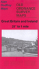
Rawdon in 1906 in a fascinating series of reproductions of old Ordnance Survey plans in the Alan Godfrey Editions, ideal for anyone interested in the history of their neighbourhood or family. Selected towns in Great Britain and Ireland are covered by maps showing the extent of urban development in the last decades of the 19th and early 20th century.In this title: the map covers the village of Rawdon, north of Leeds, and includes the hamlet of Little London. Features include Rawdon College, Larkfield Mills, Low Green, Rawdon Hall, River Aire, Acacia, Kent House, Woodlands Convalescent Home, Park Mill, St Peter's church, Woodleigh Hall, Micklefield House, Little London etc. An 1889 directory of Rawdon is on the reverse. About the Alan Godfrey Editions of the 25
Product Description
Reviews/Comments
Add New
Intelligent Comparison
Archived Product

Rawdon 1906 Stanfords
£3.50
Archived Product

Yeadon 1906 Stanfords
£3.50
Vouchers
No voucher codes found.
Do you know a voucher code for this product or supplier? Add it to Insights for others to use.
Do you know a voucher code for this product or supplier? Add it to Insights for others to use.
 Denmark