More From Contributor

£9.95
Rhine/ Main
- Frankfurt
- Northern Hesse area in a series of cycling maps of Germany at 1:150, 000 from the ADFC (Allgemeiner

...
Archived Product
£7.95
Rhine/ Main
- Northern Hesse area in a series of cycling maps of Germany from ADFC, the Allgemeiner Deutscher Fahrrad-Club, the
...
Archived Product
£7.95
Rhineland
- Eifel area in a series of cycling maps of Germany from ADFC, the Allgemeiner Deutscher Fahrrad-Club, the official
...
Archived Product
£10.99
The Rhineland
- Eifel: Cologne
- Koblenz
- Trier area of western Germany in a series of waterproof & tear-resistant, GPS


...
Archived Product
£9.95
Rhineland
- Eifel, Cologne
- Koblenz
- Trier area in a series of cycling maps of Germany at 1:150, 000 from the ADFC (Allgemeiner


...
Archived Product
£9.99
German states of Rhinel&-Palatinate (Rheinl&-Pfalz) & Saarland on an indexed road map at 1:200, 000 in the Mair Dumont’s Marco Polo series, prominently highlighting interesting locations & protected areas. A 95-page index booklet

Includes::
city centre street plans plus enlargements at 1:100, 000 showing in greater detail the environs & road access to Kaiserslautern, Koblenz, Ludwigshafen, Mainz, Saarbrücken & Trier. Also included are plans of the Frankfurt-Hahn Airport & of the Saarbrücken Messe exhibition grounds Maps in this Mair Dumont Marco Polo series indicate topography by light relief shading & the series is particularly good for identifying geographical

Features:
mountain & hill chains, valleys, national/natural parks, etc. The maps boldly stress main roads & motorways in strong colours & selected towns in large letters, but also show minor roads & villages in considerable detail. Road information

Includes::
toll roads, traffic restrictions & seasonal closures, gradient marking for steep roads, etc. Motorway services clearly indicate types of facilities available there, & driving distances are marked on many small local roads. Scenic roads & special tourist routes are highlighted. Railway network

Includes::
narrow gauge & tourist lines, cable car lines, & chair lifts. Where appropriate, ferry connections are shown. Locations worth visiting, both town/villages & natural sites, are highlighted & graded; 15 best sites are prominently marked & cross-referenced to their descriptions in the accompanying booklet. Other tourist information

Includes::
campsites & youth hostels, landmarks, recreational facilities etc. Latitude & longitude grid is drawn at intervals of 10`. Each title comes with a booklet attached to the map cover containing street plans & maps at 1:100, 000 showing in greater detail road access to main cities. The booklet also provides an index listing towns/villages with their postcodes as well as rivers & landscape features, plus a table with distances/travelling times, & for route planning an overview of the whole area covered by the main map indicating the 15 special places of interest. Map legend & the descriptions include English. To see the list of titles in this series please click on the series link.


...
Archived Product
£9.99
On Disneyland`s ` Jungle Cruise`, three men are forever chased up a palm tree by a rhinoceros whose sharp horn moves endlessly just out of reach of the lowest man`s bottom. Having lived with the memory of this ride since childhood, the author was struck when she came across a reference to this `natives up a tree` scene in an 1838 natural history description. Such images have demonized rhinos for generations; this book examines how such a solitary animal came to earn such a bad reputation. Rhinoceros` wildness has roots in the ancient, prehistoric & mythic. Many sightings of the rhinoceros were thought to prove the existence of the mythical unicorn, which was said to be impossible to capture alive. Later the rhino was captured, & a few were brought to Europe throughout the Renaissance to the 18th century to be displayed as wonders of nature. In America, the first rhinoceros arrived in 1830 & was hailed as the most savage of animals, & thereafter it became the most desired hunting trophy. No wonder that these animals are now an endangered species when we also consider that rhino horn is much sought after as an ingredient in Asian medicine.” Rhinoceros” explores sources ranging from film & literature, to natural history description & exhibition, & asks whether the savagery of the rhino is a reality or a legacy of its mythic past. Well illustrated & persuasively argued, ” Rhinoceros” will appeal to all enthusiasts eager to learn about the culture, history & nature of this animal, as well as specialists, from art historians to conservation biologists. ...
Archived Product
£9.99
Moon Handbooks aren't your average guides. For more than 30 years, these books have appealed to an eclectic group of travelers, from backpacking students to solo adventurers to families on vacation (and a budget). The Ocean State, whether you experience it from the shores of Little Compton, the isolation of Block Isl&, the bays of Bristol, the urban landscapes of Providence, or the shores of Newport
- packs a tremendous amount of variety into a tiny area. Suggested travel strategies & lists of must-see sights provide you with real insights so you can decide where you should go, stay, & eat
- without hassles or regrets. Suggested travel strategies include: The Best of Rhode Isl&, Eating Your Way Through the Ocean State, Sampling the Great Outdoors, A Long Weekend in Newport, & A Long Weekend in Providence. Andrew provides information on where to trek, climb, cycle, boat, & shop. Complete with maps, photographs, illustrations, & special emphasis on leading destinations such as East Bay, Sakonnet, Newport, South County, & Jamestown. Moon Handbooks Rhode Island has the tools you need to create your own unique trip.

...
Archived Product
£9.50
Rhodes on a clear, indexed map with topographic & tourist information, printed on light, waterproof & tear-resistant plastic paper. The map is published by Reise Know-How as part of their highly acclaimed World Mapping Project. Topography is shown by altitude & bathymetric colouring with contours & spot heights. Road network shows local roads & tracks, gives driving distances on main & secondary roads & locations of petrol stations. Ferry routes are also marked. A separate inset shows ferry connections to the nearby coast of Turkey & the islands of Simi & Tilos. The map highlights various places of interest including churches, monasteries & castles, archaeological sites, beaches, golf courses, etc. Names of towns & villages are given in both scripts; geographical features & places of interest are in Latin alphabet only. The map has both a UTM grid & a latitude & longitude grid at intervals of 5 ...
Archived Product
£11.99
Rhodes in the Landmark Visitor Guides series, exploring a range of places in Britain, Europe & the Caribbean, with a particular expertise in UK destinations. Each guide presents the reader with detailed, wide-ranging & accessible overview of the region or area, with a particular focus on history & culture, notable local attractions, the landscape, local events & family activities. A series of recommended walks & guided car tours exploring the region are also included in each title. The guides are arranged geographically by region & are ideal both for short & longer breaks, with practical guidance on recommended routes & tourist attractions, in addition to insightful inset boxes into local history, culture & traditions. Information on accommodation, restaurants & day-to-day information are more limited, though a compact Directory at the end of each guide provides basic listings of recommended accommodation & restaurants, as well as tourist information contacts & regional event calendars. International destinations also carry climate & country facts, basic phrases & other general travel practical guidance for travelling to the region. The British titles in the Landmark Visitor Guides series are highly recommended, covering titles that are rarely available from other publishers. ...
Archived Product

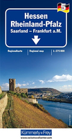
Rhineland-Palatinate - Saarland F&B

One of the titles in a series of large, indexed regional maps with fine, clear cartography. General relief is portrayed by hill-shading with selected spot heights without distracting from the other detail. The motorway network and recommended scenic routes stand out well from the background, but some may find minor local roads a little too faint. In some places exits from motorways are also rather lightly coloured. Intermediate driving distances are indicated throughout and special tourist routes are marked.The maps highlight picturesque towns and national parks, with a range of symbols marking campsites, youth hostels, museums, spas, various landmarks and places of interest, etc. Latitude and longitude grid is drawn at intervals of 10’. Map legend includes English. A separate
index attached to the cover gives the postcode for each locality, including those beyond the German territory on sheets covering border regions.
RIP - This product is no longer available on our network. It was last seen on 25.09.2019

This page now acts as a permanent archive for this product. Add more information using the comments box below to ensure it can still be found by future generations.

Use our search facility to see if it is available from an alternative contributor.
  • Availability: Out Of Stock
  • Supplier: Stanfords
  • SKU: 9783707900552
Availability: In Stock
£10.99

Product Description

One of the titles in a series of large, indexed regional maps with fine, clear cartography. General relief is portrayed by hill-shading with selected spot heights without distracting from the other detail. The motorway network & recommended scenic routes stand out well from the background, but some may find minor local roads a little too faint. In some places exits from motorways are also rather lightly coloured. Intermediate driving distances are indicated throughout & special tourist routes are marked. The maps highlight picturesque towns & national parks, with a range of symbols marking campsites, youth hostels, museums, spas, various landmarks & places of interest, etc. Latitude & longitude grid is drawn at intervals of 10’. Map legend

Includes::
English. A separate index attached to the cover gives the postcode for each locality, including those beyond the German territory on sheets covering border regions.

Reviews/Comments

Add New

Price History

Vouchers

No voucher codes found.
Do you know a voucher code for this product or supplier? Add it to Insights for others to use.

Facebook

Jargon Buster

Network - A link and communication between things. Often computers or people.
Large - something that takes up more space than normal.
Regional - An adjective to describe a set geographic area.

Supplier Information

Stanfords
Stanfords was established in 1853 and opened their iconic Covent Garden flagship store in 1901. They have become the top retailer of maps, travel books and accessories in the UK and arguably offer the largest selection of maps and travel books worldwide. Famous names such as Captain Robert Falcon Scott, Ranulph Fiennes and Michael Palin have purchased from Stanfords. They now have a shop in Bristol and both stores together with other venues operate a calendar of events including talks, book signings and exhibitions. As a specialist map retailer, the map selection is comprehensive and includes road maps, street maps and walking maps from worldwide destinations, as well as a selection of world atlases and wall maps. Books include travel guides and travel literature. Stanfords also stock globes, from miniatures made of blue marble to magnificent floor-standing globes. The website features a selection of interesting articles on travel topics.
Page Updated: 2023-11-12 20:15:36

Community Generated Product Tags

Oh No! The productWIKI community hasn't generated any tags for this product yet!
Menu