More From Contributor

£9.50
Rhodes on a clear, indexed map with topographic & tourist information, printed on light, waterproof & tear-resistant plastic paper. The map is published by Reise Know-How as part of their highly acclaimed World Mapping Project. Topography is shown by altitude & bathymetric colouring with contours & spot heights. Road network shows local roads & tracks, gives driving distances on main & secondary roads & locations of petrol stations. Ferry routes are also marked. A separate inset shows ferry connections to the nearby coast of Turkey & the islands of Simi & Tilos. The map highlights various places of interest including churches, monasteries & castles, archaeological sites, beaches, golf courses, etc. Names of towns & villages are given in both scripts; geographical features & places of interest are in Latin alphabet only. The map has both a UTM grid & a latitude & longitude grid at intervals of 5 ...
Archived Product
£11.99
Rhodes in the Landmark Visitor Guides series, exploring a range of places in Britain, Europe & the Caribbean, with a particular expertise in UK destinations. Each guide presents the reader with detailed, wide-ranging & accessible overview of the region or area, with a particular focus on history & culture, notable local attractions, the landscape, local events & family activities. A series of recommended walks & guided car tours exploring the region are also included in each title. The guides are arranged geographically by region & are ideal both for short & longer breaks, with practical guidance on recommended routes & tourist attractions, in addition to insightful inset boxes into local history, culture & traditions. Information on accommodation, restaurants & day-to-day information are more limited, though a compact Directory at the end of each guide provides basic listings of recommended accommodation & restaurants, as well as tourist information contacts & regional event calendars. International destinations also carry climate & country facts, basic phrases & other general travel practical guidance for travelling to the region. The British titles in the Landmark Visitor Guides series are highly recommended, covering titles that are rarely available from other publishers. ...
Archived Product
£9.99
Rhodes in New Holland’s Globetrotter Travel Guide series, comprising a range of practical & accessible guides to a number of cities, regions & countries worldwide. Globetrotter guides incorporate essential information in an easy-to-carry & easy-to-reference format. They provide visitors with an introduction highlighting the country’s ‘must see’ areas, allowing readers to make the most of their time away. Presented in a paperback PVC format, each guide in the series provides vital tips for visitors &

Includes::
information on the best places to stay, eat & shop, star-rated top attractions, detailed regional profiles & recommendations of the best tours & excursions. Individual titles also have a separate, pull-out overview map in the rear pocket of the guide that serves as a companion to the book itself. An introductory section profiles the destination with details of the l&, a brief history, government & economy & the people. Every chapter is summarised in the ‘ At-a-Glance’ sections at the end of each chapter. There is also a Travel Tips section at the back of each guide providing practical guidance & information on tourist information services, entry requirements, customs, health requirements, getting there, what to pack, money matters, accommodation, transport, business hours, time difference, electricity, health precautions, useful phrases, personal safety, emergencies, etiquette & tipping.

...
Archived Product
£4.99
This vibrant series of travel guides is aimed at travellers on a package or short-term holiday who need concise practical & accessible information. It specifically targets what people want from a few weeks holiday. Each handy guide features the best nightlife, shopping, beaches & activities & provides details for getting out & about to see local attractions. This series: contains summaries of the most popular resorts, including the best beaches, things to see & do, taking a break & after dark sections; describes the local cuisine &

Includes::
a concise phrase guide & menu decoder; gives advice on how to keep children entertained & venues that specifically cater for them; lists festivals & events throughout the year; reviews the types of sports & leisure activities on offer within the area; & features fun excursions & scenic trips locally & further afield. It contains: clear, full-colour resort maps locate restaurants, night-time venues, shopping & places of interest; & practical information for before you leave & during your stay, including visa requirements, customs, dress codes, emergencies, health & safety & currency.

...
Archived Product
£8.99
Rhodes is the Sunflower Walk & Eat guide to finding the best places to combine a short walk with sampling the island’s culinary delights. Pocket-sized, the guide covers walks in areas such as the Old Town, Archangelos, Mount Akramitis & Kritinia Castle, accompanied with a selection of restaurants easily accessible using local public transport. The walks also take in some of the area’s most famous sights including the Old Town, the Archbishop’s Palace & the Medieval Moat Theatre. A detailed introduction provides useful guidance on when to go, where to stay, what to take, planning your walk, local transport details, Greek food & wine, city transport areas & an area map. There are also suggestions for excursions by bus or coach. Each of the 12 walks is accompanied by information on total distance, difficulty grading, local transport options & refreshments en route, as well as any relevant opening times or entry fees at local attractions. Uniquely, each walk is accompanied by a recommended restaurant & a recipe that it specialises in. Fold-out flaps at the front & back of the book provide a basic street plan of Rhodes Town & a glossary of useful Greek food & restaurant vocabulary. ...
Archived Product
£17.99
Gary Rhodes specializes in the traditional British dishes that have fallen from favour because of their humble ingredients, or have been overshadowed by the razzmatazz of nouvelle cuisine. In the book he presents over 100 recipes, many of them updated versions of classic dishes such as braised oxtail, Lancashire hotpot, & boiled bacon with pearl barley & lentils. Vegetarian dishes are also included. In the introduction, Rhodes elaborates on how to cook vegetables in traditional ways such as roasting & braising, & how to make dressings, marinades, chutneys & pickles. ...
Archived Product
£16.99
By the late fifteenth century Ottoman Turkish mastery of the Eastern Mediterranean was nearly complete. However, the tiny island of Rhodes, just a few kilometres from the south-west coast of Turkey, remained a thorn in their side. Home to the walled headquarters of the Knights Hospitaller, a crusading Order of ”warrior monks”, Rhodes was besieged for three months by the full might of the Turkish army & artillery in 1480, but emerged undefeated. The Ottomans would inevitably return, so the Hospitallers strengthened & adapted their fortifications & defences in preparation for another siege. The Ottomans attacked again in 1522 &, after six months, captured Rhodes but were unable to defeat the Hospitallers who were allowed to leave with their lives, arms & possessions. Why were the Knights Hospitaller able to remain undefeated against the most powerful military force in the world? & what changes were made to the fortifications of their island stronghold? This book uniquely uses the eyewitness accounts, surviving guns & extant walls to deconstruct the story of these two sieges in detail, & uses these events as a backdrop to explore the wider relationship between the development of gunpowder weapons & the fortifications built to defend against them. Including detailed appendices with a wealth of images of the cannon & walls, this book will fascinate not only visitors to Rhodes, but also those who are interested in the art of medieval warfare. ...
Archived Product
£5.99
Rhodes in the Essential Guide Series from the AA exploring the best places to see & things to do in a range of popular destinations. Each illustrated, pocket-sized guide is divided into five sections
- the essence of the area, planning your trip, the best places to see, best things to do & an exploration of notable highlights, organised by area. An introductory chapter profiles each destination &

Includes::
notes on local cuisine & recommendations for short breaks. A planning section advises on pre-trip preparations & getting there & around as well as outlining useful language tips & what


...
Archived Product
£10.99
Rhodes on a large indexed map from Freytag & Berndt, including a booklet with multilingual descriptions of the island’s main sights. Although the scale is 1:50, 000 & the map is contoured, it is better suited for exploring the island by car rather than for hiking. Coverage

Includes::
Symi & Halki with Alimia, shown on separate insets. Contours enhanced by bold relief shading & colouring indicating woodlands show the topography. Road network

Includes::
local tracks & gives distances on most routes. Scenic routes are prominently highlighted. Large icons indicate various places of interest, highlighting locations with are given multilingual descriptions in the booklet attached to the map cover. The map has a 5-km UTM grid, plus margin tick & crosshairs for latitude & longitude at intervals of 2’. The booklet also

Includes::
an index plus a street plan of central Rhodes Town with its historic Old City. Multilingual map legend

Includes::
English.


...
Archived Product
£4.99
Rhodes in a series of handy holiday pocket maps from Freytag & Berndt covering popular islands & other seaside destinations in Europe. Each map is laminated, so waterproof & tear-resistant, & highlights the publishers’ recommendations of five best choices in five categories: adventure, culture, food, nature & sights. On one side is a road map with icons highlighting numerous places of interest, including campsites & youth hostels, sport & recreational facilities, marinas & beaches, architectural & historical sites, etc. The maps have no geographical coordinates. Most titles also include a small street plan of the central area in the main town. The map &, if appropriate, the street plan are annotated with colour-coded markers highlighting the publishers’ recommendations of five best choices in five categories: adventure, culture, food, nature & sights, all listed on the reverse of the map with brief notes in several languages. Also provided is a Fact Box with phone numbers for tourist offices, car hire & emergency services. Map legend & notes on the recommendations include English. To see other titles in this series please click on the series link. ...
Archived Product

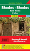
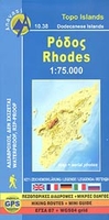
Rhodes Anavasi 10.38

Rhodes at 1:75, 000 on a contoured, GPS compatible map from a wide coverage of the Greek islands by Anavasi, printed on light, waterproof and tear-resistant synthetic paper, with a street plan of a street plan of the Old Town, hiking suggestions, etc.The map has contours at 100m intervals with additional altitude colouring and plenty of names of topographical features. Road network indicates minor unsurfaced roads and dirt tracks in poor condition; driving distances are shown on main routes and locations of petrol stations are marked. A range of symbols highlight various places of interest including archeological sites, beaches, etc. For GPS use map has both a UTM grid and a latitude/longitude grid at 5’ intervals. All place names are in both Greek and Latin alphabet.Extensive
additional information is provided on the reverse side: a simplified road map of the whole island highlighting its main archaeological and natural sites; a street plan of the Old Town of Rhodes; suggestions for hiking excursions accompanied by maps; and a small basic street plan of Lindos. All are accompanied by descriptions and colour photos. Map legend and all the text include English.To see which other Greek islands are covered by maps from Anavasi, please click on the series link.
RIP - This product is no longer available on our network. It was last seen on 25.09.2019

This page now acts as a permanent archive for this product. Add more information using the comments box below to ensure it can still be found by future generations.

Use our search facility to see if it is available from an alternative contributor.
  • Availability: Out Of Stock
  • Supplier: Stanfords
  • SKU: 9789609412162
Availability: In Stock
£7.50

Product Description

Rhodes at 1:75, 000 on a contoured, GPS compatible map from a wide coverage of the Greek islands by Anavasi, printed on light, waterproof & tear-resistant synthetic paper, with a street plan of a street plan of the Old Town, hiking suggestions, etc. The map has contours at 100m intervals with additional altitude colouring & plenty of names of topographical features. Road network indicates minor unsurfaced roads & dirt tracks in poor condition; driving distances are shown on main routes & locations of petrol stations are marked. A range of symbols highlight various places of interest including archeological sites, beaches, etc. For GPS use map has both a UTM grid & a latitude/longitude grid at 5’ intervals. All place names are in both Greek & Latin alphabet. Extensive additional information is provided on the reverse side: a simplified road map of the whole island highlighting its main archaeological & natural sites; a street plan of the Old Town of Rhodes; suggestions for hiking excursions accompanied by maps; & a small basic street plan of Lindos. All are accompanied by descriptions & colour photos. Map legend & all the text include English. To see which other Greek islands are covered by maps from Anavasi, please click on the series link.

Reviews/Comments

Add New

Price History

Vouchers

No voucher codes found.
Do you know a voucher code for this product or supplier? Add it to Insights for others to use.

Facebook

Jargon Buster

GPS - Global Positioning System - Global position using satellites
Paper - A thin sheet mainly used for writing. Available in a variety of colours. Made mainly from wood pulp.
Hiking - An outdoor activity envolving walking in nature
Waterproof - Resistant to water, usualy specified by depth in metres
Colour - The categorised spectrum of light visable to humans
Natural - not manmade
Network - A link and communication between things. Often computers or people.
Small - something that takes up less space than normal.
Road - a manmade lane or a path that is used to speed up travel.
Condition - The quality of a product or service.
Resistant - Something that can repel against something.
Altitude - Something that can be quite high in relation to sea or ground level.
Wide - Something with a large width.

Supplier Information

Stanfords
Stanfords was established in 1853 and opened their iconic Covent Garden flagship store in 1901. They have become the top retailer of maps, travel books and accessories in the UK and arguably offer the largest selection of maps and travel books worldwide. Famous names such as Captain Robert Falcon Scott, Ranulph Fiennes and Michael Palin have purchased from Stanfords. They now have a shop in Bristol and both stores together with other venues operate a calendar of events including talks, book signings and exhibitions. As a specialist map retailer, the map selection is comprehensive and includes road maps, street maps and walking maps from worldwide destinations, as well as a selection of world atlases and wall maps. Books include travel guides and travel literature. Stanfords also stock globes, from miniatures made of blue marble to magnificent floor-standing globes. The website features a selection of interesting articles on travel topics.
Page Updated: 2023-11-12 20:15:36

Community Generated Product Tags

Oh No! The productWIKI community hasn't generated any tags for this product yet!
Menu