
 United Kingdom
 France
 Germany
 Netherlands
 Sweden
 USA
USA
 Italy
Italy
 Spain
Spain
More From Contributor

Rolls-Royce
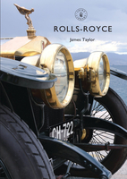
Rolls-Royce is one of Britain`s legendary car brands, representing the pinnacle of engineering quality and luxury like no other manufacturer. Since 1904, when Charles Stewart Rolls and Frederick Henry Royce began their collaboration, the Rolls-Royce name has earned respect and admiration the world over. This is the full story of Britain`s premier luxury car-maker, from the early experimental models through the 40/50 Silver Ghost, the Twenty, the Phantoms, the Wraiths and their post-1945 successors, with evocative names such as Silver Shadow and Silver Seraph. It celebrates more than 110 years of car manufacture under the Rolls-Royce brand, revealing how careful management and simple dedication have ensured that the Rolls-Royce name remains a byword for the best of the best.

Product Description
Reviews/Comments
Add New
Vouchers
No voucher codes found.
Do you know a voucher code for this product or supplier? Add it to Insights for others to use.
Do you know a voucher code for this product or supplier? Add it to Insights for others to use.
 Denmark