
 United Kingdom
 France
 Germany
 Netherlands
 Sweden
 USA
USA
 Italy
Italy
 Spain
Spain
More From Contributor


Rwanda
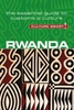
Rwanda is the world`s premier gorilla-tracking destination and was made famous as the setting for the film Gorillas in the Mist. However there is much to see beyond magical encounters with gorillas: Lake Kivu, the mountain-ringed inland sea; the immense Nyungwe Forest National Park with its chimpanzees, monkeys, and rare birds; and the wild savanna of Akagera National Park. Written in an engaging and colourful style this new edition is packed with personal anecdotes of people and places met across the country. With an emphasis on eco-tourism, there is a dedicated chapter to each of the national parks outlining all the practicalities: how to get there, how to obtain a permit; where to spot wildlife; how to identify flora; and how to identify the best trips offered by tour operators.
Rwanda provides the most comprehensive coverage of any English-language guidebook on the market. Rwanda is the world`s premier gorilla-tracking destination and was made famous as the setting for the film Gorillas in the Mist.However there is much to see beyond magical encounters with gorillas: Lake Kivu, the mountain-ringed inland sea; the immense Nyungwe Forest National Park with its chimpanzees, monkeys, and rare birds; and the wild savanna of Akagera National Park. Written in an engaging and colourful style this new edition is packed with personal anecdotes of people and places met across the country. With an emphasis on eco-tourism, there is a dedicated chapter to each of the national parks outlining all the practicalities: how to get there, how to obtain a permit; where to spot
wildlife; how to identify flora; and how to identify the best trips offered by tour operators. Rwanda provides the most comprehensive coverage of any English-language guidebook on the market.

Product Description
Reviews/Comments
Add New
Vouchers
No voucher codes found.
Do you know a voucher code for this product or supplier? Add it to Insights for others to use.
Do you know a voucher code for this product or supplier? Add it to Insights for others to use.
 Denmark