More From Contributor

£12.95
In the cyclists` guide series from Mica publishers, here are 30 circular road cycle routes of 35 miles to 115 miles, exploring the best of Scotland`s panoramic back roads from the Far North-West to the Borders. The routes include two Cairngorm crossings & the spectacular Bealach na Ba in Applecross, some of the toughest & most spectacular challenges in the country, as well as gentler cross-country & coastal routes round the Black Isle, Moray Coast, Ayrshire, Arran & East Lothian. These day circuits include detailed descriptions & Ordnance Survey mapping, plus variations & extensions to ensure you get the best from your day. Route profiles indicate uphill & downhill sections & the spread of total height gain. There are also route fact files indicating starting point, distance, height gain, maximum gradient & approximate time. There are extensions & variations to shorten & lengthen routes, plus all important cafe stops en route are listed. ...
Archived Product
£14.99
Right across the world there are people who think of themselves as Scottish Highlanders, people who, though they may be separated from Scotland's hills & glens by many thousands of miles & several generations, still identify with this unique locality on the western edge of Europe. Examining their roots, their contribution to Scotland's evolution, their dispersal across the globe & the myths surrounding them, James Hunter sets out to explore & explain the passions & emotions surrounding the Scottish Highlanders. ...
Archived Product
£10.39
Scottish Highlands & Islands in the Countries, Regions & Cities series from Rough Guides; comprehensively detailed guidebooks specifically designed for independent travellers & serving a range of worldwide destinations. Widely recognised for their free editorial style, Rough Guide authors are allowed to express their personal opinions on a range of subjects. Although sometimes controversial, this editorial stance allows readers to experience more detailed & personal takes on each destination, a feature often more limited in other guidebooks. Cultural & historical nuances are explored in significant depth throughout the text & descriptions on the ambience of individual settings alongside personal recommendations, particularly in cities, are notably prevalent. Each Rough Guide in the Countries, Regions & Cities series has a similar layout. A ...
Archived Product
£9.99
Scottish Highlands & Islands in the AA 50 Walks series; comprising an extensive range of walking guides helping you to explore the best walking routes in Great Britain. Each guide covers a total of 50 walks, many of which are circular, between 2-10 miles & also that are suitable for a range of different walking standards. Every walk in the guides has an information box showing clear details of distance, minimum time, level of difficulty, any ascents, the nature of the terrain & landscape, suggested Ordnance Survey map, grid references for starting & finishing points, dog friendliness, parking & any public toilets en route. There are also suggestions of what to look out for & recommended places to eat & drink. Detailed walk descriptions are accompanied by clear mapping of the route ahead, in addition to colour photographs illustrating the highlights of selected routes. ...
Archived Product
£7.99
Scottish Highlands in the Landmark Visitor Guides series, exploring a range of places in Britain, Europe & the Caribbean, with a particular expertise in UK destinations. Each guide presents the reader with detailed, wide-ranging & accessible overview of the region or area, with a particular focus on history & culture, notable local attractions, the landscape, local events & family activities. A series of recommended walks & guided car tours exploring the region are also included in each title. The guides are arranged geographically by region & are ideal both for short & longer breaks, with practical guidance on recommended routes & tourist attractions, in addition to insightful inset boxes into local history, culture & traditions. Information on accommodation, restaurants & day-to-day information are more limited, though a compact Directory at the end of each guide provides basic listings of recommended accommodation & restaurants, as well as tourist information contacts & regional event calendars. International destinations also carry climate & country facts, basic phrases & other general travel practical guidance for travelling to the region. The British titles in the Landmark Visitor Guides series are highly recommended, covering titles that are rarely available from other publishers. ...
Archived Product
£12.99
Written by Stephen Whitehorne, one of Scotland's best-known photographer/authors, this book brings to life some of the most breathtaking scenery in the British Isles. Stephen has explored every nook & cranny of the Highlands & Skye
- as well as the mountaintops. The Highlands are one of Europe's last great wilderness areas, one of the few remaining landscapes where genuine solitude can be sought & where the luxuries of silence & space abound. While the tourist boards tend to perpetuate the myths of kilt & bagpipe, the Loch Ness monster & romantic Medieval castles, most people visit Scotland for the reality
- for the beauty & great diversity of its scenery, to discover remote lochs, atmospheric glens & dramatic mountains. The car tours, picnics & walks in this book will allow you to discover the very best the Highlands have to offer, whether from your seat in the car, out on a short stroll or committed to an energetic mountain hike. The photographic images in this book
- all of calendar quality
- will whet your appetite & remain a wonderful souvenir of your holiday in the Highlands.


...
Archived Product
£34.95
Scottish Highlands Central Postcode Sector Map at 1:150, 000, encapsulated version, in a series of postcode sector maps showing the first part of the postcode & the first number of the second part, the Inward Code. Coverage extends north to Easter Ross, south to Glen Spean, east to Grantown-on-Spey, & west to Kyle of Lochalsh. Map Marketing’s series of postcode sector maps covers Great Britain & Northern Ireland on 36 titles, each available only as a flat map, either on paper or encapsulated for greater durability. Presentation

Includes::
postcode changes in the most recent Royal Mail Postcode updates. The series covers Great Britain at 1:150, 000 (1” to 2.4 miles), with Northern Ireland shown at 1:210, 000 & London at two scales: 1:60, 000 for the area within the M25 & in more detail at 1:15, 000 for central London. Postcode area, district & sector boundaries & numbers/letters are shown in red, with County & Unitary Authority boundaries in green. The map base shows motorways, primary, ‘A’ & down to unclassified roads, with conurbation shapes & city plan insets showing street level detail for major cities. To see the list of all the titles in this series please click on the series link.LAMINATED & ENCAPSULATED WALL MAPS:- LAMINATED wall maps have a thin layer of plastic usually applied to the printed side only. They can be written on with suitable marker pens without any damage to the map but, unless laminated on both sides, they are not damp-proof.- ENCAPSULATED wall maps are sealed between two sheets of plastic. They are more rigid & heavier than laminated maps of the same size. They are damp-proof & do not crinkle in humid conditions. Encapsulation gives the map a shiny surface, similar to being displayed behind glass.- PLEASE NOTE: many publishers & retailers often use these two terms interchangeably. Our map titles & descriptions follow the definitions provided above.

...
Archived Product
£24.95
Scottish Highlands Central Postcode Sector Map at 1:150, 000, paper version, in a series of postcode sector maps showing the first part of the postcode & the first number of the second part, the Inward Code. Coverage extends north to Easter Ross, south to Glen Spean, east to Grantown-on-Spey, & west to Kyle of Lochalsh. Map Marketing’s series of postcode sector maps covers Great Britain & Northern Ireland on 36 titles, each available only as a flat map, either on paper or encapsulated for greater durability. Presentation

Includes::
postcode changes in the most recent Royal Mail Postcode updates. The series covers Great Britain at 1:150, 000 (1” to 2.4 miles), with Northern Ireland shown at 1:210, 000 & London at two scales: 1:60, 000 for the area within the M25 & in more detail at 1:15, 000 for central London. Postcode area, district & sector boundaries & numbers/letters are shown in red, with County & Unitary Authority boundaries in green. The map base shows motorways, primary, ‘A’ & down to unclassified roads, with conurbation shapes & city plan insets showing street level detail for major cities. To see the list of all the titles in this series please click on the series link.

...
Archived Product
£34.95
Scottish Highlands North Postcode Sector Map at 1:150, 000, encapsulated version, in a series of postcode sector maps showing the first part of the postcode & the first number of the second part, the Inward Code. Coverage extends north to Cape Wrath, south to Kildermorie, east to Achenclyth, & west to Priest Isl&. Map Marketing’s series of postcode sector maps covers Great Britain & Northern Ireland on 36 titles, each available only as a flat map, either on paper or encapsulated for greater durability. Presentation

Includes::
postcode changes in the most recent Royal Mail Postcode updates. The series covers Great Britain at 1:150, 000 (1” to 2.4 miles), with Northern Ireland shown at 1:210, 000 & London at two scales: 1:60, 000 for the area within the M25 & in more detail at 1:15, 000 for central London. Postcode area, district & sector boundaries & numbers/letters are shown in red, with County & Unitary Authority boundaries in green. The map base shows motorways, primary, ‘A’ & down to unclassified roads, with conurbation shapes & city plan insets showing street level detail for major cities. To see the list of all the titles in this series please click on the series link.LAMINATED & ENCAPSULATED WALL MAPS:- LAMINATED wall maps have a thin layer of plastic usually applied to the printed side only. They can be written on with suitable marker pens without any damage to the map but, unless laminated on both sides, they are not damp-proof.- ENCAPSULATED wall maps are sealed between two sheets of plastic. They are more rigid & heavier than laminated maps of the same size. They are damp-proof & do not crinkle in humid conditions. Encapsulation gives the map a shiny surface, similar to being displayed behind glass.- PLEASE NOTE: many publishers & retailers often use these two terms interchangeably. Our map titles & descriptions follow the definitions provided above.

...
Archived Product
£24.95
Scottish Highlands North Postcode Sector Map at 1:150, 000, paper version, in a series of postcode sector maps showing the first part of the postcode & the first number of the second part, the Inward Code. Coverage extends north to Cape Wrath, south to Kildermorie, east to Achenclyth, & west to Priest Isl&. Map Marketing’s series of postcode sector maps covers Great Britain & Northern Ireland on 36 titles, each available only as a flat map, either on paper or encapsulated for greater durability. Presentation

Includes::
postcode changes in the most recent Royal Mail Postcode updates. The series covers Great Britain at 1:150, 000 (1” to 2.4 miles), with Northern Ireland shown at 1:210, 000 & London at two scales: 1:60, 000 for the area within the M25 & in more detail at 1:15, 000 for central London. Postcode area, district & sector boundaries & numbers/letters are shown in red, with County & Unitary Authority boundaries in green. The map base shows motorways, primary, ‘A’ & down to unclassified roads, with conurbation shapes & city plan insets showing street level detail for major cities. To see the list of all the titles in this series please click on the series link.

...
Archived Product

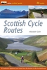
Scottish Highlands - The Hillwalking Guide: 60 Day Walks, Includes 86
Detailed Trail Maps - Planning, Places To Stay, Places To Eat

Practical walking guide to over 80 hills in the Scottish Highlands and Islands. This Scottish hill-walking book covers Scottish hill walks, monros, corbetts and tracks including Ben Nevis walking guide and Cairngorm walks. Includes 86 detailed walking maps: walking times, directions, tricky junctions, places to stay, places to eat, points of interest written onto the map. These are not general-purpose maps but fully edited maps drawn by walkers for walkers. 60 day-walks for all abilities, graded for difficulty, 2-day and 3-day treks. Profile maps to show climbs and descents. Detailed accommodation: B&Bs, campsites, bunkhouses, bothies, hostels, hotels, pubs. Places to eat: cafes, pubs, teashops, restaurants. What to see. Guides to 62 gateway towns and villages. Detailed
public transport information.
RIP - This product is no longer available on our network. It was last seen on 25.09.2019

This page now acts as a permanent archive for this product. Add more information using the comments box below to ensure it can still be found by future generations.

Use our search facility to see if it is available from an alternative contributor.
  • Availability: Out Of Stock
  • Supplier: Stanfords
  • SKU: 9781905864775
Availability: In Stock
£13.99

Product Description

Practical walking guide to over 80 hills in the Scottish Highlands & Islands. This Scottish hill-walking book covers Scottish hill walks, monros, corbetts & tracks including Ben Nevis walking guide & Cairngorm walks.

Includes::
86 detailed walking maps: walking times, directions, tricky junctions, places to stay, places to eat, points of interest written onto the map. These are not general-purpose maps but fully edited maps drawn by walkers for walkers. 60 day-walks for all abilities, graded for difficulty, 2-day & 3-day treks. Profile maps to show climbs & descents. Detailed accommodation: B& Bs, campsites, bunkhouses, bothies, hostels, hotels, pubs. Places to eat: cafes, pubs, teashops, restaurants. What to see. Guides to 62 gateway towns & villages. Detailed public transport information.

Reviews/Comments

Add New

Intelligent Comparison

Oooops!
We couldn't find anything!
Perhaps this product's unique.... Or perhaps we are still looking for comparisons!
Click to bump this page and we'll hurry up.

Price History

Vouchers

No voucher codes found.
Do you know a voucher code for this product or supplier? Add it to Insights for others to use.

Facebook

Jargon Buster

Day - The time it takes a planet or other space objects to complete one rotation.
Gateway - Something that tends to be able to walk through usually accompanied by a gate
Accommodation - A room in which someone can live in, for example in a hotel
Practical - Weather a task is easy to carry out and realistically succeed.
Transport - Something that carries people or goods.

Supplier Information

Stanfords
Stanfords was established in 1853 and opened their iconic Covent Garden flagship store in 1901. They have become the top retailer of maps, travel books and accessories in the UK and arguably offer the largest selection of maps and travel books worldwide. Famous names such as Captain Robert Falcon Scott, Ranulph Fiennes and Michael Palin have purchased from Stanfords. They now have a shop in Bristol and both stores together with other venues operate a calendar of events including talks, book signings and exhibitions. As a specialist map retailer, the map selection is comprehensive and includes road maps, street maps and walking maps from worldwide destinations, as well as a selection of world atlases and wall maps. Books include travel guides and travel literature. Stanfords also stock globes, from miniatures made of blue marble to magnificent floor-standing globes. The website features a selection of interesting articles on travel topics.
Page Updated: 2023-11-12 20:15:36

Community Generated Product Tags

Oh No! The productWIKI community hasn't generated any tags for this product yet!
Menu