More From Contributor

£13.99
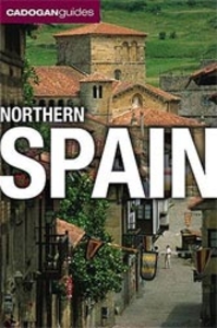
Northern Spain Eyewitness travel guide from Dorling Kindersley is a lavishly illustrated book concerned with providing the visitor with detailed background information to sightseeing in the country & a broad cultural introduction. Popular historical buildings & museums are often described with cutaway diagrams allowing you to view ...
Archived Product
£13.99
Explore the diverse sights of one of the most spectacular regions in Europe with the DK Eyewitness Travel Guide Northern Spain. From the magnificent Guggenheim Museum in Bilbao to the beautiful beaches of San Sebastian, you`ll find the best things to do in Northern Spain with fantastic images & detailed descriptions. See the medieval sights of Santiago de Compostela, unwind in the scenic wine country of La Rioja & discover the unique traditions of the Basque Country with the help of comprehensive illustrations, maps & itineraries. Plus, the DK Eyewitness Travel Guide Northern Spain has expert tips & reviews to help you make the most of the food, culture & attractions of this fascinating Spanish region. ...
Archived Product
£6.99
Spain in the Pocket Guide series from Berlitz; a collection of handy, pocket-sized guides dedicated to an extensive range of cities, regions & countries worldwide. Written in narrative form, individual guides explore the history, main sights & attractions, food & drink, accommodation & local culture of the destination in detail. Each Berlitz pocket guide has a similar format, with colour-coded sections helping readers locate information quickly in addition to distinctive chapters exploring the city or region. An introduction outlines the destination for visitors & a section dedicated to 'A Brief History' actually explores the area in relative depth. A where to go chapter is organized by region & city & is written in prose form with references to individual sites highlighted in bold for clarity. There are also further suggestions on where & when to eat. Recommendations for leisure activities in the region, including sport, nightlife & shopping, are also provided & tailored accordingly for each destination. Handy travel tips are listed alphabetically in a dedicated section, providing practical guidance & helping visitors make the most of their stay. The main hotels, particularly for cities, are also listed in an accommodation section, offering a brief overview with approximate price bandings & relevant contact details. ...
Archived Product
£6.99
This fully revised & updated Berlitz Pocket Guide is packed with all the information you need to enjoy Spain, in a genuinely pocketable format. Places to go & unmissable attractions are explored within easy-to-use, colour-coded sections, so you can locate the information you need at a glance. The country`s top 10 attractions are identified on a dedicated double-page spread to help you plan your trip & ensure that you see the very best sights, areas of natural beauty & more. The brand new feature `A Perfect Tour` offers top recommendations for a truly heavenly day out exploring Spain`s most memorable places & linking the key sights together. Not only does the guide provide in-depth information but there are full-colour photographs throughout providing a highly visual introduction to this stunning destination. Full colour fold-out maps are also included to provide instant orientation wherever you are. A concise history chapter & the handy cultural tips throughout combine to give you a deeper understanding of the country`s heritage. The ` Where To Go` section details Spain`s must-see sights, landmarks & museums, whilst ` What To Do` covers the best of Spain`s shopping, activities, entertainment & sports, as well as ideas for children. The ` Eating Out` chapter recommends Spain`s local specialities, & the comprehensive ` Travel Tips` section provides an A-Z summary of all the expert practical advice you will need, including reliable recommendations of hotels & restaurants to suit all budgets, as well as information on climate, health, transport, currency & much more. Small in size but big on content, this guide will help you get to the heart of this truly exciting country & all it has to offer. ...
Archived Product
£27.99
Road Atlas of Spain, 2017 edition, at 1:300, 000 in a spiral-bound format, with an additional folded road map for route planning, plus a Spanish/ English DVD. The atlas is produced in a convenient 17x 32cm spiral-bound format, but with all the map pages opening up to 44x 32cm. Detailed road classification indicates toll & free motorways & gives driving distances on all local routes. 152 special tourist routes are highlighted, including Camino de Santiago – The Way of St James to Compostela. Mountain passes are graded into three categories according to likelihood of problems with snow closures. The map also shows 116 Via Verde routes (hiking tracks along the disused railway lines). A range of symbols indicate various places of interest, including campsites, paradors, Casa Rural accommodation, castles & ruins, golf courses, etc. Topographic information is provided by names of various mountain ranges & main peaks; 1100 national parks & other protected areas are marked. The maps have no geographical coordinates. Extensive index has over 20, 000 place names. Map legend is in Spanish only. The atlas also provides maps for over 58 of the country’s main cities. Each city has a street plan of its central area indicating principal traffic routes, car parks & where appropriate metro stations, with a list of main places of interest highlighting on the plan. Also provided for each location is a road map showing access to the city centre & Madrid has a diagram of its two motorway rings. The atlas also

Includes::
several useful lists, e.g. toll sections of motorways, motorway exits, airports, UNESCO World Heritage sites, etc. The atlas is supplied in a presentation box, together with a separate fold-out, double-sided road map of the country & a bilingual DVD, updatable via Web, which also

Includes::
1112 Protected Natural Spaces, 152 Tourist Routes & 117 Greenways. Requirements: Windows 7 or higher; Version 22; 5 GB free Hard Disk for installation & 2 GB RAM or higher (recommended).


...
Archived Product
£6.99
Southern Spain & Portugal at 1:800, 000 on a very large, 155cm wide map from Insight Guides, designed to show the Balearic Islands in their proper geographical position from the mainl&. Large street plans show Valencia, Seville & Lisbon. Coverage starts just south of Madrid & in Portugal from north of Leiria. Topography is shown by unobtrusive relief shading with names of various mountain rages & main peaks, plus the boundaries of national & natural parks. Road network clearly displays road & junction numbers, shows motorway services, indicates roads closed to or not suitable for caravans, & gives driving distances on main routes. Where a road meets the edge of the map, the distance to the nearest large town (s) is indicated. Railway lines & ferry connections are included & domestic airports are marked. Within Spain the map also shows regional & provincial boundaries. Names of towns & villages worth visiting are prominently highlighted & a very wide range of small, colour-coded icons highlight numerous places of interest; various natural sites, archaeological remains & historic buildings, cultural & recreational facilities, etc. The map has no geographical coordinates. Extensive index is on the reverse. Multilingual map legend

Includes::
English. Three large panels provide street plans of the central districts of Valencia, Seville & Lisbon; all show metro stations & selected car parks, highlight main traffic arteries & indicate various places of interest. Further panels show the Canaries & the Azores & Madeira.

...
Archived Product
£9.99
Spain in the AA Spiral Guides series; comprising a selection of titles exploring a wide range of cities, regions & countries in a handy, spiral loose-leaf format. Fold-out flaps at the front & back of each title give an overview of the main regions covered, with page numbers so visitors can locate their destination easily. Each guide explores the destination geographically by region or area & provides the essential information for the main sites & attractions in addition to a recommended tour of each area by car. An introductory section - ...
Archived Product
£15.99
This title presents off the beaten track locations & doors into local culture including expanded coverage of Northern Spain. It


...
Archived Product
£9.99
Meet Andrew: French teacher, writer & long-distance cyclist. Now, meet Reggie, his bike. With two European cycling adventures already under his belt, Andrew was ready for a new challenge. Exchanging his job as a teacher in Oxfordshire for an expedition on Reggie the bike, he set off on his most daring trip yet: a journey from Tarifa in Spain to Nordkapp in Norway
- from Europe`s geographical south to its northernmost point. Join the duo as they take on an epic journey across nearly 8000 km of Europe, through mountains, valleys, forests & the open road, proving that no matter where you`re headed, life on two wheels is full of surprises.
...
Archived Product
£19.99
Spain in the National Geographic Traveler guide series, produced by America’s leading travel publishers, exploring a range of cities, regions & countries worldwide & using the expertise & tradition of National Geographic to provide a comprehensive survey of each destination. Each of the guides in the series draws upon National Geographic’s rich history of travel experience & is researched by authors familiar with the area. Whilst the content is influenced by an American editorial style, individual titles are still accessible to a non-American audience, with a combination of practical guidance & detailed information included in each guide. The series also relies upon the extensive image libraries of National Geographic to present a rich visual image of each destination. Individual National Geographic Traveler titles are organised uniformly, allowing readers to access information quickly & easily. Introductory sections provide information on Charting your Trip, with details of getting there & around & a History & Culture chapter profiling history, food & drink, land & landscape, flora & fauna & arts & literature. Chapter are arranged geographically by region, with notable cities & areas principally describing the main sites & attractions, with further information on directions, history & practicalities. There are also a number of individual features & insider tips throughout each guide covering subjects such as walking tours, local culture, driving tours, recommended local experiences & in-depth thematic short histories of the culture & histories of individual regions. A Travelwise section at the back of each guide provides essential practical information on when to go, what to take, further reading, getting there & around, local etiquette, media, holidays, money matters, religion, smoking, time differences, opening times, travellers with disabilities & accommodation. Restaurants & hotels are listed with brief descriptions & information on prices, location, contact details & facilities for the relevant regional chapters in the guide. ...
Archived Product

Spain Southern

Southern Spain on a single-sided, indexed road map at 1:800, 000 from Insight. This large map includes many places of interest and additional street plans of Seville, Valencia and Lisbon in greater detail.The network of main roads is displayed, with distinctions between motorways (with junctions), toll motorways, dual carriageways, main and secondary roads. Markers indicate distances between selected points and symbols indicate filling stations, restaurants and motels en route. Airports, major ports and ferry terminals are marked, and the legend distinguishes between standard and high speed routes on the rail network. Ferry routes are marked for major destinations and an inset lists international routes, with contact details for ferry companies. Major towns and cities are
displayed, as are many smaller towns. Provinces are named and demarcated.Mountain ranges are named and highlighted with relief shading, with spot heights for the main peaks. Main lakes and rivers are shown.Many places of interest are annotated on the map, such as: museums, heritage sites, ruins and castles; churches, cathedrals, mosques and monasteries; national parks, nature reserves, sailing areas and beach resorts; and viewpoints, hiking areas, mountain resorts and ski resorts.The map itself, excluding the legend and insets, measures 150 x 71 cm (approximate). Reaches as far north as the Sierra de Gredos and to a point just south of Madrid. It includes the Spanish Balearic and Atlantic Islands (and the Azores and Madeira), the far north of Morocco (including Ceuta and
Melilla), and southern Portugal to a point slightly south of Coimbra. (See adjoining image for coverage.)Also includes enlarged street plans of Seville, Valencia and Lisbon at 1:17, 500 (approximate), with detail of main streets, urban rail networks, districts and many places of interest. One-way streets are shown for Valencia and Lisbon.An index booklet lists places, streets (for the city plans) and main places of interest.
RIP - This product is no longer available on our network. It was last seen on 25.09.2019

This page now acts as a permanent archive for this product. Add more information using the comments box below to ensure it can still be found by future generations.

Use our search facility to see if it is available from an alternative contributor.
  • Availability: Out Of Stock
  • Supplier: Stanfords
  • SKU: 9789812589057
Availability: In Stock
£5.99

Product Description

Southern Spain on a single-sided, indexed road map at 1:800, 000 from Insight. This large map

Includes::
many places of interest & additional street plans of Seville, Valencia & Lisbon in greater detail. The network of main roads is displayed, with distinctions between motorways (with junctions), toll motorways, dual carriageways, main & secondary roads. Markers indicate distances between selected points & symbols indicate filling stations, restaurants & motels en route. Airports, major ports & ferry terminals are marked, & the legend distinguishes between standard & high speed routes on the rail network. Ferry routes are marked for major destinations & an inset lists international routes, with contact details for ferry companies. Major towns & cities are displayed, as are many smaller towns. Provinces are named & demarcated. Mountain ranges are named & highlighted with relief shading, with spot heights for the main peaks. Main lakes & rivers are shown. Many places of interest are annotated on the map, such as: museums, heritage sites, ruins & castles; churches, cathedrals, mosques & monasteries; national parks, nature reserves, sailing areas & beach resorts; & viewpoints, hiking areas, mountain resorts & ski resorts. The map itself, excluding the legend & insets, measures 150 x 71 cm (approximate). Reaches as far north as the Sierra de Gredos & to a point just south of Madrid. It

Includes::
the Spanish Balearic & Atlantic Islands (and the Azores & Madeira), the far north of Morocco (including Ceuta & Melilla), & southern Portugal to a point slightly south of Coimbra. (See adjoining image for coverage.) Also

Includes::
enlarged street plans of Seville, Valencia & Lisbon at 1:17, 500 (approximate), with detail of main streets, urban rail networks, districts & many places of interest. One-way streets are shown for Valencia & Lisbon. An index booklet lists places, streets (for the city plans) & main places of interest.

Reviews/Comments

Add New

Price History

Vouchers

No voucher codes found.
Do you know a voucher code for this product or supplier? Add it to Insights for others to use.

Facebook

Jargon Buster

Hiking - An outdoor activity envolving walking in nature
Cm - Centimetres, one centimetre is equal to 10 milimetres
Beach - An area on the coast consisting of a sandy or pebbled area
Lisbon - The capital city of Portugal
Spain - A country within the EU.
Spanish - The main language spoken in Spain and Latin America.
speed - A measurement of how fast an object travels between two points
Network - A link and communication between things. Often computers or people.
Large - something that takes up more space than normal.
Road - a manmade lane or a path that is used to speed up travel.

Supplier Information

Stanfords
Stanfords was established in 1853 and opened their iconic Covent Garden flagship store in 1901. They have become the top retailer of maps, travel books and accessories in the UK and arguably offer the largest selection of maps and travel books worldwide. Famous names such as Captain Robert Falcon Scott, Ranulph Fiennes and Michael Palin have purchased from Stanfords. They now have a shop in Bristol and both stores together with other venues operate a calendar of events including talks, book signings and exhibitions. As a specialist map retailer, the map selection is comprehensive and includes road maps, street maps and walking maps from worldwide destinations, as well as a selection of world atlases and wall maps. Books include travel guides and travel literature. Stanfords also stock globes, from miniatures made of blue marble to magnificent floor-standing globes. The website features a selection of interesting articles on travel topics.
Page Updated: 2023-11-12 20:15:36

Community Generated Product Tags

Oh No! The productWIKI community hasn't generated any tags for this product yet!
Menu