
 United Kingdom
 France
 Germany
 Netherlands
 Sweden
 USA
USA
 Italy
Italy
 Spain
Spain
More From Contributor


Steigerwald Regional Park: Northern Part
Steigerwald Regional Park: northern part, map no. 50-8, in a series of special GPS compatible recreational editions of the German topographic survey at 1:50, 000, with waymarked hiking trails and cycling routes, campsites and youth hostels, etc. The map covers an area around Bamberg, Ha
Product Description
Reviews/Comments
Add New
Intelligent Comparison
Archived Product
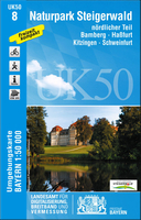
Steigerwald Regional Park: Northern Part Stanfords
£11.50
Archived Product
Steigerwald Regional Park: Southern Part Stanfords
£8.25
Archived Product
Spessart Regional Park: Northern Part Stanfords
£12.50
Archived Product
Odenwald Regional Park: Northern Part (2-map Set) Stanfords
£13.50
Archived Product

Fichtelgebirge Regional Park: Western Part Stanfords
£8.25
Archived Product
Spessart Regional Park: Southern Part Stanfords
£8.25
Archived Product
Harz Regional Park: Western Part Stanfords
£11.50
Archived Product
Oberpfälzer Wald Regional Park: Eastern Part Stanfords
£11.50
Vouchers
No voucher codes found.
Do you know a voucher code for this product or supplier? Add it to Insights for others to use.
Do you know a voucher code for this product or supplier? Add it to Insights for others to use.
 Denmark