
 United Kingdom
 France
 Germany
 Netherlands
 Sweden
 USA
USA
 Italy
Italy
 Spain
Spain
More From Contributor


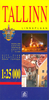
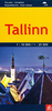

Tallinn
Tallinn on a double-sided street plan from Estonia’s leading map publishers Regio, covering the central districts at 1:10, 000 and the whole city at 1:37, 000, with tram and trolleybus lines with stops, numerous tourist sights, etc.On one side is a street plan of Tallinn’s central districts, including its historic Old Town. Tram and trolleybus lines are shown with names of stops and for visitors by car one way streets plus locations of car parks and petrol stations are marked. Streets are annotated with selected house numbers for easier identification of atlases. Symbols mark selected hotels (with names), markets and shopping centres, museums and cultural institutions, foreign embassies, etc. 45 of the city’s principal sights are prominently highlighted and annotated with
mobile phone numbers for English language descriptions.On the reverse is a street plan of the whole city at 1:37, 000, with tram and trolleybus lines. Principal traffic arteries are highlighted, as well as locations of petrol stations plus various sights and services outside the city centre. Neither street plan is indexed, Also provided is a map of the city’s parking zones with information how to pay by mobile phone. Map legend and all other information include English.
mobile phone numbers for English language descriptions.On the reverse is a street plan of the whole city at 1:37, 000, with tram and trolleybus lines. Principal traffic arteries are highlighted, as well as locations of petrol stations plus various sights and services outside the city centre. Neither street plan is indexed, Also provided is a map of the city’s parking zones with information how to pay by mobile phone. Map legend and all other information include English.

Product Description
Reviews/Comments
Add New
Vouchers
No voucher codes found.
Do you know a voucher code for this product or supplier? Add it to Insights for others to use.
Do you know a voucher code for this product or supplier? Add it to Insights for others to use.
 Denmark