More From Contributor
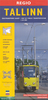
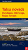
£6.95
Transport map of Tallinn showing tram, bus & trolleybus routes within the city’s administrative area with line numbers & stops, plus an enlargement of the city centre, street index & list of lines with times of first & last services. On one side is a street plan of the whole city at 1:28, 000 overprinted with tram, but & trolleybus routes, all showing line numbers, stops with their names &, where appropriate, the direction of traffic. The city centre is presented in greater detail at 1:8, 700. Also included is a map of the parking zones with an explanation how to pay the fee by mobile phone. On the reverse is a street index plus lists of tram, bus & trolleybus lines with operating times, first & last services & frequency. Map legend

Includes::
English. The headings in the tables on the reverse are in Estonian.

...
Archived Product
£6.95
Tallin in the Wallpaper* City Guide series published by Phaidon encompassing a collection of pocket-size guides dedicated to the design elements in major cities. Compiled by experts at the Wallpaper* magazine, the guides are widely recognised for appealing to design-conscious travellers & are aimed at those interested in art, design & architecture. Each guide identifies the best bars, restaurants, hotels, places to shop, leisure activities & excursions with a unique emphasis on the finest examples of unusual architecture & design. Each Wallpaper* City Guide has the same layout, with separate tabs allowing readers & travellers to access individual sections easily. The tabs consist of Landmarks, Hotels, 24 Hours, Urban Life, Architour, Shopping, Sports & Escapes. High quality colour photographs appear alongside brief descriptions of each hotel, bar or attraction, highlighting distinctive & unusual styles of architecture & design. Extra pages are provided at the back of each guide, allowing readers to record their own notes & sketches. ...
Archived Product
£17.99
Fully titled Tallis’s Illustrated Plan of London & its Environs, this reproduction map measures 76x 56cm. It was originally published in 1851 to mark that year’s Great Exhibition of Industry of all Nations, the location of which is marked in Hyde park on the map. Coverage extends from Fulham in the south west to Leyton Marsh in the north east. Hachuring (a style of hill-shading) emphasises the significant hills eg. in Greenwich Park & Hampstead Heath. Unobtrusively superimposed on the map is a 3 mile radius circle, centred Approx. on Newgate Street near St Paul’s Cathedral. Around the margins of the sheet are small images of London landmarks. ...
Archived Product
£11.50
Topographic survey of France at 1:25, 000 in IGN`s excellent TOP25 / Série Bleue series. All the maps are GPS compatible, with a 1km UTM grid plus latitude & longitude lines at 5’ intervals. Contours are at 5m intervals except for mountainous areas where the maps have contours at 10m intervals, vividly enhanced by hill shading & graphics for rocky terrain. Colouring with graphics indicates different types of vegetation or land use (deciduous or coniferous forests, moors, orchards, vineyards, etc). PLEASE NOTE: coverage of France at this scale is currently being revised – the format & the presentation of each title are indicated by the letters at the end of its Sheet Reference number (e.g. 0416ET, 3531ETR, 1923SB, etc.)MAPS WITH FULL TOURIST OVERPRINT & AN ENGLISH MAP LEGEND: all TOP25 maps & the SB editions of Série Bleue have an overprint highlighting waymarked walking trails including long-distance GR routes &, where appropriate, ski routes. Symbols indicate campsites, gîtes d’etape, refuges, equestrian centres & other recreational facilities or sites, tourist information centres, cultural heritage, etc. Towns & locations of particular interest are highlighted.- ET or OT = single-sided TOP25 map covering approx. 29x 21 km / 18x 13 miles.- ETR or OTR = waterproof & tear resistant TOP25 map covering the same area as the corresponding ET or OT number, but double-sided, printed on a smaller size sheet with a good overlap between the sides.- SB = Série Bleue map with full tourist overprint; these maps, first introduced in summer 2014, each cover approx. 29x 24km / 18x 15 miles.SÉRIE BLEUE maps with numbers ending in E (Est) or O (Ouest): most editions now indicate the GR routes, but do not show any other tourist information. Map legend is in French only. Each map covers approx. 14x 20km / 9x 12 miles. ...
Archived Product
£9.99
The environs of Talsi on a contoured & GPS compatible map at 1:75, 000 from the Latvian publishers Jana Seta, with detailed presentation the road or rail networks, places of interest & tourist facilities, etc. Dundaga, Mersrags, Roja, Sabile, Stende, Talsi & Valdemarpils are also covered by street plans at 1:20, 000. Maps in this series are double-sided with a good overlap between the sides. Topography & landscape are shown by contours at 10m intervals, numerous spot heights, & colouring/graphics for different types of land use or terrain (orchards, forests, swamps, etc). Finely graded road network indicates “difficult to travel unsurfaced roads”, shows driving distances on main & secondary routes, & indicates locations of petrol stations. Railway lines are shown with stations & stops; the maps also show narrow gauge lines & abandoned routes. Interesting locations are highlighted & symbols indicate hotels & other tourist accommodation, campsites, viewpoints, hills & interesting natural sites, etc. The maps have latitude & longitude lines at 5’ & 10’ respectively. Map legend

Includes::
English. To see the other titles in this series please click on the series link.

...
Archived Product
£3.50
Talwrn in 1910 in a fascinating series of reproductions of old Ordnance Survey plans in the Alan Godfrey Editions, ideal for anyone interested in the history of their neighbourhood or family. The map covers the Talwrn area, south-west of Wrexham. Coverage stretches from Offa`s Dyke westward to Bronwlfa Wood. Features include the GWR Rhos Branch, Legacy station & a short stretch of the Legacy Branch, Talwrn, Bryn-yr-Owen, Pentre-bychan Hall, Cadwgan Hall, Bronwylfa, Vrondeg Hall, Aber-oer, etc. Directories of Esclusham Below & Above, plus a railway timetable for the Wrexham to Ponkey Crossing Halt & Wrexham to Wynn Hall Halt lines are on the reverse. About the Alan Godfrey Editions of the 25” OS Series: Selected towns in Great Britain & Ireland are covered by maps showing the extent of urban development in the last decades of the 19th & early 20th century. The plans have been taken from the Ordnance Survey mapping & reprinted at about 15 inches to one mile (1:4, 340). On the reverse most maps have historical notes & many also include extracts from contemporary directories. Most maps cover about one mile (1.6kms) north/south, one & a half miles (2.4kms) across; adjoining sheets can be combined to provide wider coverage.FOR MORE INFORMATION & A COMPLETE LIST OF ALL AVAILABLE TITLES PLEASE CLICK ON THE SERIES LINK. ...
Archived Product
£11.99
One of the titles in a series of topographic maps covering much of north-west Africa, produced as part of the IMW* project in 1960’s. Each map covers an area spanning 6° in longitude & 4° in latitude. There is some variation in colouring & the depiction of terrain, but hill-shading, spot heights & contours are used to show the general relief. Additional graphics show features such as dunes, rock outcrops, cliffs, sand areas, escarpments, marshes, seasonal lakes & watercourses, & areas liable to flooding. Bathymetric contours are also included. Communications detail

Includes::
roads, major trails & railways, although there is some inconsistency in colouring & the extent of classification, e.g. not all maps distinguish seasonal roads. On most maps intermediate road distances are indicated on main routes. Symbols show airports, mosques, mines, oil & gas fields, lighthouses, ruins & significant isolated buildings. Administrative boundaries are marked & latitude & longitude lines are drawn at 1° intervals, with further margin ticks at 1’ intervals. The map legend is in French only on some sheets, & in English & French on others.* The International Map of the World was a project conceived in the early 20th century to compile a world map series at 1:1, 000, 000 through the efforts of participating nations. The value of the program has declined since 1970 & the IMW is no longer regarded as an active international series.

...
Archived Product
£12.99
One of the titles in a series of road maps of the administrative states of Mexico, highlighting places of interest. The maps show four different grades of roads, with intermediate driving distances on main routes, railways, local airports, ferry connections & administrative boundaries. Topographic information is limited to names of main mountain ranges, spot heights for main peaks, rivers & lakes. The maps have no geographical coordinates. Map legend is in Spanish only. On the reverse each title has a black & white version of the same map, highlighting places of interest with brief notes in Spanish only. ...
Archived Product
£13.99
Road maps of Mexico’s states from Ediciones Independencia highlighting numerous places of interest & tourist facilities, with each title also providing a large street plan of the provincial capital plus maps of other local towns, popular tourist resorts and/or archaeological sites. The state maps show the road & rail networks on a clear base, with topography indicated by rivers & areas liable to inundation, plus names of main mountain ranges & peaks (no heights). National parks & other protected areas are brightly highlighted. A range of symbols provides information for tourists: accommodation including campsites & trailer parks, historical & archaeological sites, beaches & spas, sport & leisure centres, natural curiosities, etc. The maps show latitude & longitude as margin ticks & crosshairs, mostly at 30’ or 1° intervals. Map legend

Includes::
English. Most maps have no index. Each title

Includes::
a large street plan of the provincial capital, plus plans of selected other towns. In addition to street names, the plans also show names of local districts. Plans of the state capital usually have a list of various locations, facilities and/or places on interest highlighted on it, & some include an enlargement showing the town centre in greater detail. Each title also has a table of distances, plus a table showing various facilities & places of interest in the main towns of the state.


...
Archived Product
£12.99
Tamba Kosi
- Likhu Khola region at 1:50, 000 in a series of detailed topographic maps of selected trekking areas of Nepal originally
...
Archived Product

Talsi Region

Double-sided road map of the Talsi Region at 1:100, 000 from Jana Seta with street plans of Roja, Dundaga, Kolka, Mersrags, Talsi, Sabile, Stende and Valdermarpils at 1:20, 000. Coverage extends south to Sabile and west as far as lake Usmas Ezers.The road network is shown, with distances shown in kilometres on most roads, as well as some minor roads, including unsurfaced roads; filling stations are prominently highlighted. Points of interest such as parks, mountain skiing tracks and cliffs are marked clearly. Latitude and longitude lines are marked at 5
RIP - This product is no longer available on our network. It was last seen on 25.09.2019

This page now acts as a permanent archive for this product. Add more information using the comments box below to ensure it can still be found by future generations.

Use our search facility to see if it is available from an alternative contributor.
  • Availability: Out Of Stock
  • Supplier: Stanfords
  • SKU: 9789984074665
Availability: In Stock
£8.25

Product Description

Double-sided road map of the Talsi Region at 1:100, 000 from Jana Seta with street plans of Roja, Dundaga, Kolka, Mersrags, Talsi, Sabile, Stende & Valdermarpils at 1:20, 000. Coverage extends south to Sabile & west as far as lake Usmas Ezers. The road network is shown, with distances shown in kilometres on most roads, as well as some minor roads, including unsurfaced roads; filling stations are prominently highlighted. Points of interest such as parks, mountain skiing tracks & cliffs are marked clearly. Latitude & longitude lines are marked at 5

Reviews/Comments

Add New

Price History

Vouchers

No voucher codes found.
Do you know a voucher code for this product or supplier? Add it to Insights for others to use.

Facebook

Jargon Buster

Network - A link and communication between things. Often computers or people.
Road - a manmade lane or a path that is used to speed up travel.

Supplier Information

Stanfords
Stanfords was established in 1853 and opened their iconic Covent Garden flagship store in 1901. They have become the top retailer of maps, travel books and accessories in the UK and arguably offer the largest selection of maps and travel books worldwide. Famous names such as Captain Robert Falcon Scott, Ranulph Fiennes and Michael Palin have purchased from Stanfords. They now have a shop in Bristol and both stores together with other venues operate a calendar of events including talks, book signings and exhibitions. As a specialist map retailer, the map selection is comprehensive and includes road maps, street maps and walking maps from worldwide destinations, as well as a selection of world atlases and wall maps. Books include travel guides and travel literature. Stanfords also stock globes, from miniatures made of blue marble to magnificent floor-standing globes. The website features a selection of interesting articles on travel topics.
Page Updated: 2023-11-12 20:15:36

Community Generated Product Tags

Oh No! The productWIKI community hasn't generated any tags for this product yet!
Menu