More From Contributor

£6.25
Tamil Nadu in a series of locally produced administrative maps of Indian states, each with a booklet providing a guide to the area. The maps show the division of each state into districts & have more small towns & villages than on more general maps of India available from other publishers. Presentation is now considerably enhanced with the districts shown in different colours. The maps indicate each district ...
Archived Product
£4.95
Tamil Nadu in a series of state maps of India from Eicher Goodearth reflecting a change in locally produced maps to a more modern style of cartography. Each map is double-sided &

Includes::
an index of localities, street plans of main cities, a distance table & a route planner map of the whole of India. Each title comes with a small booklet with brief descriptions of main places of interest & colour photos. The maps show road & rail networks, indicating intermediate distances on many local roads. Towns & villages of particular tourist interest are highlighted & symbols mark national parks & wildlife sanctuaries, temples, etc. The base map shows rivers, lakes & local waterways system & has spot heights for peaks, but the range of elevation colouring is too finely graded to provide any useful information. No geographical coordinates are marked. The maps show the names & boundaries of local districts, indicating state capitals & district or tehsil administrative headquarters. Outside the state boundaries the colour range of the print is reduced, so only main roads are clearly visible. Please note: the various series of state maps of India often show different small villages, supplementing each other to provide a more detailed picture of each state. In this title: street plans of Chennai, Coimbatore & Puducherry, plus a country wide India route planner & a distance chart in kilometres.

...
Archived Product
£6.50
Indian state of Tamil Nadu on road map from the Delhi-based International Publications, showing many small towns & villages, with a 40-page booklet describing the state & its sights. Additional features include street plans of Chennai, Coimbatore, Mudurai, & Tiruchchirappalli, all annotated with facilities & sights; a physical map of the state; a distance chart; plus a facts & figures table. The booklet

Includes::
notes on arts & crafts, cuisine, beaches, etc. Unless indicated to the contrary in the individual description, maps in this series present the state with its constituent districts in different colours & also show the division of districts into talukas. Town symbols indicate both district & taluka headquarters. Road network

Includes::
many local roads, some with driving distances, although sometimes locations are marked without road access to them shown on the map. Railway lines are included & local airports are marked. Symbols indicate various locations of interest, including historical sites, wildlife sanctuaries, beaches, etc. In many titles additional panels around the main map and/or in the accompanying booklet provide more information: enlargements with more detailed presentation of the road network, street plans of main cities, etc. The booklets, which also include a general introduction to the state & district-by-district descriptions, are published on high quality paper & are illustrated with numerous colour photos. To see the list of titles in this series please click on the series link.


...
Archived Product
£8.99
Two days before Christmas in 1987, at the age of seventeen, Niromi de Soyza found herself in an ambush as part of a small platoon of militant Tamil Tigers fighting government forces in the bloody civil war that was to engulf Sri Lanka for decades. With her was her lifelong friend Ajanthi, also aged seventeen. Leaving behind them their shocked middle-class families, the teenagers had become part of the Tamil Tigers` first female contingent. Equipped with little more than a rifle & a cyanide capsule each, Niromi`s group managed to survive on their wits in the jungle, facing not only the perils of war but starvation, illness & growing internal tensions among the militant Tigers. But then events erupted in ways that she could no longer bear. How was it that this well-educated, mixed-race, middle-class girl from a respectable family came to be fighting with the Tamil Tigers? Today she lives in Sydney with her husband & children, but Niromi de Soyza is not your ordinary woman & this is her compelling story. ...
Archived Product
£25.00
In 2014 the Somerset Levels suffered from the worst flooding in over twenty years. Inevitably the residents asked for more drainage, more dredging & more money. This timely new edition of the acclaimed classic brings the story up-to-date as we wait for the winter floods to return, offering a blueprint for solving flooding forever. As a practical landscape architect working in the water industry, Jeremy Purseglove has been actively involved in building a wider brief for land drainage engineers so that they can enhance, rather than destroy, the heritage of our rivers & wetlands. Taming the Flood draws extensively on this experience, analysing many of the conflicting demands made on rivers & wetlands. Purseglove charts the conservation, agriculture & development, & outlines practical proposals for the protection & use of these sensitive ecological habitats. Beautifully written & magnificently illustrated with line drawings & maps, this book serves both as a celebration of the richness of the British countryside, & as a warning of the legacy of loss & destruction we could so easily leave to future generations. ...
Archived Product
£7.99
Tampa – St Petersburg map in a series of Rand Mc Nally’s regional road maps covering the environs of main US cities. The map covers the coast of western Florida, extending from well north of Ocala to south of Sarasota & inland to include Disney World. Insets provide street plans of Saint Petersburg, Tampa, Sarasota & Clearwater. Other communities covered by the map include Arcadia, Bartow, Bay Lake, Bradenton, Brooksville, Clermont, Inverness, Lakel&, Leesburg, Tarpon Springs, Winter Haven & Zephyrhills. Maps in this series present the road network on a clear background with no relief shading to show the area’s topography, but with national or state parks, forests & other protected areas indicated by colouring. Roads are numbered and/or named, showing toll highways, exit numbers of interchanges, services & rest areas. Local airports are marked, but railways & other urban transport lines are not included unless specifically indicated in the individual description. Each town is presented in a different colour, providing those unfamiliar with the region a very clear picture of the area. Various places of interest & facilities are highlighted, including cultural & historical sites, educational institutions, sport & recreational facilities, etc. Each title is indexed. Several maps also include enlargements of the downtown area, plans of international airports, a mileage & driving times diagram for a much wider region than covered by the main map, etc
- for more information please see the individual descriptions. To see all the titles in this series please click on the series link.
...
Archived Product
£6.50
Tampa in Florida on an indexed street plan from Rand Mc Nally in their extensive range of maps covering cities in the United States. An inset provides a more detailed street plan of downtown Tampa. Communities covered by this map include East Tampa, Gibsonton, Lutz, Mullis City, Progress Village & Temple Terrace. Rand Mc Nally street plans provide coverage of cities with their outer suburbs, clearly indicating main traffic arteries: highways (distinguishing between free & toll access), plus primary & secondary routes. Road numbers and/or names are clearly displayed & exit numbers are indicated. Locations of service & rest areas are marked & one way streets are shown. Longer streets are annotated with block numbers for easier identification of addresses. The maps show railway, bus &, where appropriate, metro stations. A range of symbols indicate various places of interest including cultural & academic institutions, various municipal facilities, golf courses, etc. The plans have extensive street indexes, supplemented by lists of points of interest, parks & recreational areas, shopping malls, stations, schools, etc. ...
Archived Product
£17.99
The 1:50 000 topographic map gives a more general picture of the ground features than a basic map. It shows settlements, houses, roads, cultivated areas, waterways, cutting areas, mires, rock exposures, & relief. One map sheet covers an area of 30 x 40 km & one centimetre corresponds to 500 metres on the ground. The 1:50, 000 topographic map is also an ideal complement to nautical charts as it provides useful information about the land areas adjacent to waterways. For example, all Finnish sea areas are covered by 1:50 000 topographic map sheets. ...
Archived Product
£17.99
Topographic mapping from Mexico’s national survey agency, Instituto Nacional de Estadística, Geografía e Informática. The maps have contours at 20m intervals with relief shading & indicate various types of terrain & vegetation, e.g. dense vegetation, cultivated areas, swamps, sand dunes, salt pans, etc. UTM grid is at 10km intervals, with latitude & longitude shown by margin ticks at intervals of 5`. Map legend is in Spanish only. To see the other titles in this series please click on the series link. ...
Archived Product

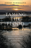
Taming The Flood: Rivers, Wetlands And The Centuries-Old Battle
Against Flooding

`Exquisitely written` Sunday TimesBeautifully written and magnificently illustrated with photographs, line drawings and maps, this book serves both as a celebration of the richness of the British countryside, and as a warning of the legacy of loss and destruction we could so easily leave to future generations.In recent years the Somerset Levels suffered from the worst flooding in over twenty years, and more recently, flooding in Cumbria and other parts of Britain have reached new levels of severity. Taming the Flood analyses many of the conflicting demands made on rivers and wetlands, offering practical solutions which aim to protect, rather than destroy, these important ecological habitats.Exploring the old arguments and new solutions raised over the last 400 years, this
completely updated edition of the classic Taming the Flood reveals how harnessing nature, rather than attempting to repress it, is the only answer to the environmental disasters we are faced with today.As a practical landscape architect and ecologist working in the water industry, Jeremy Purseglove has been actively involved in land drainage engineering to try to enhance, rather than destroy, the heritage of our rivers and wetlands. He charts the conservation, agriculture and development of our rivers and wetlands, outlining practical proposals for the protection and use of these sensitive habitats.From the Lancashire mosses and the Derwent Ings, Otmoor and the Fens, to Romney Marsh and the Somerset Levels, he traces the history and natural history of our rivers and wetlands,
describing in vivid detail both the beauty of these strange and ancient landscapes, and the often disastrous results of attempts to tame them.
RIP - This product is no longer available on our network. It was last seen on 25.09.2019

This page now acts as a permanent archive for this product. Add more information using the comments box below to ensure it can still be found by future generations.

Use our search facility to see if it is available from an alternative contributor.
  • Availability: Out Of Stock
  • Supplier: Stanfords
  • SKU: 9780008132217
Availability: In Stock
£9.99

Product Description

` Exquisitely written` Sunday Times Beautifully written & magnificently illustrated with photographs, line drawings & maps, this book serves both as a celebration of the richness of the British countryside, & as a warning of the legacy of loss & destruction we could so easily leave to future generations. In recent years the Somerset Levels suffered from the worst flooding in over twenty years, & more recently, flooding in Cumbria & other parts of Britain have reached new levels of severity. Taming the Flood analyses many of the conflicting demands made on rivers & wetlands, offering practical solutions which aim to protect, rather than destroy, these important ecological habitats. Exploring the old arguments & new solutions raised over the last 400 years, this completely updated edition of the classic Taming the Flood reveals how harnessing nature, rather than attempting to repress it, is the only answer to the environmental disasters we are faced with today. As a practical landscape architect & ecologist working in the water industry, Jeremy Purseglove has been actively involved in land drainage engineering to try to enhance, rather than destroy, the heritage of our rivers & wetlands. He charts the conservation, agriculture & development of our rivers & wetlands, outlining practical proposals for the protection & use of these sensitive habitats. From the Lancashire mosses & the Derwent Ings, Otmoor & the Fens, to Romney Marsh & the Somerset Levels, he traces the history & natural history of our rivers & wetlands, describing in vivid detail both the beauty of these strange & ancient landscapes, & the often disastrous results of attempts to tame them.

Reviews/Comments

Add New

Intelligent Comparison

Oooops!
We couldn't find anything!
Perhaps this product's unique.... Or perhaps we are still looking for comparisons!
Click to bump this page and we'll hurry up.

Price History

Vouchers

No voucher codes found.
Do you know a voucher code for this product or supplier? Add it to Insights for others to use.

Facebook

Jargon Buster

agriculture - The production of goods or food by farming.
water - A chemical substance. Chemical formula H2O.
History - Anything that happens in the past. An acedemic subject.
Natural - not manmade
Practical - Weather a task is easy to carry out and realistically succeed.
Classic - Something that is still like it was originally a high quality standard.

Supplier Information

Stanfords
Stanfords was established in 1853 and opened their iconic Covent Garden flagship store in 1901. They have become the top retailer of maps, travel books and accessories in the UK and arguably offer the largest selection of maps and travel books worldwide. Famous names such as Captain Robert Falcon Scott, Ranulph Fiennes and Michael Palin have purchased from Stanfords. They now have a shop in Bristol and both stores together with other venues operate a calendar of events including talks, book signings and exhibitions. As a specialist map retailer, the map selection is comprehensive and includes road maps, street maps and walking maps from worldwide destinations, as well as a selection of world atlases and wall maps. Books include travel guides and travel literature. Stanfords also stock globes, from miniatures made of blue marble to magnificent floor-standing globes. The website features a selection of interesting articles on travel topics.
Page Updated: 2023-11-12 20:15:36

Community Generated Product Tags

Oh No! The productWIKI community hasn't generated any tags for this product yet!
Menu