
 United Kingdom
 France
 Germany
 Netherlands
 Sweden
 USA
USA
 Italy
Italy
 Spain
Spain
More From Contributor

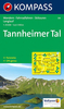

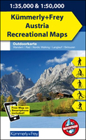
Tannheimer Tal - Fernpass - Unteres Lechtal - Reutte - Plansee K+F
Outdoor Map 5
Tannheimer Tal - Fernpass - Unteres Lechtal - Reutte - Plansee area of the Tyrol at 1:35, 000 on a GPS compatible, double-sided map from Kümmerly+Frey printed on sturdy, waterproof and tear-resistant synthetic paper; contoured, with hiking, cycling and ski routes, accommodation facilities, locations for other recreational activities, etc.Maps in the K+F recreational series covering the Austrian Alps are either at 1:50, 000 or 1:35, 000. Contour interval is 40m, enhanced by relief shading and finely drawn additional graphic relief to provide an excellent representation of the terrain. The maps have plenty of names of peaks, valleys, etc, plus colouring/graphics indicating different types of vegetation, and show boundaries of national parks or other protected areas.An overprint,
graded according to the difficulty of the route, highlights local hiking trails and long-distance paths indicating, where appropriate, their numbers or names. Also marked are local and long-distance cycle routes, plus a selection of mountain-bike trails, cross-country and alpine ski routes and horse-riding paths. Symbols mark locations for other outdoor activities (climbing, paragliding), different types of accommodations including alpine huts, campsites and youth hostels, sites of botanical or cultural interest, etc. The maps have a 1- km UTM grid. Map legend includes English.Each title also provides a small road map of the region around the area covered by it.To see the complete list of all the titles please click on the series link.
graded according to the difficulty of the route, highlights local hiking trails and long-distance paths indicating, where appropriate, their numbers or names. Also marked are local and long-distance cycle routes, plus a selection of mountain-bike trails, cross-country and alpine ski routes and horse-riding paths. Symbols mark locations for other outdoor activities (climbing, paragliding), different types of accommodations including alpine huts, campsites and youth hostels, sites of botanical or cultural interest, etc. The maps have a 1- km UTM grid. Map legend includes English.Each title also provides a small road map of the region around the area covered by it.To see the complete list of all the titles please click on the series link.

Product Description
Reviews/Comments
Add New
Vouchers
No voucher codes found.
Do you know a voucher code for this product or supplier? Add it to Insights for others to use.
Do you know a voucher code for this product or supplier? Add it to Insights for others to use.
 Denmark