
 United Kingdom
 France
 Germany
 Netherlands
 Sweden
 USA
USA
 Italy
Italy
 Spain
Spain
More From Contributor


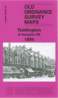
Teddington And Hampton Hill 1894
Teddington and Hampton Hill in 1894 in a fascinating series of reproductions of old Ordnance Survey plans in the Alan Godfrey Editions, ideal for anyone interested in the history of their neighbourhood or family. Two versions cover this area: the western part of Teddington, including Broad Street, Church Road and Park Road, and the area westward to Hampton Hill, including Windmill Road, High Street, Mill Road. Features include a stretch of Queen`s or Cardinal`s River, Fulwell & Hampton Hill station, Teddington Cemetery, St Peter & St Paul`s church Teddington, St James church Hampton, the northern part of Bushy Park with Upper Lodge. The introductory essay by John Griffiths for the 1894 edition also includes a section on `General Roy`s Base and the Origins of the Ordnance
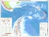
Survey`; the East End of Roy`s base is on the map. The maps also has a selection of directory entries.About the Alan Godfrey Editions of the 25” OS SeriesSelected towns in Great Britain and Ireland are covered by maps showing the extent of urban development in the last decades of the 19th and early 20th century. The plans have been taken from the Ordnance Survey mapping and reprinted at about 15 inches to one mile (1:4, 340). On the reverse most maps have historical notes and many also include extracts from contemporary directories. Most maps cover about one mile (1.6kms) north/south, one and a half miles (2.4kms) across; adjoining sheets can be combined to provide wider coverage.FOR MORE INFORMATION AND A COMPLETE LIST OF ALL AVAILABLE TITLES PLEASE CLICK ON THE SERIES LINK.
Survey`; the East End of Roy`s base is on the map. The maps also has a selection of directory entries.About the Alan Godfrey Editions of the 25” OS SeriesSelected towns in Great Britain and Ireland are covered by maps showing the extent of urban development in the last decades of the 19th and early 20th century. The plans have been taken from the Ordnance Survey mapping and reprinted at about 15 inches to one mile (1:4, 340). On the reverse most maps have historical notes and many also include extracts from contemporary directories. Most maps cover about one mile (1.6kms) north/south, one and a half miles (2.4kms) across; adjoining sheets can be combined to provide wider coverage.FOR MORE INFORMATION AND A COMPLETE LIST OF ALL AVAILABLE TITLES PLEASE CLICK ON THE SERIES LINK.

Product Description
Reviews/Comments
Add New
Intelligent Comparison
Archived Product
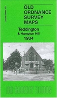
Teddington And Hampton Hill 1934 Stanfords
£3.50
Archived Product
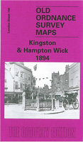
Kingston And Hampton Wick 1894 Stanfords
£3.50
Archived Product

Brixton And Herne Hill 1894 Stanfords
£3.50
Vouchers
No voucher codes found.
Do you know a voucher code for this product or supplier? Add it to Insights for others to use.
Do you know a voucher code for this product or supplier? Add it to Insights for others to use.
 Denmark