More From Contributor

£22.50
The Great Vegetable Plot is Sarah Raven`s guide to growing vegetables for all keen cooks & any level of gardener. In it, she demonstrates how to plan & plant your plot, recommends the best vegetables to grow & eat & gives clear instructions on how to cultivate them using minimum input to get maximum reward. Divided into 3 sections, the book shows you what & what not to grow & the basic principles & techniques to help you achieve this. A landmark Gardeners` World book, it brings the principles of simplicity & speed to the vegetable plot, as well as including delicious food pictures to illustrate why it`s worth growing your own. Illustrated with over 250 photographs by the award-winning photographer Jonathan Buckley, the book is a stylish & practical guide to vegetable gardening, & a companion volume to Sarah`s previous title, Grow Your Own Cut Flowers. ...
Archived Product
£25.00
From the high-level route across the Pyrenees to the scenic Kerry Way in Irel&, from a descent through the Samaria Gorge in Crete to an ascent of Helvellyn in the Lake District, this book identifies the greatest walks in Europe: twelve of the best long-distance walks (taking from four to fifteen days to complete) & twelve extraordinary day walks. Among the long-distance walks are the incomparable GR20 in Corsica
- a coast-to-coast journey through jagged peaks & deep, forested valleys; the ancient Ridgeway across English downland; the Jungfrau Horseshoe in Austria, which visits the best viewpoints of the Bernese Oberland`s most famous alpine peaks; & the Kungsleden, or Royal Trail, through the Swedish wilderness. Short walks include the Snowdon Horseshoe, one of the finest mountain walks in Britain; a walk through the Verdon Gorge in France, Europe`s equivalent of the Grand Canyon; & an excursion to the Inaccessible Pinnacle on the romantic Isle of Skye in Scotl&. Richard Sale describes each route, explaining noteworthy features of all kinds & giving historical & cultural details as well as useful information about maps, statistics & the like. His lavish & spectacular photographs of landscapes & wildlife capture the walks` spirit & character. The book will be a boon & a delight to walkers, inspiring them to relive past adventures & tempting them to plan expeditions for the future.
...
Archived Product
£9.99
China`s Great Wall north of Beijing is one of the world`s most famous sights. Millions every year climb the line of stone snaking over mountains. We all feel we know the Wall. But we are wrong. It is too big, too varied, too complex to be captured by a few images or a day-trip. Myths surround it. Many believe that the stone barrier marches across all China, that it has been in existence for over 2, 000 years, & that it is the only man-made structure visible from the Moon. In fact, most of it is made from earth, & much of it is not there at all. It cannot even be seen from earth orbit, let alone the Moon. Estimates of its length vary from 1, 500 to 5, 000 miles. Even its name is deceptive
- it is not an it, a single entity, but many walls (hence the uncertain length), built at different times. Yet behind the confusion are great simplicities. The many walls are united by two ideas
- self-protection & unity
- which go back to the First Emperor, who founded the nation in 221 BC. For 2, 000 years, the Wall marked the border between China & nomadic peoples to the north & west. Mutual hostility inspired centuries of attacks, counter-attacks & Wall-building, until the northward spread of China in the 20th century made the Wall redundant. For this riveting account, John Man travelled the Wall from the far western deserts to the Pacific, exploring the grandest sections & many `wild` ones. He is the first writer to describe two unknown walls in Mongolia. He covers two millennia of history, from the country`s first unification to the present day, when the Great Wall, built & rebuilt over centuries of war, has become a symbol of tranquillity.


...
Archived Product
£24.00
Over many years & many journeys, Daniel Schwartz has patiently & meticulously photographed one of mankind`s supreme monuments
-
...
Archived Product
£20.00
It is commonly & mistakenly believed that there is a single Great Wall of China. Rather, it is made up of many small walls built over the course of time. The first defensive wall in China dates from around 688 BC, but the Great Walls that we know today were mainly completed in the Ming Dynasty (1368-1644). Man has used it in ways that range from a potent defensive measure to an iconic piece of cultural heritage to a major tourist attraction. The Great Wall of China brings together some fascinating insights into the study of the Walls. Diverse methods are employed to illustrate the social & political history of the Wall from ancient times up to the present day. Scholarly, but accessible essays are interspersed with contemporary interviews which reveal the local experience of this Chinese institution. The book is divided into 6 major themes: Fame, Form, Forces, Foundations, Frontiers & Facades & comprises 13 essays by authors from Australia, China & the US. Accompanying an exhibition held in the Powerhouse Museum, Sydney & the National Museum of China, Beijing, they consider the Wall from historical, defensive, conservationist & touristic perspectives. This is an innovative & informative discussion of the Great Walls of China which deserves to stand as a classic for all those interested in this illustrious construction. ...
Archived Product
£12.99
Drawing directly on original manuscripts, this collection comprises the major short stories published after Kafka`s death. It


...
Archived Product
£25.00
A journey along the Great Wall in the past & present, this landmark volume presents an extraordinary portrait of the world`s most famous man-made structure. Author/photographer William Lindesay spent three years traveling 35, 000 km across North China, carrying his cameras, tripod & a file of vintage photographs, the earliest dating from 1871, looking for places from which he could see the Great Wall in the past & present, side by side.. ...
Archived Product
£20.00
The Great War July 1, 1916: The First Day of the Battle of the Somme. It is an illustrated panorama with an essay by Adam Hochschild. ” Sacco`s work [is] the best argument around for comics as a journalistic medium”. (GQ). Launched on July 1, 1916, the Battle of the Somme has come to epitomize the madness of the First World War. Almost 20, 000 British soldiers were killed & another 40, 000 were wounded that first day, & there were more than one million casualties by the time the offensive halted a few months later. In The Great War, acclaimed cartoonist Joe Sacco depicts the events of that day in an extraordinary, 24-foot-long wordless panorama: from the riding exercises of General Douglas Haig to the massive artillery positions & marshalling areas behind the trench lines, to the legions of British soldiers going `over the top` & being cut down in No-Man`s-L&, to the tens of thousands of wounded soldiers retreating & the dead being buried en masse. Printed on fine accordion-fold paper & packaged in a deluxe hardcover slipcase with a 16-page accompanying booklet, The Great War is a landmark work in Sacco`s illustrious career, & makes visceral one of the bloodiest days in history. ...
Archived Product
£9.99
Excellent World War I commemorative map from the IGN presenting an overview of the Western Front supported by three more detailed enlargements of the main battlefields including the Somme area, & highlighting 15 special Remembrance Trails, remaining trenches, numerous memorial sites, museums, cemeteries, etc. Prepared by the IGN in collaboration with the Mission du Centenaire programme set up by the French Government, the map has a far more detailed base for presenting all the WWI-related information than found on other maps of the Western Front. A road map of northern France at 1:410, 000 shows the whole of the front line in October 1914 from the Swiss border to the coast of Flanders, also indicating the limit of the German advance & the eventual Armistice line of 11.11.1918. Three panels provide more detailed enlargements at 1:290, 000: the Béthune
- Péronne area including the Somme battlefields, Arras & the Vimy Ridge; the Reims
- Compiègne area with Chemin des Dammes; plus Verdun. Both the main map & the enlargements indicate numerous memorial locations, including several commemorative tours by car, train, bicycle or walking, e.g. The Front route between Ypres & the Somme, a 92-km Albert
- Thiepval
- Péronne route through the main Somme battlefields, The British Circuit of Remembrance & The Victoria Cross routes near Soissons, etc. 15 tours have brief descriptions with website addresses & some with QR codes for downloading further information. Also provided is a year-by-year list of the principal Western Front battles with each entry cross-referenced to its location on the main map. Map legend & all the text are in English, French & German.PLEASE NOTE: although the map covers the whole of the Western Front, including Flanders with Ypres & Passendale/ Passchendaele, the overprint within Belgium is more limited – the map is designed to provide information mainly within France. This title is also available as a wall map but with its map legend & and all the additional text only in French.


...
Archived Product
£17.99
IGN’s excellent World War I commemorative map presented in an encapsulated, waterproof wall map format, size 121 x 100cm (46.5” x 39.5” approx). The map provides an overview of the Western Front supported by three more detailed enlargements of the main battlefields including the Somme area, & highlights 15 special Remembrance Trails, remaining trenches, numerous memorial sites, museums, cemeteries, etc. Prepared by the IGN in collaboration with the Mission du Centenaire programme set up by the French Government, the map has a far more detailed base for presenting all the WWI-related information than found on other maps of the Western Front. A road map of northern France at 1:410, 000 shows the whole of the front line in October 1914 from the Swiss border to the coast of Flanders, also indicating the limit of the German advance & the eventual Armistice line of 11.11.1918. Three panels provide more detailed enlargements at 1:290, 000: the Béthune
- Péronne area including the Somme battlefields, Arras & Vimy Ridge; the Reims
- Compiègne area with Chemin des Dammes; plus Verdun. Both the main map & the enlargements indicate numerous memorial locations, including several commemorative tours by car, train, bicycle or walking, e.g. The Front route between Ypres & the Somme, a 92-km Albert
- Thiepval
- Péronne route through the main Somme battlefields, The British Circuit of Remembrance & The Victoria Cross routes near Soissons, etc. 15 tours have brief descriptions with website addresses & some with QR codes for downloading further information. Also provided is a year-by-year list of the principal Western Front battles with each entry cross-referenced to its location on the main map. PLEASE NOTE: in this wall map format, map legend & all the additional text are in French only; in the folded version of this title all the information

Includes::
English. Although the map covers the whole of the Western Front, including Flanders with Ypres & Passendale/ Passchendaele, the overprint within Belgium is more limited – the map is designed to provide information mainly within France.LAMINATED & ENCAPSULATED WALL MAPS:- LAMINATED wall maps have a thin layer of plastic usually applied to the printed side only. They can be written on with suitable marker pens without any damage to the map but, unless laminated on both sides, they are not damp-proof.- ENCAPSULATED wall maps are sealed between two sheets of plastic. They are more rigid & heavier than laminated maps of the same size. They are damp-proof & do not crinkle in humid conditions. Encapsulation gives the map a shiny surface, similar to being displayed behind glass.- PLEASE NOTE: many publishers & retailers often use these two terms interchangeably. Our map titles & descriptions follow the definitions provided above.


...
Archived Product

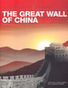
The Great Wall Of China (spiral Bound)

The Great Wall of China is the largest construction on earth, yet myths about it are more widely known than facts. The best way to appreciate the Great Wall is to explore it on foot. This richly illustrated book focuses on especially rewarding parts of the Ming Dynasty Wall (1368-1644). The book offers: walking notes on seven sections in detail; clear site plans of Badaling, Mutianyu and Simatai; two map panels showing the entire Wall network, plus one panel around Beijing (larger scale); practical information about transport and travel; introduction to Mandarin Chinese, Pinyin and pictographs; lavishly illustrated, with 70 colour photographs; rucksack-friendly format The sections include Laolongtou, where the Wall runs into the sea, and Panjiakou reservoir, a tranquil hike and
boat trip. The glorious stretch from Simatai to Jinshanling runs along high ridges with 30 watch towers, and the Badaling and Mutianyu sections are surprisingly accessible from Beijing. The book sets the Ming Wall in the context of wall systems developed by different dynasties since the seventh century BC.
RIP - This product is no longer available on our network. It was last seen on 25.09.2019

This page now acts as a permanent archive for this product. Add more information using the comments box below to ensure it can still be found by future generations.

Use our search facility to see if it is available from an alternative contributor.
  • Availability: Out Of Stock
  • Supplier: Stanfords
  • SKU: 9781898481171
Availability: In Stock
£12.50

Product Description

The Great Wall of China is the largest construction on earth, yet myths about it are more widely known than facts. The best way to appreciate the Great Wall is to explore it on foot. This richly illustrated book focuses on especially rewarding parts of the Ming Dynasty Wall (1368-1644). The book offers: walking notes on seven sections in detail; clear site plans of Badaling, Mutianyu & Simatai; two map panels showing the entire Wall network, plus one panel around Beijing (larger scale); practical information about transport & travel; introduction to Mandarin Chinese, Pinyin & pictographs; lavishly illustrated, with 70 colour photographs; rucksack-friendly format The sections include Laolongtou, where the Wall runs into the sea, & Panjiakou reservoir, a tranquil hike & boat trip. The glorious stretch from Simatai to Jinshanling runs along high ridges with 30 watch towers, & the Badaling & Mutianyu sections are surprisingly accessible from Beijing. The book sets the Ming Wall in the context of wall systems developed by different dynasties since the seventh century BC.

Reviews/Comments

Add New

Intelligent Comparison

Oooops!
We couldn't find anything!
Perhaps this product's unique.... Or perhaps we are still looking for comparisons!
Click to bump this page and we'll hurry up.

Price History

Vouchers

No voucher codes found.
Do you know a voucher code for this product or supplier? Add it to Insights for others to use.

Facebook

Jargon Buster

Foot - A part of the body at the bottom end of the leg
Foot - or Feet - a measurement equivilent to 30cm
Watch - A small clock designed to be worn on a person
Wall - A physical barrier between two areas
Colour - The categorised spectrum of light visable to humans
Earth - A planet third from the sun. Similar size to Venus but rich in water and complex life.
Network - A link and communication between things. Often computers or people.
Rucksack - A bag which is carried on the back.
Rewarding - Achieving and doing something good.
Practical - Weather a task is easy to carry out and realistically succeed.
Transport - Something that carries people or goods.

Supplier Information

Stanfords
Stanfords was established in 1853 and opened their iconic Covent Garden flagship store in 1901. They have become the top retailer of maps, travel books and accessories in the UK and arguably offer the largest selection of maps and travel books worldwide. Famous names such as Captain Robert Falcon Scott, Ranulph Fiennes and Michael Palin have purchased from Stanfords. They now have a shop in Bristol and both stores together with other venues operate a calendar of events including talks, book signings and exhibitions. As a specialist map retailer, the map selection is comprehensive and includes road maps, street maps and walking maps from worldwide destinations, as well as a selection of world atlases and wall maps. Books include travel guides and travel literature. Stanfords also stock globes, from miniatures made of blue marble to magnificent floor-standing globes. The website features a selection of interesting articles on travel topics.
Page Updated: 2023-11-12 20:15:36

Community Generated Product Tags

Oh No! The productWIKI community hasn't generated any tags for this product yet!
Menu