
 United Kingdom
 France
 Germany
 Netherlands
 Sweden
 USA
USA
 Italy
Italy
 Spain
Spain
More From Contributor


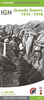


The Great War 1914-1918 - From Liege To The Yser And The Somme
The Great War 1914-1918: from Liege to the Yser and the Somme, a commemorative map at 1:250, 000 from the Belgian national survey organization showing current road network with an overprint highlighting lines of attack, museums and memorials, etc.The map is double-sided and covers most of Belgium plus parts of northern France (but please see below), Extensive bold overprint indicates lines attack by the Germans and of retreat by the Belgian forces, also front lines at different dates. Large icons mark locations of military cemeteries colour-coded to indicate the nationality and annotated with the number of graves, battle sites, museums, etc. The map also shows locations where atrocities were committed against Belgian civilians, with separate panels providing additional more
detailed information for each province. The map has latitude and longitude margin ticks at 5’ intervals. Further panels provide a more detailed enlargement of the Ypres Salient area and information on the fighting in 1914 around Liege, Brussels and Namur. The map is surrounded by panels of contemporary and present day photos and drawings. Accompanying booklet provides more information, particularly about the fighting in 1914. The main map legend and the text in the booklet include English; annotations of some of the additional map panels and photos/drawings are in French and/or Flemish only.PLEASE NOTE: in France the map does cover the main Somme battlefields, but the area south of Albert and west of Laon is not included. Within Belgium, for visiting the Ypres Salient battlefields
using more detailed mapping of this area is recommended.
Product Description
Reviews/Comments
Add New
Vouchers
No voucher codes found.
Do you know a voucher code for this product or supplier? Add it to Insights for others to use.
Do you know a voucher code for this product or supplier? Add it to Insights for others to use.
 Denmark