
 United Kingdom
 France
 Germany
 Netherlands
 Sweden
 USA
USA
 Italy
Italy
 Spain
Spain
More From Contributor


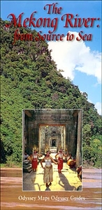
The Mekong River From Source To Sea Odyssey Map
The Mekong River from Source to Sea map from Odyssey Books presenting the river accompanied by extensive descriptions of various aspects of it landscape, flora and fauna, ethnic minorities along its shores, etc, with on the reverse a wider region of South-East Asia.On one side the river is presented with its more immediate surroundings, from its source in Tibet across southern China, along the borders of Burma, Laos and Thailand to Cambodia and its Delta in Vietnam. The map shows the dense network of Mekong’s tributaries, towns and main villages, and the topography of the surrounding countryside. The accompanying notes, illustrated with numerous colour photos, provide interesting information about Expeditions and Explorers, Ethnic Minorities, Mysteries of the Mekong, Trees,
Plants and Herbal Medicines, etc.The whole of the reverse side it taken by a map of South-East Asia at 1:3, 150, 000, extending from the source of the Mekong in the Tibetan Plateau to the southern border of Thailand. Numerous other rivers are also marked, including the Irrawaddy in Burma. Topography is indicated by altitude colouring. The map presents the region’s network of main roads, indicating border crossings, as well as railway connections plus international and domestic airports. Symbols highlight locations of UNESCO’s cultural and natural World Heritage sites, national parks and wildlife reserves, and other places of interest. Also marked are dams on the Mekong: existing, under constructions and planned. Latitude and longitude lines are drawn at 5° intervals.
Plants and Herbal Medicines, etc.The whole of the reverse side it taken by a map of South-East Asia at 1:3, 150, 000, extending from the source of the Mekong in the Tibetan Plateau to the southern border of Thailand. Numerous other rivers are also marked, including the Irrawaddy in Burma. Topography is indicated by altitude colouring. The map presents the region’s network of main roads, indicating border crossings, as well as railway connections plus international and domestic airports. Symbols highlight locations of UNESCO’s cultural and natural World Heritage sites, national parks and wildlife reserves, and other places of interest. Also marked are dams on the Mekong: existing, under constructions and planned. Latitude and longitude lines are drawn at 5° intervals.

Product Description
Reviews/Comments
Add New
Vouchers
No voucher codes found.
Do you know a voucher code for this product or supplier? Add it to Insights for others to use.
Do you know a voucher code for this product or supplier? Add it to Insights for others to use.
 Denmark