More From Contributor

£8.99
An upstart French duke who sets out to conquer the most powerful & unified kingdom in Christendom. It is an invasion force on a scale not seen since the days of the Romans. One of the bloodiest & most decisive battles ever fought. This riveting book explains why the Norman Conquest was the single most important event in English history. Assessing the original evidence at every turn, Marc Morris goes beyond the familiar outline to explain why England was at once so powerful & yet so vulnerable to William the Conqueror`s attack. Why the Normans, in some respects less sophisticated, possessed the military cutting edge. How William`s hopes of a united Anglo-Norman realm unravelled, dashed by English rebellions, Viking invasions & the insatiable demands of his fellow conquerors. This is a tale of powerful drama, repression & seismic social change: the Battle of Hastings itself & the violent ` Harrying of the North`; the sudden introduction of castles & the wholesale rebuilding of every major church; the total destruction of an ancient ruling class. Language, law, architecture, even attitudes towards life itself were altered forever by the coming of the Normans. Marc Morris, author of the bestselling biography of ” Edward I, A Great & Terrible King”, approaches the Conquest with the same passion, verve & scrupulous concern for historical accuracy. This is the definitive account for our times of an extraordinary story, a pivotal moment in the shaping of the English nation. ...
Archived Product
£19.99
With their 70th anniversary just around the corner, the D-Day landings have lost none of their impact. Even today the vestiges of Hitler s Atlantic Wall speak of the huge undertaking necessary for the Allies to gain a foothold in Normandy. In this beautiful new full-color book, the reader goes on-site to the sacred battleground from its scarred medieval villages to the remains of modern means of destruction. The huge armada that attacked from Britain left behind many signs of their passage: from the huge caissons of the mulberry harbor around Arromanches, the gun emplacements at Longues & Merville, to the multitude of hardware used as memorials tanks, artillery, pillboxes & the many graves & cemeteries that honor those who died on both sides. It is in memory of the dead that much of what can be seen on the ground survives, but as the last few survivors reach their 90s, a new audience requires information about the events of the past that can only come from seeing the ground where the battle was fought. Today, the beaches are a fascinating mixture of the new & the old, including the new visitors center at Colleville & the renovation & expansion of the Utah Beach museum even as further new memorials jostle with the older sites that have changed little in 70 years. The Normandy Battlefields details what can be seen on the ground today using a mixture of media to provide a complete overview of the campaign. Maps old & new highlight what has survived & what hasn t; then-&-now photography allows fascinating comparisons with the images taken at the time particularly the aerial views & computer artwork provides graphic details of things that can t be seen today. The book describes the area from Cherbourg to Le Havre by way of the key D-Day locations, providing a handbook for the visitor & an overview for the armchair traveler. It covers, wherever possible, the forces from both sides & the memorials to those young men who fought so many years ago.” ...
Archived Product
£12.99
Chronicling the `other Norman invasion`, The Normans in the South is the epic story of the House of Hauteville, & in particular Robert Guiscard, perhaps the most extraordinary European adventurer between the times of Caesar & Napoleon. In one year, 1084, he had both the Eastern & Western Emperors retreating before him & one of the most formidable of medieval Popes in his power. His brother, Roger, helped him to conquer Sicily from the Saracens, & his nephew Roger II went on to create the cosmopolitan kingdom whose remaining monuments still dazzle us today. The Normans in the South is the first of two volumes that recount an extraordinary chapter in Italian history. ...
Archived Product
£12.95
Who were the Norse gods
- the mighty Aesyr, led by Odinn, & the mysterious Vanir? In The Norse Myths we meet this passionate
...
Archived Product
£12.95
Welcome to the NC500. This tourist route takes in over 500mi (900km) of some of the UK`s most stunning scenery. The North Coast ...
Archived Product
£8.99
A ship sets sail with a killer on board.. .1859. A man joins a whaling ship bound for the Arctic Circle. Having left the British Army with his reputation in tatters, Patrick Sumner has little option but to accept the position of ship`s surgeon on this ill-fated voyage. But when, deep into the journey, a cabin boy is discovered brutally killed, Sumner finds himself forced to act. Soon he will face an evil even greater than he had encountered at the siege of Delhi, in the shape of Henry Drax: harpooner, murderer, monster. ...
Archived Product
£16.99
The Areas of Outstanding Natural Beauty have been described as the jewels of the English landscape & the North Wessex Downs, the third largest AONB, is no exception. Its predominant feature is its underlying chalk geology & it covers one of the most continuous tracts of chalk downland in Engl&. As well as its treasures in the form of chalk & ancient woodl&, the North Wessex Downs also has a fascinating human history, stretching back some 5, 000 years. The archaeology of the area is both rich & varied, with a number of impressive monuments, including the Neolithic stone circle at Avebury
- which forms part of a World Heritage Site, the truly beautiful Uffington White Horse & the magical Wayland`s Smithy, plus a myriad of Bronze Age barrows & Iron Age hill forts. Despite being located in southern England
- a densely populated region
- the North Wessex Downs is surprisingly unspoilt & sparsely populated, giving it a true sense of the idyllic England of old. Hidden amongst the folded contours of this chalk countryside are picture-postcard villages with thatched cottages, historic churches & magnificent stately houses, while out on the open downs breathtaking views stretch over rounded chalk hills, with wide open skies above. Explores the North Wessex Downs Area of Outstanding Natural Beauty in depth, covering the landscape, prehistoric treasures & more modern developments, from the Kennet & Avon Canal to crop circles Takes you on a journey through a landscape steeped in 5, 000 years of history Illustrated throughout with more Approx. 150 colour photographs Written by a local author who has explored the area over many years

Includes::
useful visitor information so that readers can more easily explore & enjoy for themselves, the many places mentioned in the book


...
Archived Product
£12.99
The North-West Highlands, which for the purposes of this book

Includes::
all the Scottish mainland north &

...
Archived Product
£3.99
The North West Trail Cycle Route at 1:125, 000 in a series of cycling maps from Sustrans, the charity behind developing UK’s National Cycle Network. The map is printed on light waterproof synthetic paper & presents several routes in the western part of Northern Irel&, taking in Strabane, Omagh, Enniskillen & the Upper & Lower Lough Erne. The routes also cross over to Donegal & Sligo in the Irish Republic Each title in the Sustrans series of cycling maps covers either a single route, presented in sections on separate strip maps, or a wider area with the main cycling route (s) prominently highlighted but other recommendations for cyclists also marked. The area covered each map is shown on our website on its individual “coverage” image. The route has markers indicating steep gradients, controlled access, distances & possible danger points. Route profiles indicate riding surface & the density of traffic (main road, minor road & traffic-free) &, where appropriate, street plans show the course of the route across towns & cities. On maps covering a wider area around the main National Cycle Route suggestions of possible day ride excursions are also marked. A range of symbols highlight various facilities & places of interest, including tourist information centres, youth hostels, cafes & pubs, grocery shops, cycle shops & hire, historical & natural sites, etc. For access by rail, the rail network is shown with stations &, where appropriate, metro stations are also marked. Topography is shows by altitude colouring. Unless specifically indicated in the individual description, the maps do not show British National Grid lines for GPS. Each title also contains contact addresses for various useful organizations, etc. Many titles are printed on light, waterproof & tear-resistant synthetic paper. ...
Archived Product
£12.99
Paul Morley grew up in Reddish, less than five miles from Manchester & even closer to Stockport. Ever since the age of seven Morley has always thought of himself as a northerner. What that meant, he wasn`t entirely sure. It was for him, as it is for millions of others in Engl&, an absolute, indisputable truth. Forty years after walking down grey pavements on his way to school, Paul explores what it means to be northern & why those who consider themselves to be believe it so strongly. Like industrial towns dotted across great green landscapes of hills & valleys, Morley breaks up his own history with fragments of his region`s own social & cultural background. Stories of his Dad spreading margarine on Weetabix stand alongside those about northern England`s first fish & chip shop in Mossley, near Oldham. Ambitiously sweeping & beautifully impressionistic, without ever losing touch with the minute details of life above the M25, The North is an extraordinary mixture of memoir & history, a unique insight into how we, as a nation, classify the unclassifiable. ...
Archived Product

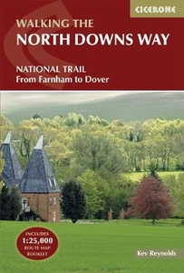
The North Downs Way

A guidebook to walking the North Downs Way National Trail, a 130 mile (208km) walk between the high downland of Farnham and the historic city of Dover on the Kent coast, with an optional visit to Canterbury. The route is described in 11 stages, and is fully illustrated with colour photographs and OS map extracts. The North Downs Way is one of the easier national trails with a modest number of steep (but short) ascents and descents and long sections with no noticeable height gain or loss. Several historic sites including Neolithic burial chambers, Roman roads and Norman churches are passed and much of the route follows The Pilgrims` Way. The area also boasts many literary connections with some of the most celebrated voices in English literature. A separate pocket-sized map booklet is
included and shows the full route on 1:25, 000 scale OS maps.
RIP - This product is no longer available on our network. It was last seen on 25.09.2019

This page now acts as a permanent archive for this product. Add more information using the comments box below to ensure it can still be found by future generations.

Use our search facility to see if it is available from an alternative contributor.
  • External links may include paid for promotion
  • Availability: Out Of Stock
  • Supplier: Stanfords
  • SKU: 9781852848613
Availability: In Stock
£16.95

Product Description

A guidebook to walking the North Downs Way National Trail, a 130 mile (208km) walk between the high downland of Farnham & the historic city of Dover on the Kent coast, with an optional visit to Canterbury. The route is described in 11 stages, & is fully illustrated with colour photographs & OS map extracts. The North Downs Way is one of the easier national trails with a modest number of steep (but short) ascents & descents & long sections with no noticeable height gain or loss. Several historic sites including Neolithic burial chambers, Roman roads & Norman churches are passed & much of the route follows The Pilgrims` Way. The area also boasts many literary connections with some of the most celebrated voices in English literature. A separate pocket-sized map booklet is included & shows the full route on 1:25, 000 scale OS maps.

Reviews/Comments

Add New

Intelligent Comparison

Oooops!
We couldn't find anything!
Perhaps this product's unique.... Or perhaps we are still looking for comparisons!
Click to bump this page and we'll hurry up.

Price History

Vouchers

No voucher codes found.
Do you know a voucher code for this product or supplier? Add it to Insights for others to use.

Facebook

Jargon Buster

Colour - The categorised spectrum of light visable to humans
Pocket - A bag shaped insert in clothing used to carry items

Supplier Information

Stanfords
Stanfords was established in 1853 and opened their iconic Covent Garden flagship store in 1901. They have become the top retailer of maps, travel books and accessories in the UK and arguably offer the largest selection of maps and travel books worldwide. Famous names such as Captain Robert Falcon Scott, Ranulph Fiennes and Michael Palin have purchased from Stanfords. They now have a shop in Bristol and both stores together with other venues operate a calendar of events including talks, book signings and exhibitions. As a specialist map retailer, the map selection is comprehensive and includes road maps, street maps and walking maps from worldwide destinations, as well as a selection of world atlases and wall maps. Books include travel guides and travel literature. Stanfords also stock globes, from miniatures made of blue marble to magnificent floor-standing globes. The website features a selection of interesting articles on travel topics.
Page Updated: 2023-11-12 20:15:36

Community Generated Product Tags

Oh No! The productWIKI community hasn't generated any tags for this product yet!
Menu