
 United Kingdom
 France
 Germany
 Netherlands
 Sweden
 USA
USA
 Italy
Italy
 Spain
Spain
More From Contributor


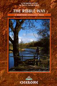
The Ribble Way
The Ribble Way is Dennis and Jan Kelsall’s Cicerone guide to exploring the trail that leads through the Ribble Valley and leads walkers though some of the finest scenery in north-west England. The 71 mile Ribble Way traces the whole length of the valley and the guide traces the route from the Lancashire village of Longton, near the estuary mouth, to the source of the Ribble, high on Cam Fell in the Yorkshire Dales. The guide is organized into seven convenient stages detailing the route from Longton over Penwortham Bridge and through Ribchester, across Brungerley and Gisburn Bridges through to Settle and Horton and the Ribble’s source. Each chapter begins with a general description of the day’s walking and an information box giving details of total distance, height gain, a
general route assessment, the relevant map and also practical information on parking, refreshments and toilets en route. Detailed route descriptions are accompanied by Ordnance Survey extracts mapping the route in addition to colour photographs illustrating some of the highlights of this picturesque north western countryside.
general route assessment, the relevant map and also practical information on parking, refreshments and toilets en route. Detailed route descriptions are accompanied by Ordnance Survey extracts mapping the route in addition to colour photographs illustrating some of the highlights of this picturesque north western countryside.

Product Description
Reviews/Comments
Add New
Vouchers
No voucher codes found.
Do you know a voucher code for this product or supplier? Add it to Insights for others to use.
Do you know a voucher code for this product or supplier? Add it to Insights for others to use.
 Denmark