More From Contributor

£8.99
At the start of the 137-kilometre Tour de Mont Aigoual, Tim Krabbe glances up from his bike to assess the crowd of spectators. ` Non-racers, ` he writes. ` The emptiness of those lives shocks me.` Immediate & gripping from the first page, we race with the author as he struggles up the hills & clings on during descents in the unforgiving French mountains. Originally published in 1978, The Rider is a modern-day classic that is recognised as one of the best books ever written about the sport. Brilliantly conceived & best read at a break-neck pace, it is a loving, imaginative & passionate tribute to the art of cycle racing. ...
Archived Product
£8.99
Fred Scully is determined to carve a new life for himself & his young family in Irel&. For months he has laboured alone to make their dilapidated cottage habitable, & now his wife & child are coming to meet him: this will be their fresh start. But when he arrives at the airport to collect them, only his small daughter steps off the plane... So begins Tim Winton`s The Riders. This is Scully`s desperate journey across Europe, trying to track down the wife he comes to realize he didn`t know. ...
Archived Product
£16.99
Running for nearly 90 miles across southern Engl&, the Ridgeway National Trail is one of our most ancient cross-county routes. Following the crest of a sequence of well-defined chalk escarpments
- the Marlborough Downs, the Berkshire or White Horse Downs & the Chilterns
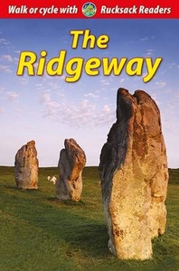
- the Ridgeway leads from Overton Hill near the Neolithic stone circle at Avebury to imposing Ivinghoe Beacon close to Dunstable, at its half-way point crossing the River Thames at Streatley. Used for centuries as a trade route, a pathway for the armies of Saxon & Dane, a cattle drove & a local cart track, the Ridgeway is today an official National Trail, designated in 1973 by the Countryside Commission. West of the Thames the route is a continuous green road, while the eastern, typically-wooded Chiltern section is mostly footpaths. In its entirety the Ridgeway is a notable backpacking expedition. This book follows the route as it traverses the ever-changing downl&, shares the frequent spectacular views to capture the atmosphere of this special cross section of Engl&. It should fascinate & enthuse all those who use the Ridgeway be they Sunday afternoon strollers, cross-country cyclists, equestrians or hardy backpackers.

...
Archived Product
£14.99
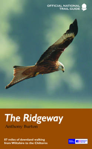
The Ridgeway follows one of the oldest `green roads` in Europe. It runs for 87 miles (140 km) from Overton Hill in the west, across the Marlborough Downs & the Vale of the White Horse, to Ivinghoe Beacon on the northern edge of the Chilterns. This is the complete, official guide for the long-distance walker or the weekend stroller. All you need is this one book. Anthony Burton`s official guide has been fully revised & updated for 2013, & this new edition has been completely redesigned with more & bigger photographs & much new background history & information. National Trail Guides are the official guidebooks to the fifteen National Trails in England & Wales & are published in association with Natural Engl&, the official body charged with developing & maintaining the Trails. ...
Archived Product
£11.99
The Ridgeway National Trail runs for 87 miles (139 km) through south-west England along one of Europe`s most ancient pathways. This waterproof guidebook contains detailed directions for walkers & advice for cyclists. It is full of background & practical information, supported by 80 colour photographs & a dropdown map. ...
Archived Product
£12.99
The Ridgeway follows one of the oldest 'green roads' in Europe. It runs for 87 miles (140 km) from Overton Hill in the west, across the Marlborough Downs & the Vale of the White Horse, to Ivinghoe Beacon on the northern edge of the Chilterns, this is the complete, official guide for the long-distance walker or the weekend stroller. All you need is this one book. National Trail Guides are the official guidebooks to the fifteen National Trails in England & Wales & are published in association with Natural Engl&, the official body charged with developing & maintaining the Trails. ...
Archived Product
£18.99
The South Downs
- Central at 1:40, 000 in a series of maps printed on waterproof fabric, from Splash Maps, designed for outdoor
...
Archived Product
£7.95
Here is a collection of 20 tried & tested circular walks ranging in length between 2.5 & 8.5 miles. They include crucial dog-walking factors such as livestock, stiles & roads, with warnings in advance when a lead is necessary & when it`s safe for your dog to run free. The routes pass by a number of quintessential English villages, many of which boast welcoming, dog-friendly pubs, along with ancient churches, remote hamlets, stunning views, idyllic cottages, imposing country manor houses & delightful nature reserves. But best of all there`s plenty of places for your dog to run free when walking the Ridgeway. ...
Archived Product
£7.95
The Ridgeway Adventure Atlas, presenting the 87 miles / 139 km long hiking route between the Overton Hill near Avebury to the Ivinghoe Beacon in the Chilterns on mapping at 1:25, 000 in a series of handy A5 size Adventure Atlases from Geographers' A-Z Map Company with cartography from the Ordnance Survey ...
Archived Product
£8.95
The Ridgeway is a National Trail which covers 139km (87 miles) following, in part, an ancient path along the exposed Chiltern Hills escarpment. Starting at Overton Hill near Avebury, The Ridgeway travels northeast, passing near many Neolithic, Iron Age & Bronze Age sites to finish at Ivinghoe Beacon near Tring, Buckinghamshire. This A-Z Adventure Atlas of The Ridgeway features 36 pages of continuous Ordnance Survey mapping providing complete coverage of The Ridgeway Path. This atlas

Includes::
a route planner providing the distances between places & the amenities available, featuring:- Information Centres- Hotels/B& Bs- Youth Hostels- Campsites (seasonal opening)- Restaurants- Public Houses- Cafes (seasonal opening)- Shops- Petrol Stations Also featured is advice on safety & security when walking, details of Tourist Information Centres & a selection of QR codes linked to useful websites. This A-Z Adventure Atlas has the accuracy & quality of OS 1:25000 mapping indexed within a book, making it the perfect companion for walkers, off-road cyclists, horse riders & anyone wishing to explore the great outdoors.

...
Archived Product

The Ridgeway (139km)

The Ridgeway, a 139-km/87 miles route from Overton Hill in Wiltshire to Ivinghoe Beacon in Buckinghamshire, in a series of walking guides to the National Trails in England and Wales with colour extracts from the Ordnance Survey's Explorer series at 1:25, 000 showing points along the route cross-referenced to the text. The maps also indicate nearby places of interest and various facilities including campsites and caravan parks, youth hostels, water points, pubs, information or visitor centres, etc. Also shown are alternative sections of the route and stretches designated as bridleways or suitable for cycling.The guides are illustrated throughout with colour photos and include an introductory section on the path and the surrounding landscape, plus a chapter of useful information
including access to various locations along the route by public transport, a list of tourist information offices and principal overnight stopping places, a bibliography, etc.
RIP - This product is no longer available on our network. It was last seen on 25.09.2019

This page now acts as a permanent archive for this product. Add more information using the comments box below to ensure it can still be found by future generations.

Use our search facility to see if it is available from an alternative contributor.
  • Availability: Out Of Stock
  • Supplier: Stanfords
  • SKU: 9781845136383
Availability: In Stock
£12.99

Product Description

The Ridgeway, a 139-km/87 miles route from Overton Hill in Wiltshire to Ivinghoe Beacon in Buckinghamshire, in a series of walking guides to the National Trails in England & Wales with colour extracts from the Ordnance Survey's Explorer series at 1:25, 000 showing points along the route cross-referenced to the text. The maps also indicate nearby places of interest & various facilities including campsites & caravan parks, youth hostels, water points, pubs, information or visitor centres, etc. Also shown are alternative sections of the route & stretches designated as bridleways or suitable for cycling. The guides are illustrated throughout with colour photos & include an introductory section on the path & the surrounding landscape, plus a chapter of useful information including access to various locations along the route by public transport, a list of tourist information offices & principal overnight stopping places, a bibliography, etc.

Reviews/Comments

Add New

Price History

Vouchers

No voucher codes found.
Do you know a voucher code for this product or supplier? Add it to Insights for others to use.

Facebook

Jargon Buster

water - A chemical substance. Chemical formula H2O.
England - A country within the United Kingdom.
Colour - The categorised spectrum of light visable to humans
Km - Kilometre. A unit of measurement equal to 1000 metres.
Alternative - Another available choice or possibility
Transport - Something that carries people or goods.

Supplier Information

Stanfords
Stanfords was established in 1853 and opened their iconic Covent Garden flagship store in 1901. They have become the top retailer of maps, travel books and accessories in the UK and arguably offer the largest selection of maps and travel books worldwide. Famous names such as Captain Robert Falcon Scott, Ranulph Fiennes and Michael Palin have purchased from Stanfords. They now have a shop in Bristol and both stores together with other venues operate a calendar of events including talks, book signings and exhibitions. As a specialist map retailer, the map selection is comprehensive and includes road maps, street maps and walking maps from worldwide destinations, as well as a selection of world atlases and wall maps. Books include travel guides and travel literature. Stanfords also stock globes, from miniatures made of blue marble to magnificent floor-standing globes. The website features a selection of interesting articles on travel topics.
Page Updated: 2023-11-12 20:15:36

Community Generated Product Tags

Oh No! The productWIKI community hasn't generated any tags for this product yet!
Menu